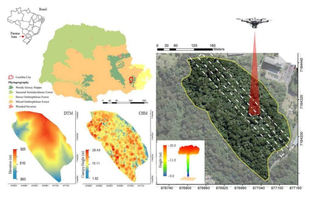
Urban forest remnants contribute to climate change mitigation by reducing the amount of carbon dioxide in urban areas. Hence, understanding the dynamics and the potential of urban forests as carbon pools is crucial to propose effective policies addressing the ecosystem services’ maintenance. Remote sensing technologies such as Light detection and ranging (Lidar) are alternatives to acquire information on urban forests accurately. In this paper, we evaluate a UAV-Lidar system’s potential to derive individual tree heights of Araucaria angustifolia trees in an Urban Atlantic Forest. Additionally, the influence of point density when deriving tree heights was assessed (2,500, 1,000, 500, 250, 100, 50, 25, 10 and 5 returns.m-2 11 ). The UAV-Lidar data was collected with the GatorEye Unmanned Flying Laboratory ‘Generation 2’. The UAV-Lidar-derived and field-based tree heights were compared by statistical analysis. Higher densities of points allowed a better description of tree profiles. Lower densities presented gaps in the Crown Height Model (CHM). The highest agreement between UAV-Lidar-derived and field-based tree heights (r = 0.73) was noticed when using 100 returns.m-2. The lowest rRMSE was observed for 50 returns.m-2 16 (8.35%).
There are no explicit differences in derived tree heights using 25 to 2,500 returns.m-2 17 . UAV- Lidar data presented satisfactory performance when deriving individual tree heights of Araucaria angustifolia trees.


