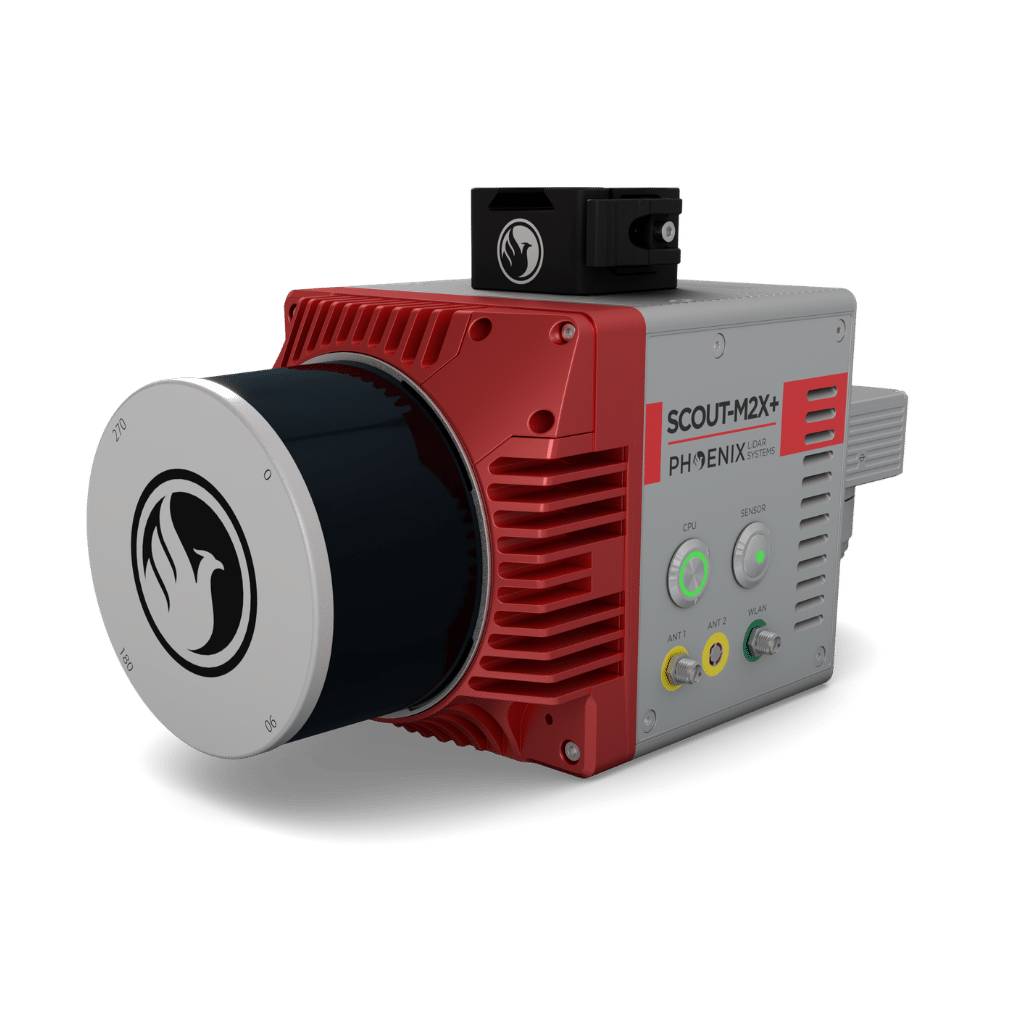
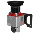
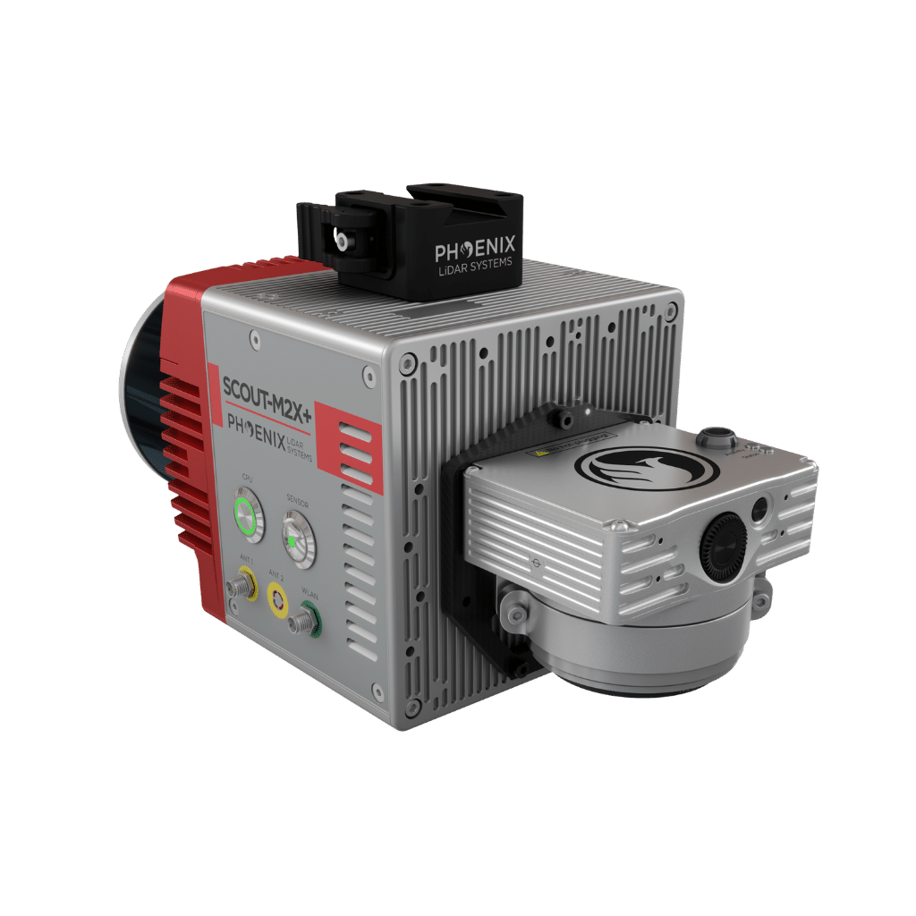
SCOUT-M2X
The ideal combination of performance, flexibility, and affordability
2-4 cm @ 100 m
RMSEz System Accuracy
4 cm @ 100 m
RMSDz Instraswath Precision
100 m
Max AGL @ 20% Reflectivity
1.8 kg
Weight
360°
Field of View
SCOUT M2X
0°
Scan Angle(s)
SCOUT M2X
KEY FEATURES

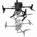
AIRCRAFT OPTIONS

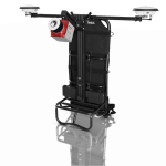
UAV

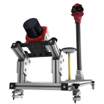
BACKPACK

VEHICLE

SLAM
PRIMARY APPLICATIONS

Construction

Agriculture & Forestry

Open Pit Mining

General Mapping

Asset Inventory Mapping
The SCOUT-M2X+ is the ideal combination of performance, flexibility, and affordability. It brings a new level of precision and accuracy to the long trusted SCOUT lineup of multi-channel mapping scanners.
Long range, high pulse rate and triple return capability allow for UAV acquisitions of more data faster through vegetation. Dense survey data can be collected by nearly any method; UAV, Mobile, Backpack, and more. The SCOUT-M2X+ is also SLAM capable, taking you where others cannot.
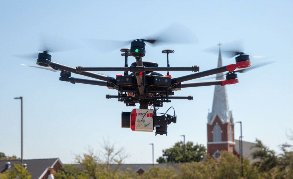
The SCOUT-M2X in aerial configuration easily integrates on M350 and other small mutli-rotor drones.
Full specifications
PLATFORM SPECS
Overall Dimensions*
18.7 x 12.3 x 14.9 cm
Operating Voltage
12 - 28 VDC
Weight
1.9 kg
Power Consumption*
~30 W
Operating Temperature*
32° - 104° F
LiDAR SENSOR SPECS
Laser Properties
905nm Class 1 (eye safe)
Range Minimum
.05 m
Range Max
300 m (80 m @ 10% for all channels)
Number of Lasers
32
Pulse Rate
640 kHz
Line Rate
10 Hz
Vertical FOV
40.3° (-20.8° to +19.5°)
Vertical Resolution
1.3°
Horizontal FOV
360°
Max Return Count
3
Laser Beam Footprint H X V
19 cm x 22 cm @ 80 m
24 cm x 27 cm @ 100 m
28 cm x 33 cm @ 120 m
24 cm x 27 cm @ 100 m
28 cm x 33 cm @ 120 m
*Without Accessories
Accessories & Options
Drone Kits
SLAM
Vehicle Mount
Backpack
DIMENSIONS (mm)
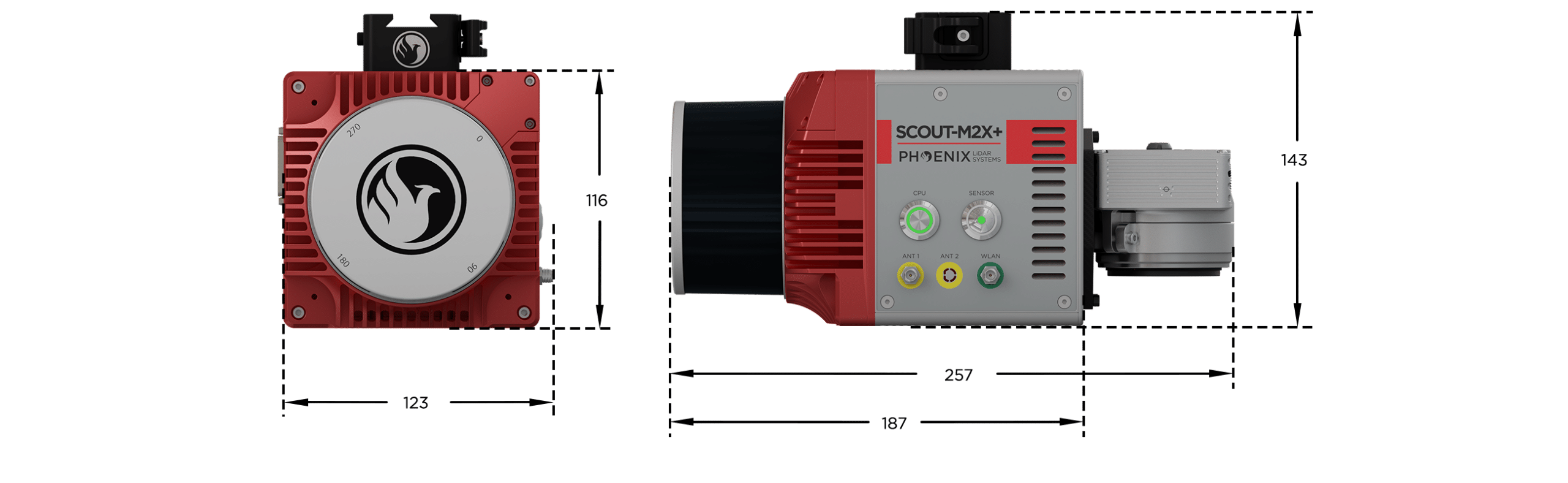
FRONT/LEFT
FRONT
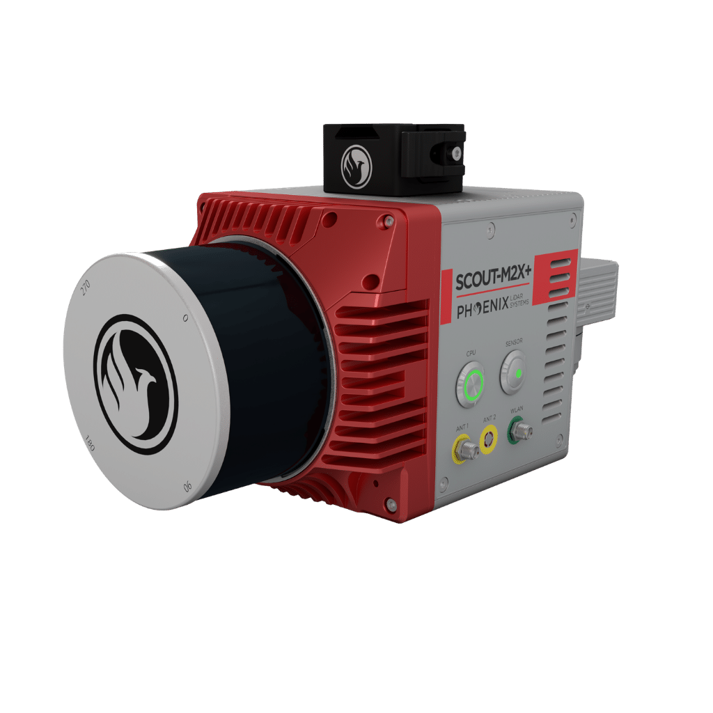
360° FOV Laser Scanner
LEFT
Power Button
CPU Status LED
Antenna 1-2
REAR/RIGHT
REAR
Mounting points :
Accessory Mounting Holes – M3/M4
RIGHT
USB
Memory Card
Ethernet
Status Lights


Automated Post-Processing in the Cloud
CAPTURE | POST-PROCESS | ANALYZE | SHARE
Meet LiDARMill, the first cloud-based, LiDAR platform for post-processing, reporting, and hosting.
LiDARMill enables surveying teams to take advantage of precision laser mapping without investing in expensive software & training.
LiDARMill enables surveying teams to take advantage of precision laser mapping without investing in expensive software & training.