This whitepaper investigates the innovative application of the GatorEye drone-borne LiDAR system for monitoring tropical forest succession through detailed canopy structural attributes. These attributes include canopy height, spatial heterogeneity, gap fraction, leaf area density (LAD) vertical distribution, canopy Shannon index, leaf area index (LAI), and understory LAI.
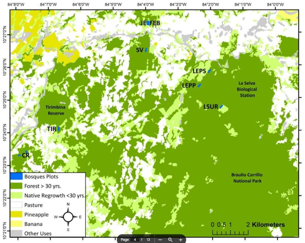
Focusing on nine tropical forest stands in the Caribbean lowlands of northeastern Costa Rica, the study evaluates the relationship between these variables and aboveground biomass (AGB) stocks and species diversity. The analysis reveals that while canopy height and AGB do not show a clear pattern with forest age, gap fraction and spatial heterogeneity increase, and understory LAI decreases as forests age.
Notably, canopy height is strongly correlated with AGB. The study demonstrates that drone-LiDAR systems significantly enhance the characterization of heterogeneous mosaics created by successional forest patches in human-managed landscapes. This technology offers a valuable tool for improving forest recovery assessments and developing mechanistic carbon sequestration models, crucial for tracking progress within the UN Decade on Ecosystem Restoration.
