Product
In this LiDAR News original article, “Airborne LiDAR Lays Foundation for Oklahoma Energy Project,” covers a large-scale LiDAR mapping project to prepare for an energy development project.
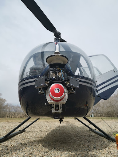
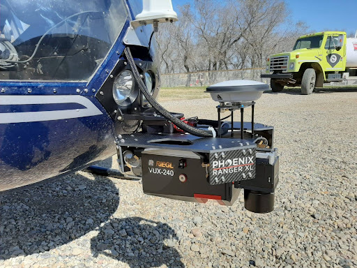
Airborne LiDAR continues to play an important role in supporting large-scale energy and infrastructure development by delivering accurate, high-resolution terrain data quickly and efficiently. This case study examines how the Blew & Associates team used the RANGER-U240 to support an energy project in Oklahoma and the benefits it provided throughout the surveying and planning process.
Download the PDF below, or read the original article on LiDAR News to read the whole piece.
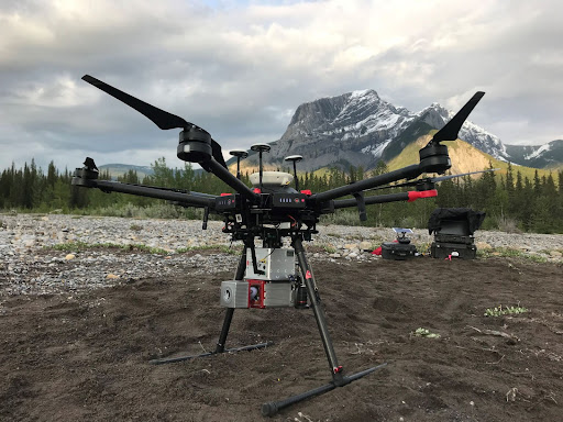
The RECON-F4 was flown at 120 m for a mapping flight at Phoenix LiDAR’s calibration site, flown at 6 m/s.
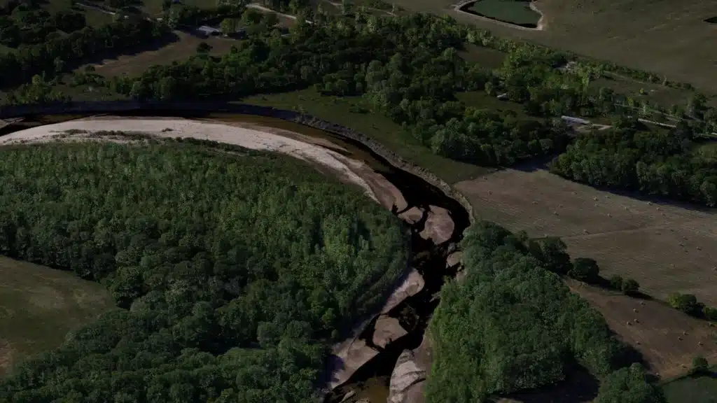
This RANGER-U580 sample dataset covers roughly 50 square miles of North Austin, Texas.
The project was flown with a Cessna 172 at 75 knots and 615 m above ground level. Data was processed in SpatialExplorer version 9.
Results:
34 points/m², per flight line
7 cm GSD
Full RANGER-U580 dataset available for download. Contact our team at sales@phoenixlidar.com for a link to download.
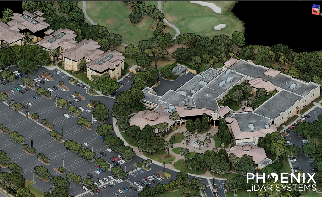
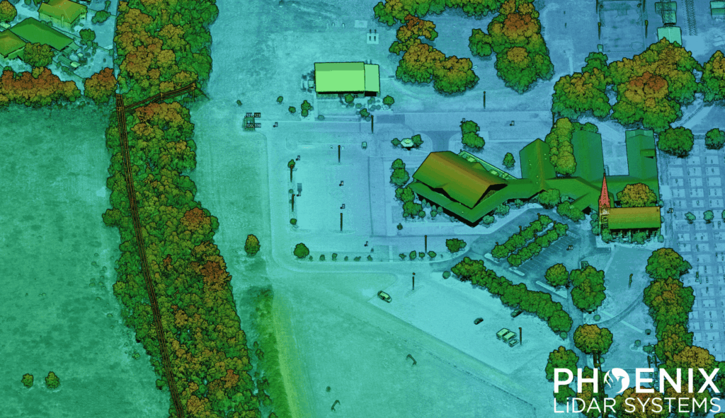
Check out our RANGER-Flex 𝗠𝗼𝗯𝗶𝗹𝗲 + 𝗔𝗲𝗿𝗶𝗮𝗹 𝗱𝗮𝘁𝗮 𝘀𝗲𝘁 of the University of Central Florida – Rosen College of Hospitality Management, recorded during the 2025 TopoDOT User Conference.
This data set features mobile and aerial scans by the RANGER-Flex, which were matched together using 𝗟𝗶𝗗𝗔𝗥𝗦𝗻𝗮𝗽. First, the site was flown using a single 𝗥𝗔𝗡𝗚𝗘𝗥-𝗙𝗹𝗲𝘅 LiDAR system mounted to a Harris Aerial 𝗛𝟲𝗘. Then, this same aerial LiDAR system was mounted inside the 𝗥𝗙𝗠𝟮 𝗺𝗼𝗯𝗶𝗹𝗲 𝘀𝘆𝘀𝘁𝗲𝗺, which enables dual-head mobile LiDAR collection.
Once the mobile data set was collected, the scans were matched together automatically using 𝗟𝗶𝗗𝗔𝗥𝗦𝗻𝗮𝗽’𝘀 𝗖𝗼𝗻𝘁𝗿𝗼𝗹 𝗖𝗹𝗼𝘂𝗱 functionality. Both scans were then colorized using the 𝟲𝟭 𝗠𝗣 𝗥𝟲 aerial camera.
Full Dataset available for download. Contact our team at sales@phoenixlidar.com for a link to download.
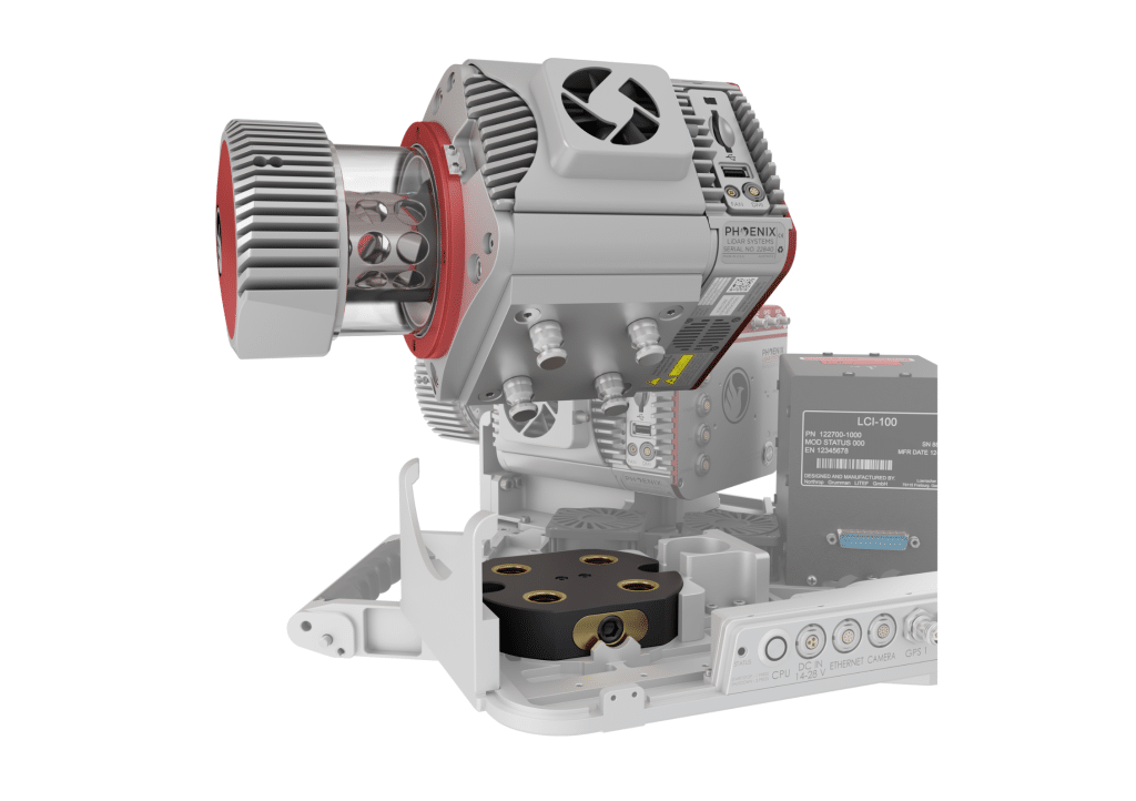
Modularity is a key feature of the RANGER-FLEX laser mapping product line.
These systems can be quickly reconfigured, with sensors added and/or removed, to allow for optimized utilization on a variety of vehicle types. Modularity also presents a challenge: How can a system calibration, which is a cornerstone of data accuracy, be preserved if laser scanners and cameras are routinely separated from each other and from the navigation system? The RANGER-FLEX has been engineered to specifically address this, and a series of datasets were collected to test the stability of its calibration.
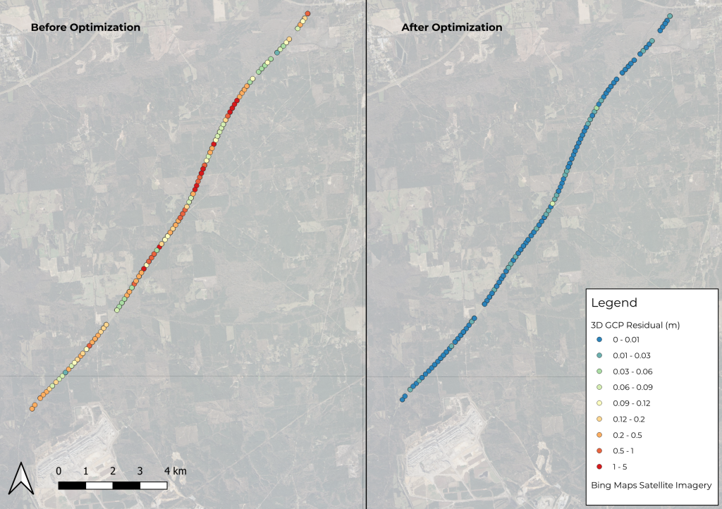
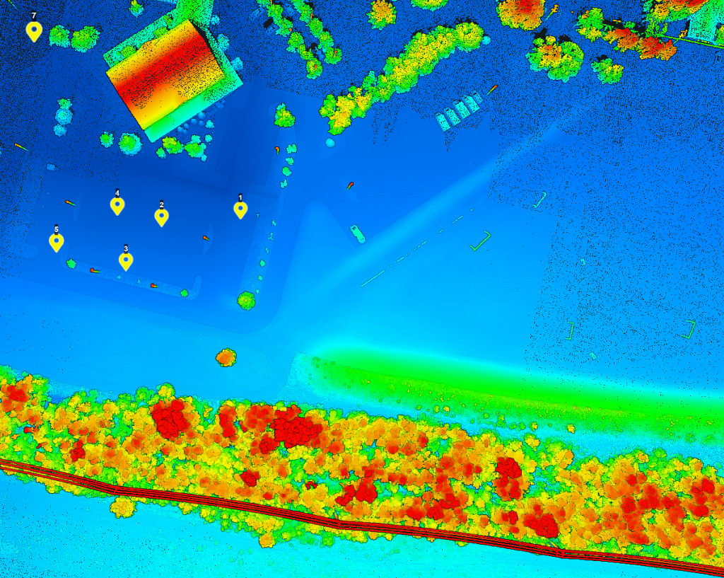
Phoenix LiDAR’s SpatialExplorer’s LiDARSnap strip alignment tool was tested using a challenging mobile LiDAR dataset collected along a rural state road, Natchez Trace Parkway, near Mathiston, Mississippi. Approximately 17.5 km of the parkway was mapped using the RANGER Flex dual-head mobile LiDAR mapping system.
Of the total mapped area, nearly 85% was covered by a dense tree canopy, which posed a significant accuracy challenge due to the limited availability of GNSS signals. LiDARSnap was utilized not only to calibrate the relative accuracy of the two passes but also to georeference the scan in relation to leveled control.
This paper discusses the processing workflow, results, and capabilities of LiDARSnap in challenging, GNSS-denied environments.
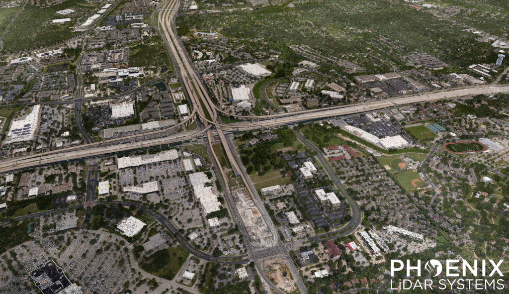
Speed: 8 m/s
Point density: ~250 points/m² per line
AGL: 120 m
No Camera Data Full FOV utilized
Safer and Faster, Higher Resolution, Survey Grade Accuracy
Use Case: How UAV-based LiDAR Has Transformed the Surveying Industry
Company: Pape-Dawson Engineers
Challenge
Pape-Dawson Engineers is the largest civil engineering firm headquartered, and exclusively located, in Texas with a staff of over 850 employees. Their team of professionals provide civil engineering, surveying, GIS, and environmental services for land development, transportation, and water resources projects for both private and public clients.
Pape-Dawson’s surveyors and engineers are faced with demanding projects with fast turnaround times. Daily challenges include mapping densely vegetated GNSS denied sites with line-of-site obstructions, access issues, and large scale sites requiring a daunting number of detailed feature measurements – to name a few.
Solution
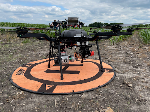
The Pape-Dawson team leverages the power of UAV-based LiDAR to safely and efficiently perform existing conditions topographic surveys. Using the Phoenix LiDAR RANGER-LITE, the team can densely collect site measurements in 1 day compared to weeks on the ground using conventional surveying methods. The enhanced resolution of the lidar data adds the value of unparalleled feature extraction.
“The wealth of data in the point cloud, no matter what you’re pulling from it, is definitely our greatest source of value.”
David Trotter
Pape-Dawson Engineers, Geospatial Specialist, Chief Pilot
Application
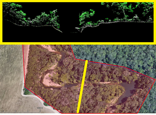
Pape-Dawson mapped two miles of riverbank for a client interested primarily in the features at the top of the bank on one side. Their team mapped the site within 45 minutes leveraging the UAV-based RANGER-LITE system. They collected the river bank of interest as well as the other bank, and even captured the exposed river bed features. Their team delivered the necessary data deliverables in two days, while simultaneously working on other projects.
Results
Heavily vegetated sites used to take Pape-Dawson’s surveyors several days to cut line through vegetation in preparation for data collection. Now, the team let’s the RANGER-LITE do the heavy lifting, mapping large scale and complex vegetated sites in under an hour. Accurate existing conditions surveys are critical, especially as it pertains to mass grading or dirt quantity calculations projects. They now capitalize on the enhanced resolution and accuracy provided by the RANGER’s LiDAR data for faster and more accurate quantity takeoffs, saving their team time and saving their customers money.
PARAMETERS
Scope: 2 mile river corridor
Acquisition Time: 45 minutes
Processing Time: 2 days
Quick Turnaround Time, Massive Data Collection, Tight Weather Window
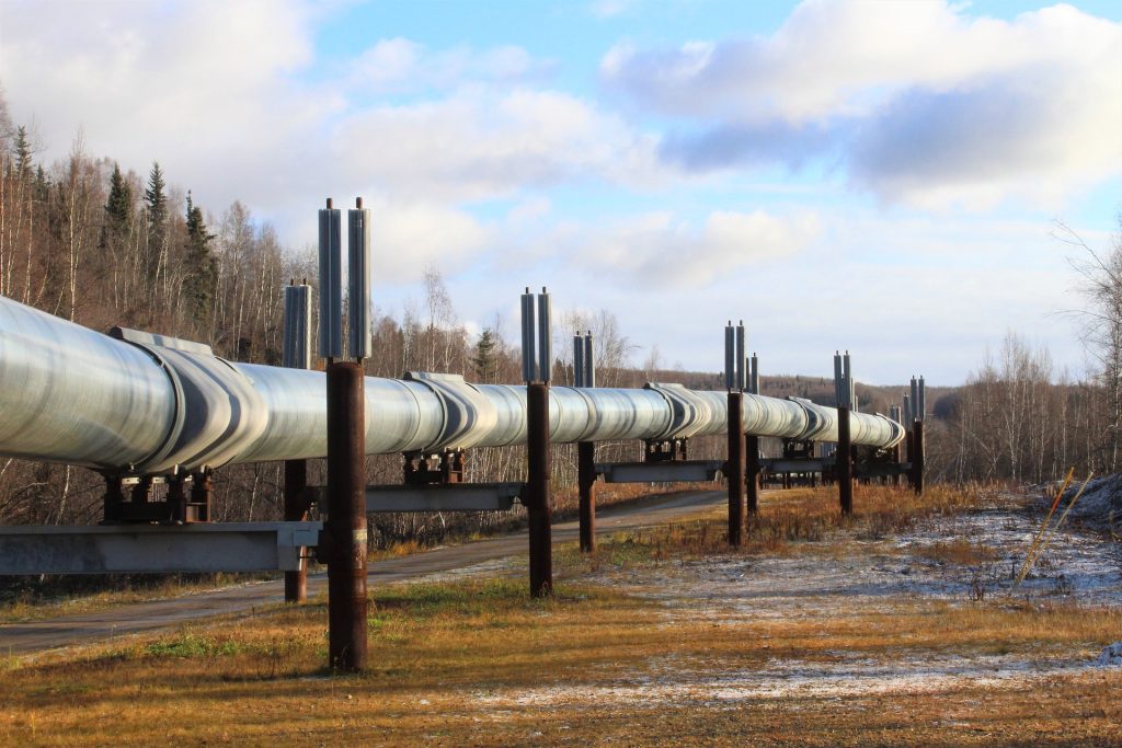
Use Case: Implementing LiDAR in Pipeline Surveys Expands Project Scope Capabilities for MSI
Company: Measurement Sciences Inc.
Challenge
MSI, Inc. leverages lidar technology in the oil and gas industry by expanding their project scopes and increasing the number of completed surveys within the short fair-weather window between snowmelt to snowfall.
They implement lidar in pipeline surveys to be able to show a grander scope of the river crossing and banks. LiDAR enables their team to produce a much more detailed pipeline profile than traditional methods (i.e. taking gridded shots every 5 meters with GNSS), and offers expanded client deliverable offerings.
Solution
MSI, Inc. leverages lidar technology in the oil and gas industry by expanding their project scopes and increasing the number of completed surveys within the short fair-weather window between snowmelt to snowfall.
They implement LiDAR in pipeline surveys to be able to show a grander scope of the river crossing and banks. LiDAR enables their team to produce a much more detailed pipeline profile than traditional methods (i.e. taking gridded shots every 5 meters with GNSS), and offers expanded client deliverable offerings.
Application
MSI, Inc. leverages LiDAR technology in the oil and gas industry by expanding their project scopes and increasing the number of completed surveys within the short fair-weather window between snowmelt to snowfall.
They implement lidar in pipeline surveys to be able to show a grander scope of the river crossing and banks. LiDAR enables their team to produce a much more detailed pipeline profile than traditional methods (i.e. taking gridded shots every 5 meters with GNSS), and offers expanded client deliverable offerings.
Results
MSI, Inc. owns and operates three Phoenix LiDAR systems: the MiniRANGER-1, RANGER-LR, and RANGER-XL. Their best collection windows are early spring and late fall, so they try to group as many sites together as possible to map consecutively during two sizeable RANGER-XL helicopter campaigns each year. They deploy the UAS-based miniRANGER to supplement sites between those two collection windows. This keeps the cost of helicopter operations down and still enables MSI to collect sites on demand, if needed, rather than waiting for the two seasonal windows. The decision process for which Phoenix system to deploy varies site by site – depending on time of year, project scope, and strictness of deliverable timelines.