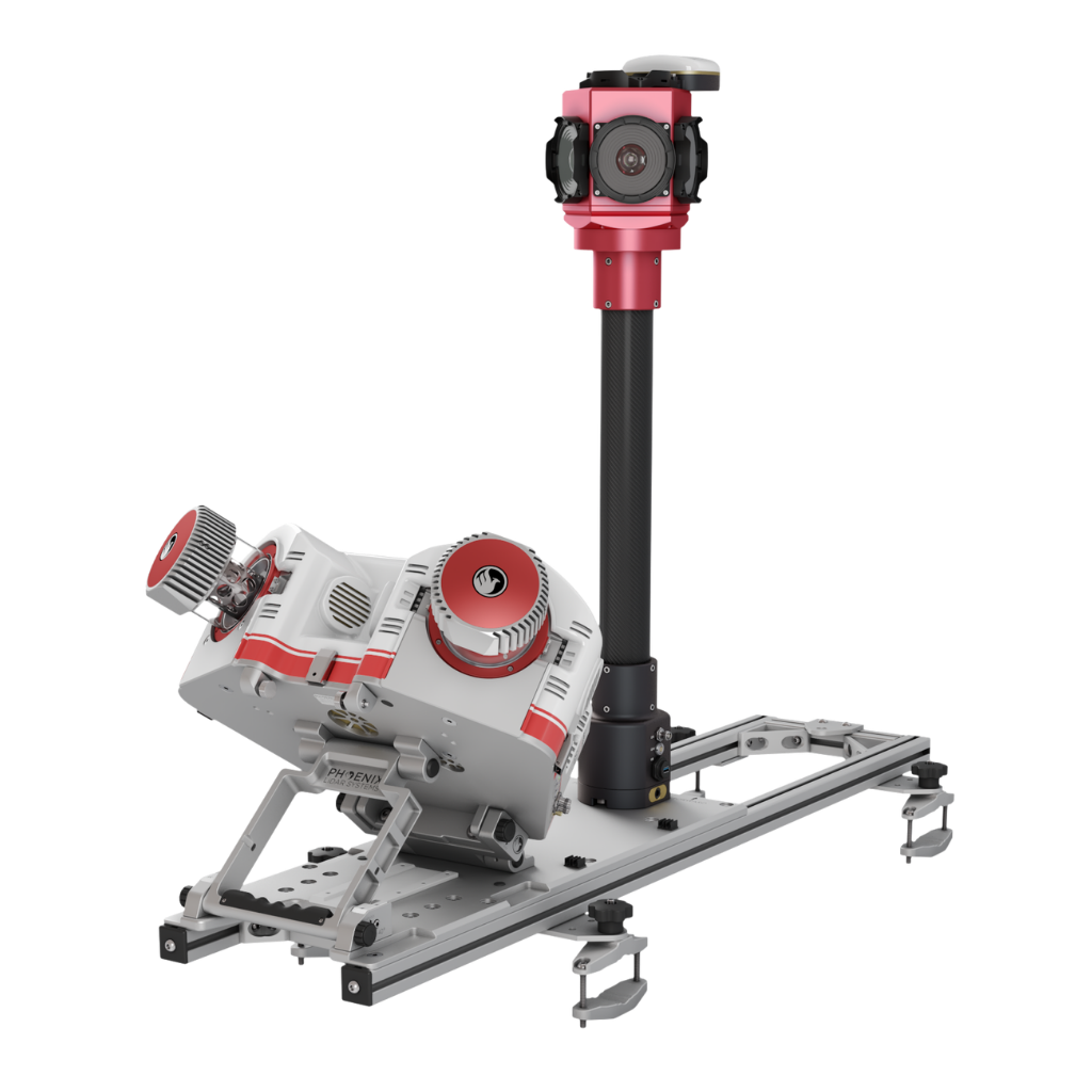
The dual scanner mobile accessory kit elevates the capabilities of our RANGER-UAV²² FLEX single scanner system by converting it into a high-performance dual scanner mobile solution, finely tuned to meet the high standards of demanding survey-grade mapping applications. The physical arrangement of the dual scanners is strategically designed to deliver substantial time savings on-site while ensuring comprehensive point coverage, achieving a remarkable speed of up to 2.4 million measurements per second.
RFM2-MOBILE ACCESSORY
The ideal combination of performance, flexibility and affordability
2.0 cm @ 120 m
RMSEz System Accuracy
2.0 cm @ 120 m
RMSDz Instraswath Precision
490 m
Recommended Range
17.4 kg
Weight
360°
Field of View
RFM2
60° x 40°
Scan Angle(s)
RFM2
OVERVIEW

OPTIONS

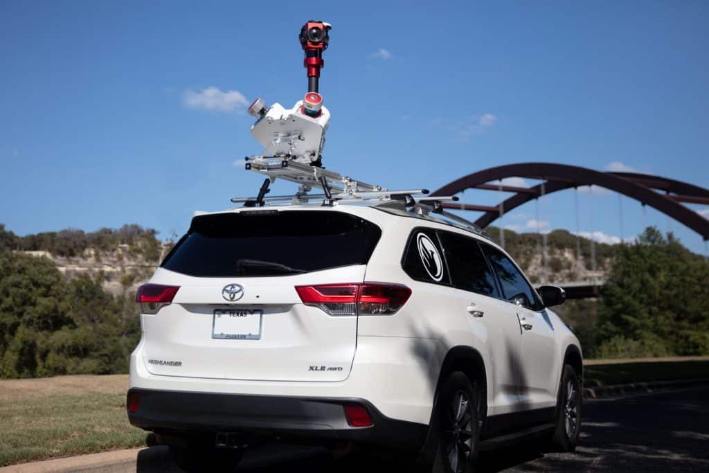
Vehicle
PRIMARY APPLICATIONS
Transportation Infrastructrure Mapping

Rail Surface Inspection

Asset Inventory Management

Construction
The RANGER-UAV²² FLEX as well as the dual scanner mobile accessory were designed with flexibility in mind. Our standalone RANGER-UAV²² FLEX payload acts as the central control unit within our dual scanner mobile accessory and when detached, becomes a versatile tool for backpack and UAV applications, adding another layer of adaptability to your toolkit.
RANGER FLEX DUAL MOBILE SYSTEM RFM2-UAV22
Full specifications
PAYLOAD SPECS
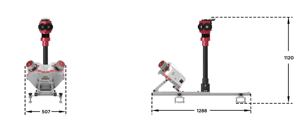
Overall Dimensions (L x W x H) (cm)
Removable Dual Head Unit: 43.2 x 53.3 x 22.8
Roof Rack: 128 x 28.5 x 12
360° Cam: 90 x 30 x 30
Roof Rack: 128 x 28.5 x 12
360° Cam: 90 x 30 x 30
Power Consumption
160 W typical
180 W typical (with 360° Camera)
180 W typical (with 360° Camera)
Weight
Removable Dual Head: 17.4 kg / 38.4 lbs
Roof Rack: 20 kg / 45 lbs
360° Cam: 9.2 kg / 20.3 lbs
Roof Rack: 20 kg / 45 lbs
360° Cam: 9.2 kg / 20.3 lbs
Operating Voltage
20 - 28 VDC
Operating Temperature
32° - 104° F
LiDAR SENSOR SPECS
Laser Wavelength
1550 nm
Range Minimum
1.5 m at ≥1 MHz PRR
Range Max
755 m at 20% reflectivity, 50 kHz PRR
Scan Speed
10 - 200 lines/second
Beam Count
1 facet rotating mirror
Max Return Count
15
Beam Divergence
IP64
Horizontal FOV
1.55 kg
Laser Accuracy
10 mm One sigma @ 150 m
Laser Safety
CLASS 1
Accessories & Options
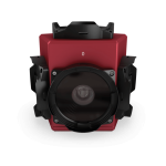
Ladybug 5+ / 6
IMU 60 FOG
DIMENSIONS (mm)
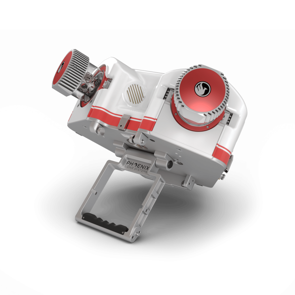
FRONT/LEFT
FRONT
Dual 360° FOV Laser Scanners
Bottom SIDE
Mounting Plate
0° and 40° Mounting Angles
Cover Latches
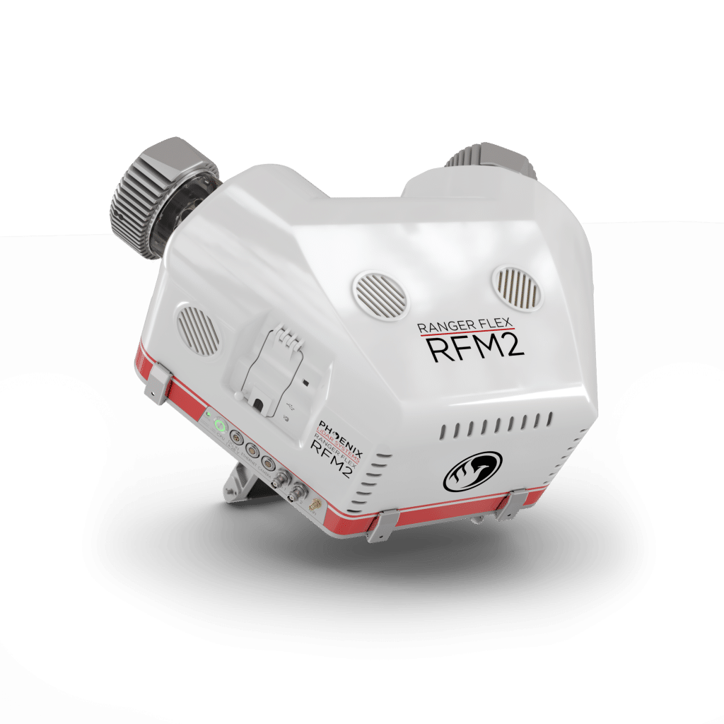
REAR/LEFT
Rear
Cover Latches
Cooling Vents
Left SIDE
Status LED and Power Button
DC IN
Ethernet, Camera, GPS 1/2, Wifi


Automated Post-Processing in the Cloud
CAPTURE | POST-PROCESS | ANALYZE | SHARE
Meet LiDARMill, the first cloud-based, LiDAR platform for post-processing, reporting, and hosting.
LiDARMill enables surveying teams to take advantage of precision laser mapping without investing in expensive software & training.
LiDARMill enables surveying teams to take advantage of precision laser mapping without investing in expensive software & training.