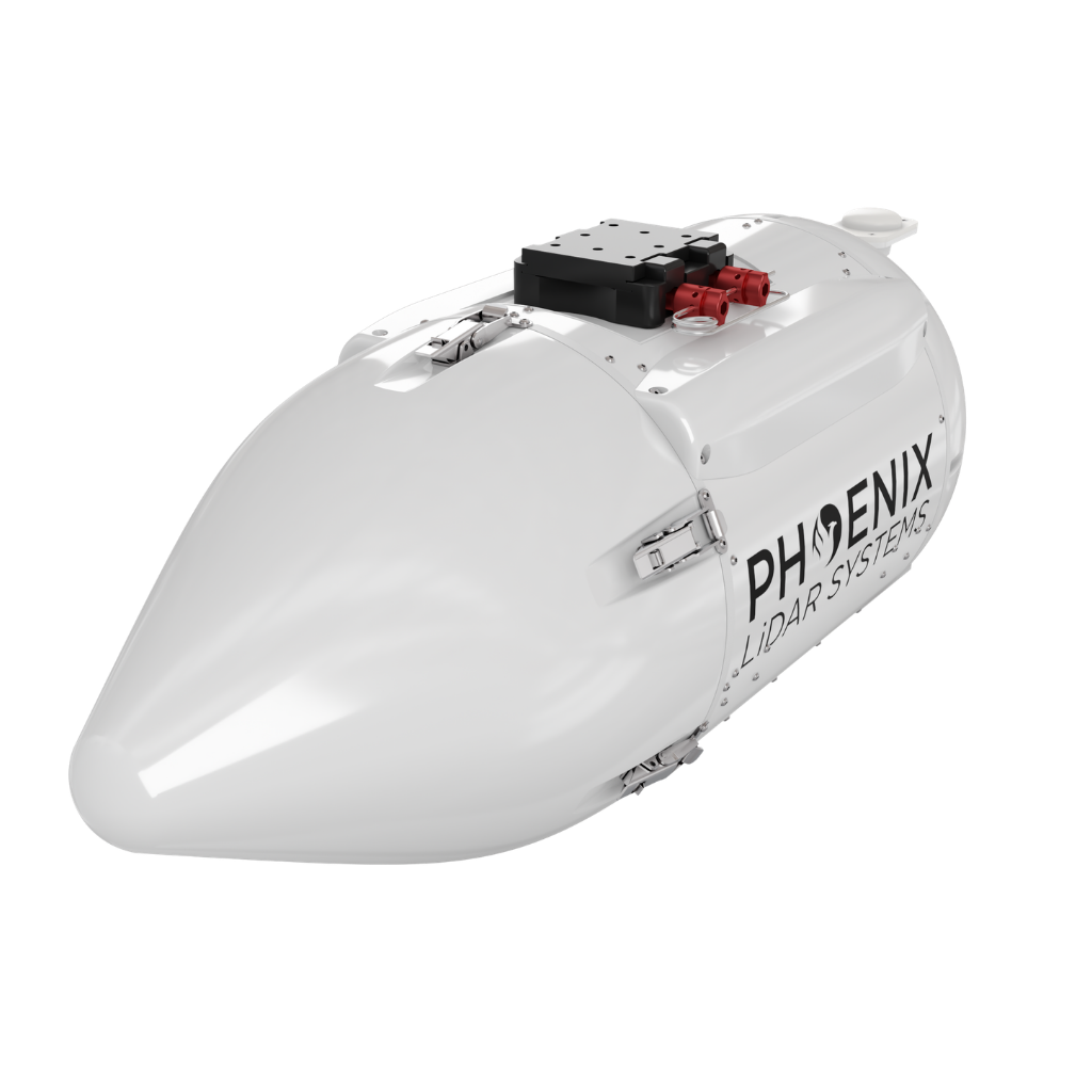
The ULTRAPOD Series from Phoenix LiDAR Systems is a complete, turnkey aerial integration solution engineered for a wide range of mapping and survey missions. The ULTRAPOD is available in two variants — UP240 and UP2 — to support specific payload configurations. The UP240 is designed to support the RANGER-U240 payload, while the UP580 is designed for the UP580. Constructed from a lightweight, durable composite housing, the ULTRAPOD is FAA and EASA approved for installation on Cessna 172, 182, 206, and 208 aircraft, providing a flexible and user-friendly mounting platform for LiDAR and imaging systems.
ULTRAPOD-UP240/UP580
A COMPLETE SURVEY-GRADE LIDAR SOLUTION FOR CERTIFIED CESSNA AIRCRAFT

2.5-5 cm @ 350 m
RMSEz System Accuracy
-
RMSDz Instraswath Precision
12 km2/h
Area Coverage
900 m
Max AGL @ 20% Reflectivity
~22 kg
Max Payload
100°
Field of View
ULTRAPOD
0°
Scan Angle(s)
ULTRAPOD
OVERVIEW

AIRCRAFT OPTIONS

Fixed Wing
PRIMARY APPLICATIONS

Utilities

Rail

Open Pit Mining

Wide Area Mapping

Agriculture & Forestry
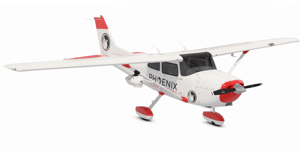
The ULTRAPOD UP240 and UP580 are designed for mounting on a wide variety of Cessna aircraft including 172, 182, 206, and 208 models.
Full specifications
Specification
UP240
UP580
Weight
6.0 kg / 13.2 lbs
5.1 kg / 11.3 lbs
Frontal Area
707.1 cm² / 109.6 in²
819.7 cm² / 127.1 in²
Length
79.4 cm / 31.25 in
85.4 cm / 33.6
Diameter
29.9 cm / 11.8 in
33 cm / 13 in
Max Payload
16.7 kg / 36.8 lbs
17.6 kg / 38.7 lbs
STC
FAA and EASA
FAA and EASA
Performance
~12 km²
~12 km²
Supported Payloads
RANGER-U160 & RANGER-U240
RANGER-U240 & RANGER-U580
Accessories & Options
IMU Upgrade
PLS Care
DIMENSIONS (mm)
ULTRAPOD UP240
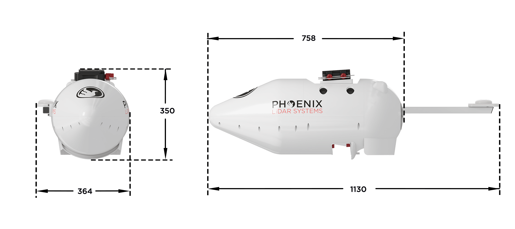
ULTRAPOD UP580


Automated Post-Processing in the Cloud
CAPTURE | POST-PROCESS | ANALYZE | SHARE
Meet LiDARMill, the first cloud-based, LiDAR platform for post-processing, reporting, and hosting.
LiDARMill enables surveying teams to take advantage of precision laser mapping without investing in expensive software & training.
LiDARMill enables surveying teams to take advantage of precision laser mapping without investing in expensive software & training.