-
RMSEz System Accuracy
6 cm @ 750 m
RMSDz Instraswath Precision
1600 m / 2754 m
Max AGL @ 20% Reflectivity
~30 kg
Weight
80°
Field of View
HALO H
0°
Scan Angle(s)
HALO H
KEY FEATURES


Helicopter

Airplane

Oil & Gas

Utilities
Construction

Mapping

Forestry

Quick Release

Air NavBox

SE8
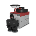
The HALO series LiDAR scanners are made for high-altitude, high-efficiency mapping. City-scale LiDAR projects are easily achievable with swath widths reaching 4,000 m. Selectable measurement rates up to 1 MHz and line speed up to 250 per second can be tuned to meet challenging pulse density specifications.
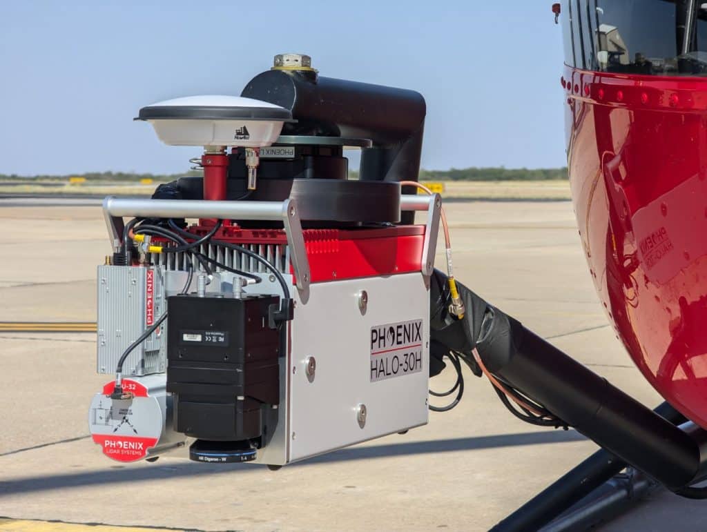
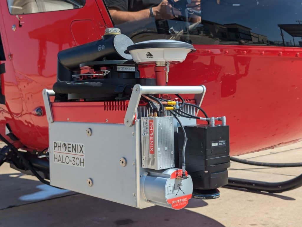
The HALO-H is available in two different models; the HALO-15H and the longer-range HALO-30H.
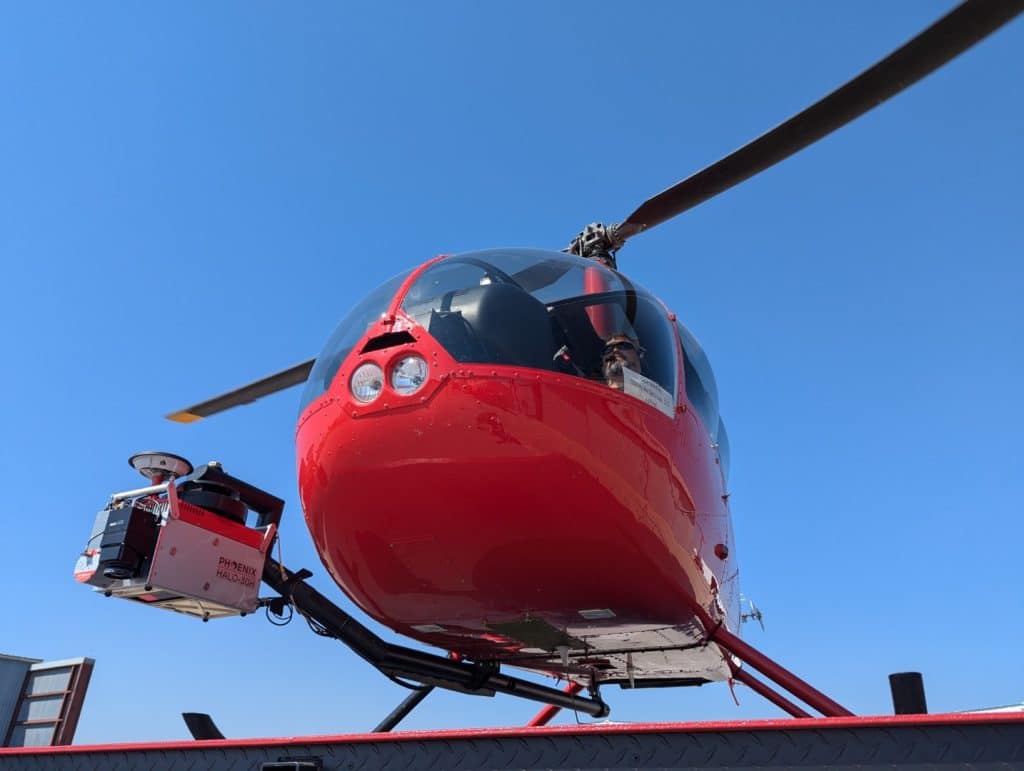
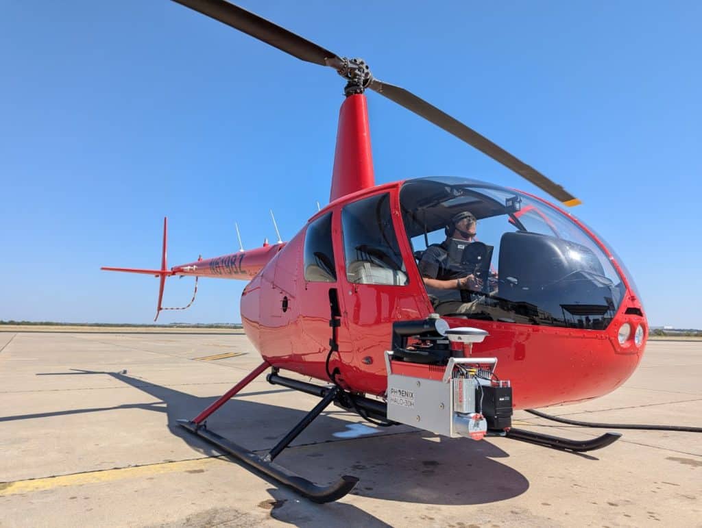
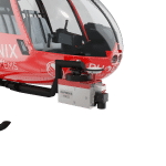
The HALO H in aerial configuration easily integrates on the ROBINSON R44 and other manned helicopters.
Full specifications
Specification
Performance
Pulse Repetition Rate (PRR)
1600 kHz
Scan Rate
20 - 250 lines/second
Field of View
80°
Laser Wavelength
1030 nm
Constellation Support
GPS, GLONASS, BEIDOU, GALILEO
Max Echoes/ Returns per pulse
Virtually Unlimited
Dimensions
51.9 x 21.6 x 24.8 cm
Operating Voltage/ Power
18-28 VDC / 155 W
Operating Temps
0 - +40° C
Beam Divergence
0.3 mrad
Sensor Precision
-
Laser Scanner Model
Geolas ELMAP-H
(1) 100% laser power
(2) 80° field of view
(3) NOHD & ENOHD determined for non-overlapping beam footprints.
Accessories & Options
Heli Mount
Camera Options
IMU Options
PLS Care
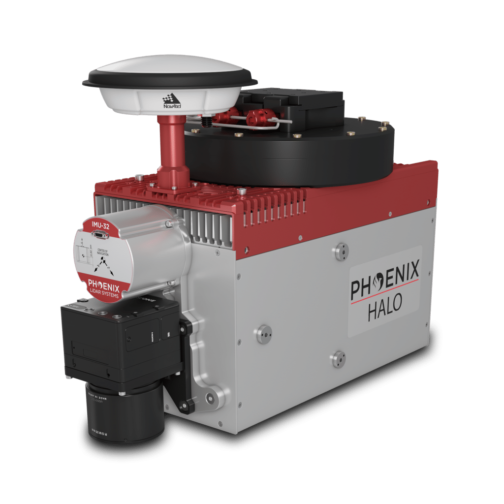
DIMENSIONS (mm)
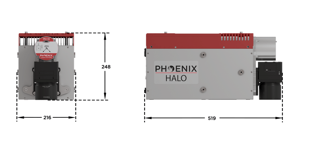
FRONT/LEFT
FRONT
Laser Scanners
GPS Mount
IMU
Camera Mount
LEFT SIDE
Accessory Mounting
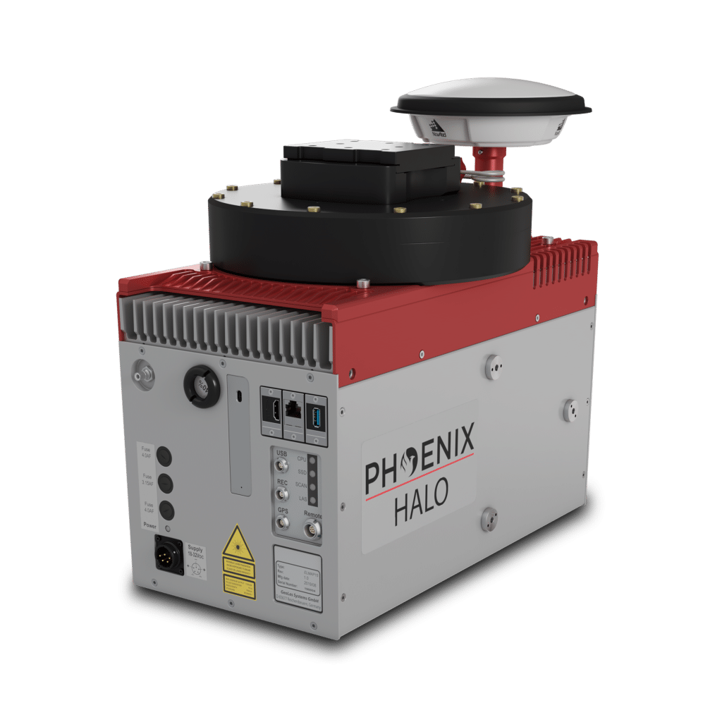
REAR/RIGHT
REAR
Power Button
Status LED
GPS Antenna 1-2
USB
Ethernet
RIGHT
Accessory Mounting


Automated Post-Processing in the Cloud
CAPTURE | POST-PROCESS | ANALYZE | SHARE
Meet LiDARMill, the first cloud-based, LiDAR platform for post-processing, reporting, and hosting.
LiDARMill enables surveying teams to take advantage of precision laser mapping without investing in expensive software & training.
LiDARMill enables surveying teams to take advantage of precision laser mapping without investing in expensive software & training.