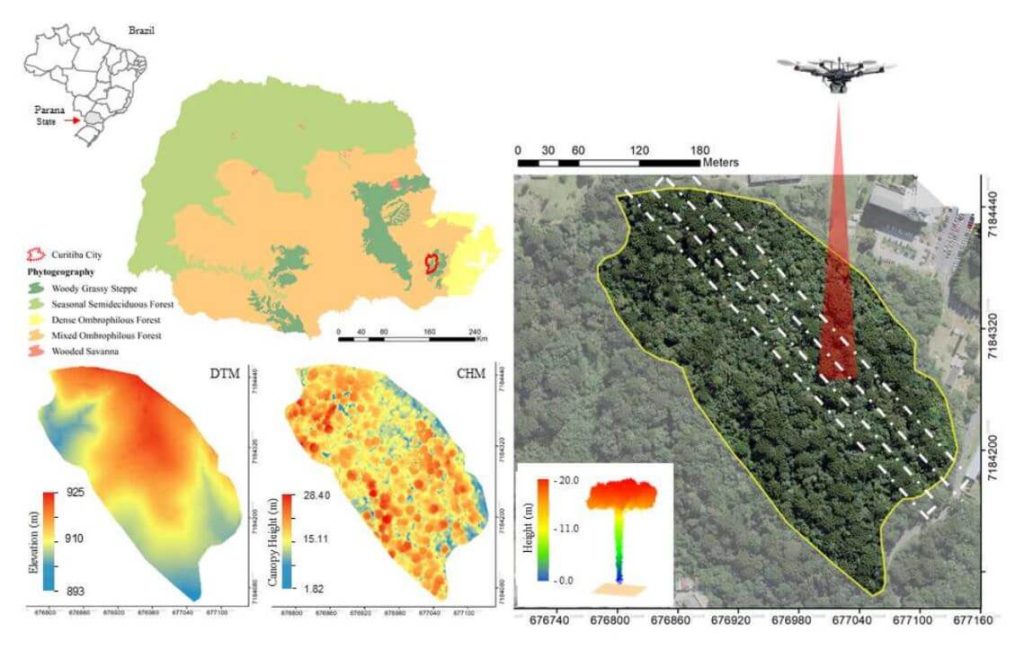
This whitepaper explores the role of urban forest remnants in mitigating climate change by reducing carbon dioxide levels in urban areas. Specifically, it focuses on the potential of UAV-LiDAR systems to accurately measure individual tree heights in an Urban Atlantic Forest, using Araucaria angustifolia trees as a case study.
Through detailed analysis, the study assesses the impact of varying point densities (ranging from 2,500 to 5 returns per square meter) on the accuracy of tree height measurements. The findings reveal that higher point densities provide more precise tree profiles, while lower densities result in gaps in the Crown Height Model (CHM). The research highlights that the optimal point density for the highest agreement between UAV-LiDAR -derived and field-based tree heights is 100 returns per square meter, with the lowest relative root mean square error (rRMSE) observed at 50 returns per square meter.
This whitepaper underscores the effectiveness of UAV-LiDAR technology in urban forest management and its implications for developing policies to maintain essential ecosystem services.