In recent years, airborne laser scanning has revolutionized the documentation of historic cultural landscapes, extending its applications from natural landscapes to built environments. The integration of unoccupied aerial vehicles (UAVs) with LiDAR systems is a transformative advancement, providing complementary data for precise mapping of targeted areas.
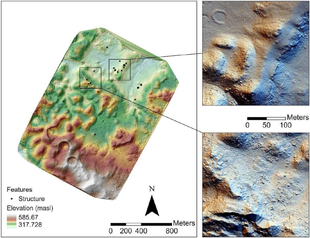
This whitepaper presents the findings from a 2019 study in the Maya Lowlands of Chiapas, Mexico, utilizing UAV LiDAR to capture and analyze data from six archaeologically significant areas. These areas, characterized by diverse environments, land cover, and archaeological features, were studied for their pre-Hispanic settlements and agrarian landscapes. The results confirm the immense potential of UAV LiDAR systems for high-precision archaeological mapping and underscore the importance of multidisciplinary collaboration.
The high-precision data acquired is invaluable for mapping archaeological features and understanding long-term land use and landscape changes in archaeological contexts.

