High Point Density, High Accuracy, High Measurement Range
Use Case: Mapping the Rocky Mountain Foothills with the Helicopter-Mounted RANGER Series
Company: SkySkopes
Challenge
SkySkopes is a professional service provider with a highly qualified operations and geospatial team. They operate a wide variety of advanced sensors and aircraft for transmission and distribution line inspections, oil and gas applications, and many other innovative use cases that focus on adding value.
The challenge was finding a solution that could be adaptable to unmanned aircraft, rotorcraft, and fixed wing platforms.
“SkySkopes utilizes unmanned aircraft, rotorcraft, fixed wing, and mobile platforms. One of the benefits of Phoenix LiDAR systems is the ability to use the same sensor on multiple platforms.”
Eric Goetsch, VP of Helicopter Operations, R&D
Solution
One of the benefits of Phoenix LiDAR systems is the ability to use the same sensor on multiple platforms. With the purchase of the RANGER-XL system, SkySkopes could bid on fixed wing, rotorcraft, and UAV based projects.
Benefits
- Ability to fly high and fast, without sacrificing point density
- Efficiently collects high precision, high accuracy data
- Adaptable to a wide variety of vehicle platforms
- Turn Key operation
“We have been able to bid on and win numerous projects just based off of our RANGER-XL LiDAR system. Being able to utilize that system in such a variety of project types and industries allows for a faster return on investment.”
Eric Goetsch – VP of Helicopter Operations, R&D
Acquisition
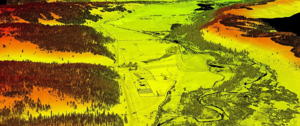
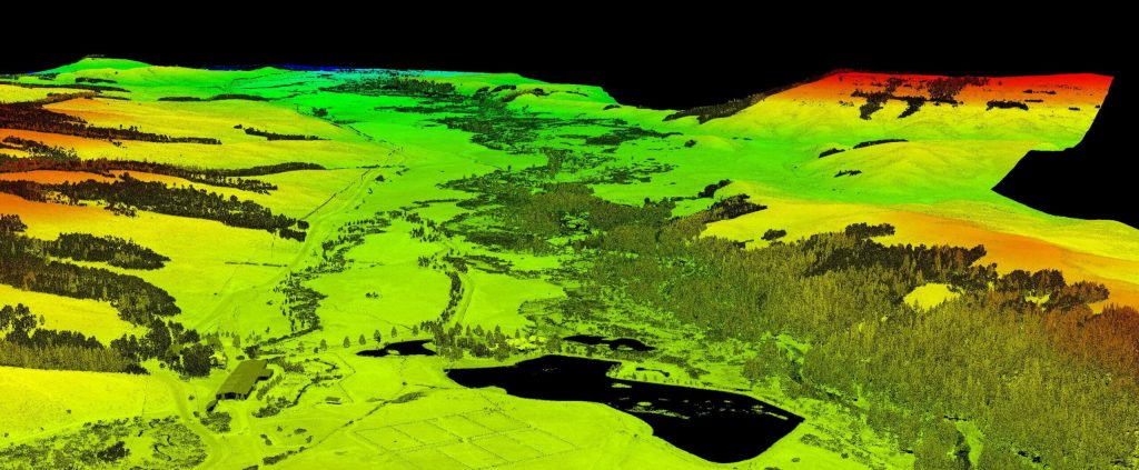
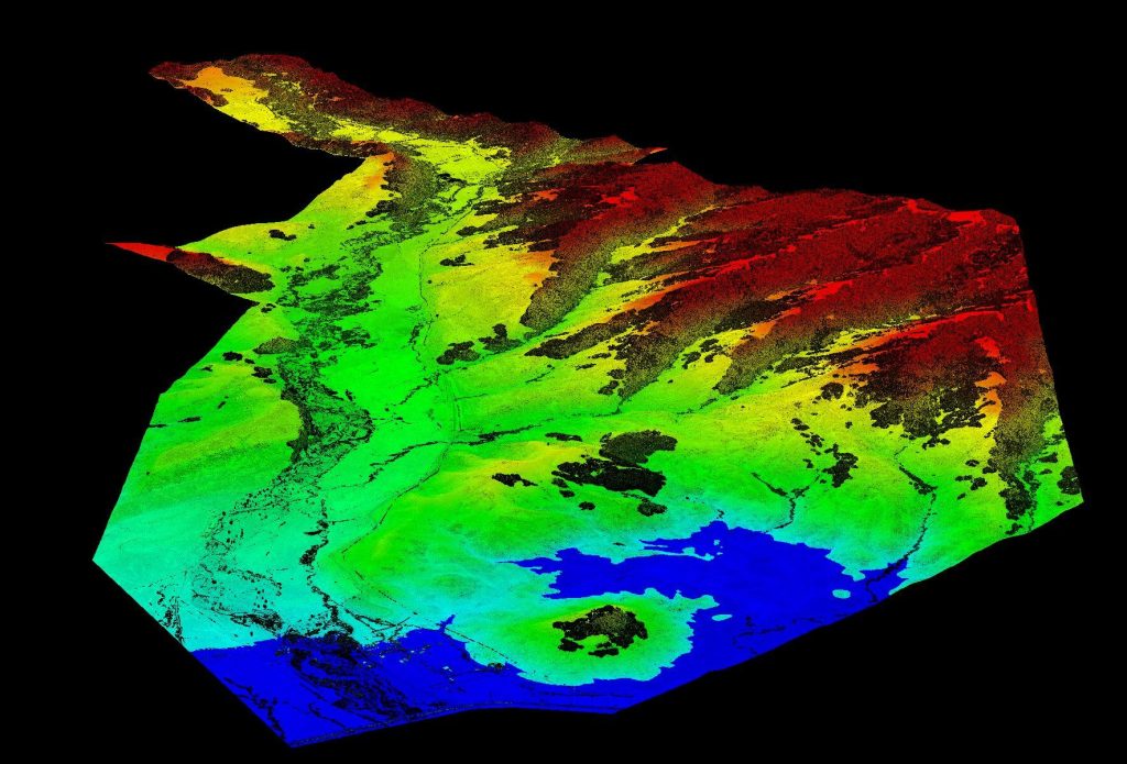
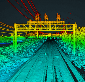
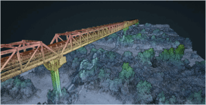
SkySkopes completed a wide area mapping pre-construction survey in the foothills of the Rocky Mountains with a scope of 12,000 acres. Taking the size of the project into consideration, as well as the complex and challenging mountainous terrain, their team selected a Bell 407 helicopter with a RANGER-XL. The RANGER-XL’s long ranging capability allowed the team to safely and efficiently collect data at 1,200ft above the ground, flying at a ground speed of 60 knots, all while meeting and exceeding the project’s point density requirement of 30 points per square meter.
Results
The SkySkopes team has reliably bid on and won numerous projects based off of the capabilities of their RANGER-XL LiDAR system. Utilizing the RANGER-XL solution in a variety of project types and industries allowed for a faster return on investment. Leveraging the ranging capabilities of the RANGER-XL combined with the endurance of the Bell 407, enables their team to safely, efficiently, and reliably map large areas while penetrating dense foliage.
PARAMETERS
Site: 2,000-acre pre-construction survey in the foothills of the Rocky Mountains
Solution: RANGER XL + Bell 407 Helicopter
AGL: 1200ft
Point Density: 30 points per square meter
Time: 5 hours