2-3.5 cm @ 120 m
RMSEz System Accuracy
2.5 cm @ 120 m
RMSDz Instraswath Precision
260 m
Max AGL @ 20% Reflectivity
1.3 kg
Weight
360°
Field of View
miniRANGER 3
0°
Scan Angle(s)
miniRANGER 3
KEY FEATURES

AIRCRAFT OPTIONS

UAV

VTOL
PRIMARY APPLICATIONS

Utilities

Rail
Construction

Mapping

Oil & Gas
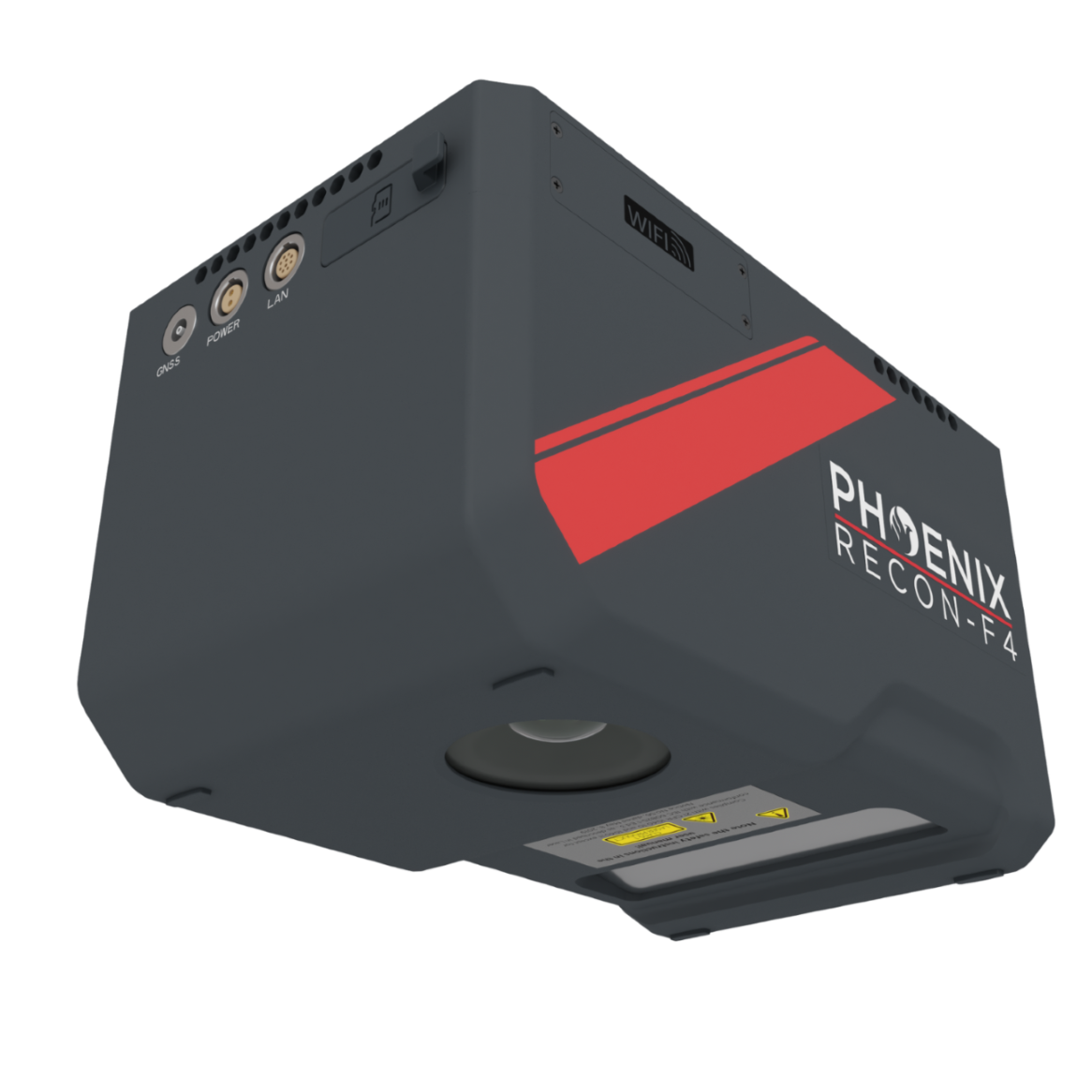
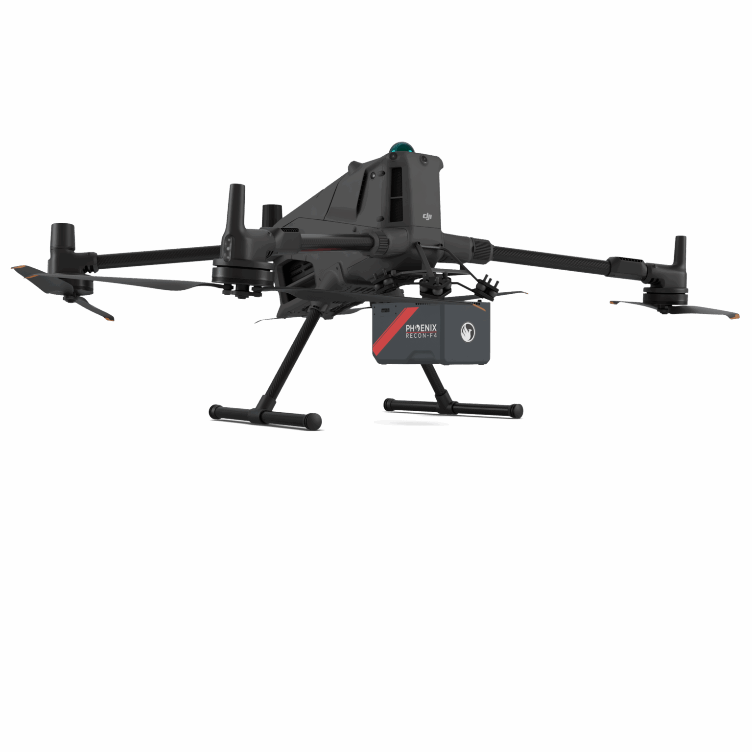
The RECON-F4 is an advanced, lightweight aerial LiDAR surveying solution designed specifically for small to mid-size drones such as the DJI M400 and Freefly Astro Max. The RECON-F4 seamlessly combines cutting-edge lightweight LiDAR technology with a high-accuracy drone optimized GNSS-INS system and an industrial-grade full-frame orthophoto camera all in a compact survey-grade 3D laser mapping solution. Combined with Phoenix LiDAR flight planning and post processing software, the RECON-F4 is an efficient and cost effective solution for 3D data acquisition and processing.
Features:
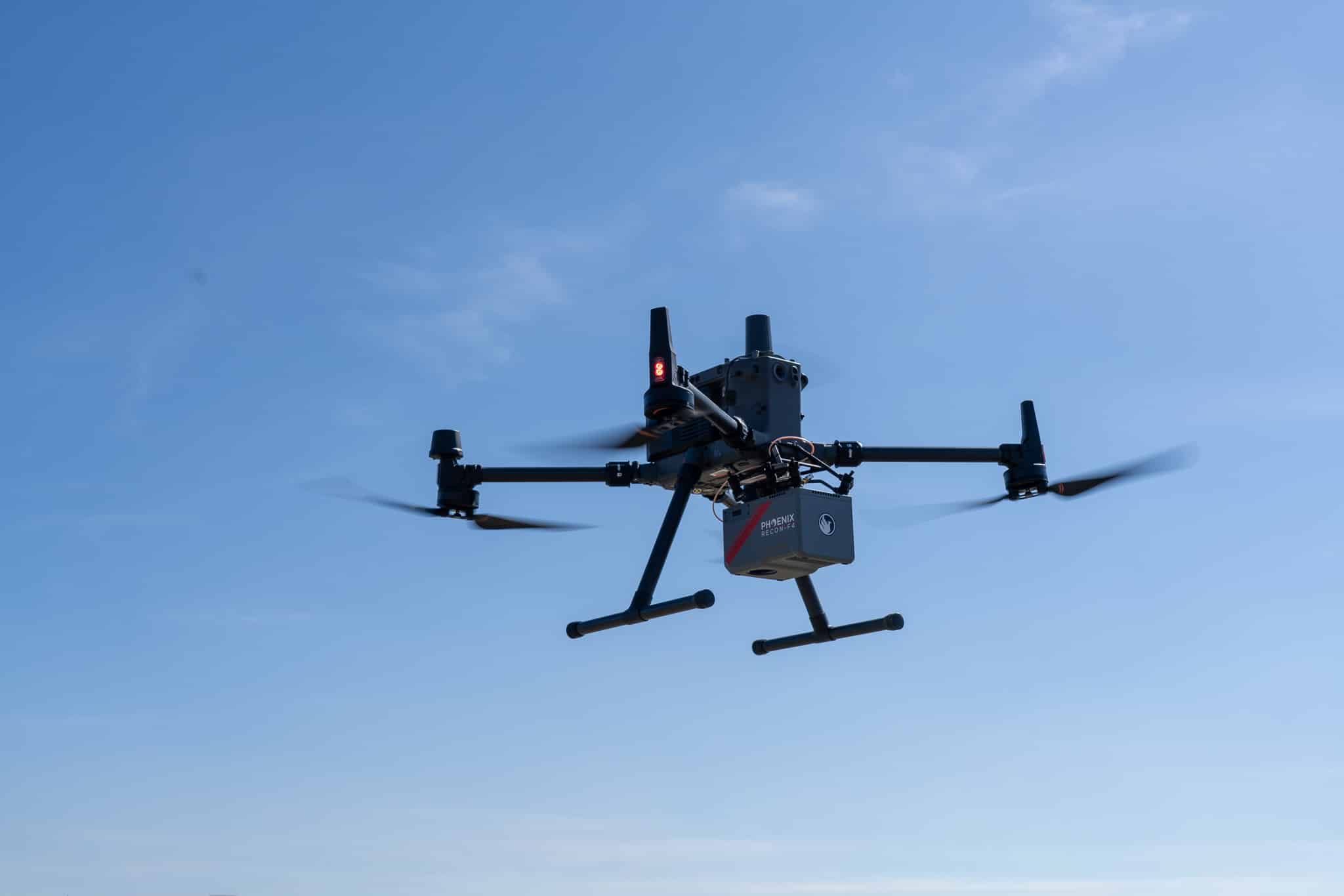
The RECON-F4 on DJI M350.
Full specifications
PLATFORM SPECS
Operating Voltage
13.7 - 32 V DC
Power Consumption
Up to 40w (36w typical)
Operating Temperature
-4° - +122° F
LiDAR SENSOR SPECS
Laser Wavelength
1535 nm (CLASS 1)
Range Maximum
420 m at 20% reflectivity, 100 kHz PRR
Scan Speed
30-300 lines/second
Horizontal FOV
80°
Pulse Repetition Rate
100 to 550 kHz
Beam Divergence
typ. 0.5 mrad @ 1/e
Minimum Range
5 m
Laser Accuracy*
10 mm One sigma @ 100 m
Laser Precision**
5 mm One sigma @ 100 m
CAMERA SPECS
Resolution
45 MP
Focal Length (FOV)
18 mm (89.84° H x 67.16° V)
Sensor Size
35.9 mm x 24 mm (8184 x 5460)
- Laser accuracy is the degree of conformity of a measured quantity to its actual (true) value.
- Laser precision is the degree to which further measurements show the same results
Dimensions

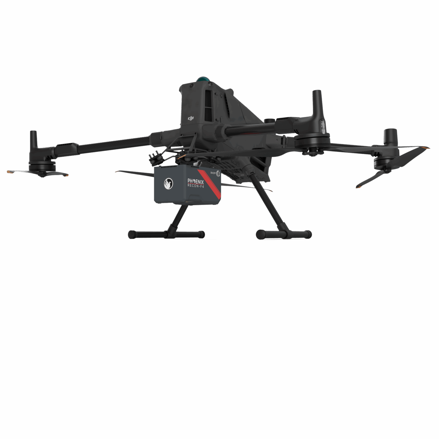
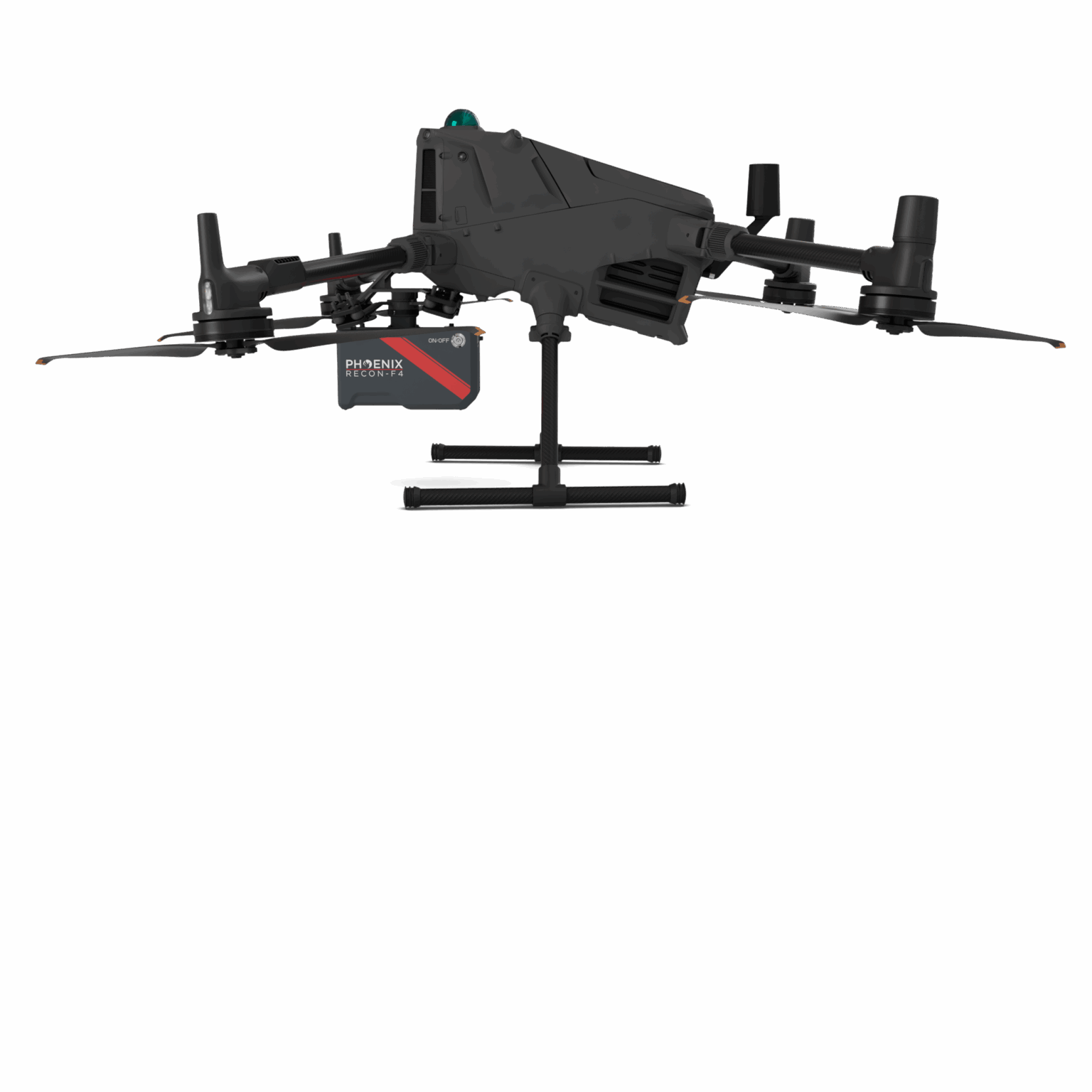
M400 Integration


Automated Post-Processing in the Cloud
CAPTURE | POST-PROCESS | ANALYZE | SHARE
Meet LiDARMill, the first cloud-based, LiDAR platform for post-processing, reporting, and hosting.
LiDARMill enables surveying teams to take advantage of precision laser mapping without investing in expensive software & training.
LiDARMill enables surveying teams to take advantage of precision laser mapping without investing in expensive software & training.