Environmental Engineering
High Point Density, High Accuracy, High Measurement Range
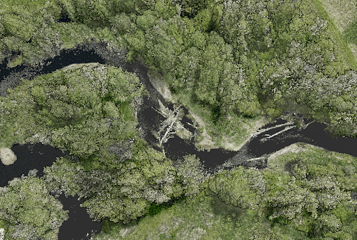
Use Case: Mapping the Rocky Mountain Foothills with the Helicopter-Mounted RANGER Series
Company: SkySkopes
Challenge
SkySkopes is a professional service provider with a highly qualified operations and geospatial team. They operate a wide variety of advanced sensors and aircraft for transmission and distribution line inspections, oil and gas applications, and many other innovative use cases that focus on adding value.
The challenge was finding a solution that could be adaptable to unmanned aircraft, rotorcraft, and fixed wing platforms.
“SkySkopes utilizes unmanned aircraft, rotorcraft, fixed wing, and mobile platforms. One of the benefits of Phoenix LiDAR systems is the ability to use the same sensor on multiple platforms.”
Eric Goetsch, VP of Helicopter Operations, R&D
Solution
One of the benefits of Phoenix LiDAR systems is the ability to use the same sensor on multiple platforms. With the purchase of the RANGER-XL system, SkySkopes could bid on fixed wing, rotorcraft, and UAV based projects.
Benefits
- Ability to fly high and fast, without sacrificing point density
- Efficiently collects high precision, high accuracy data
- Adaptable to a wide variety of vehicle platforms
- Turn Key operation
“We have been able to bid on and win numerous projects just based off of our RANGER-XL LiDAR system. Being able to utilize that system in such a variety of project types and industries allows for a faster return on investment.”
Eric Goetsch – VP of Helicopter Operations, R&D
Acquisition
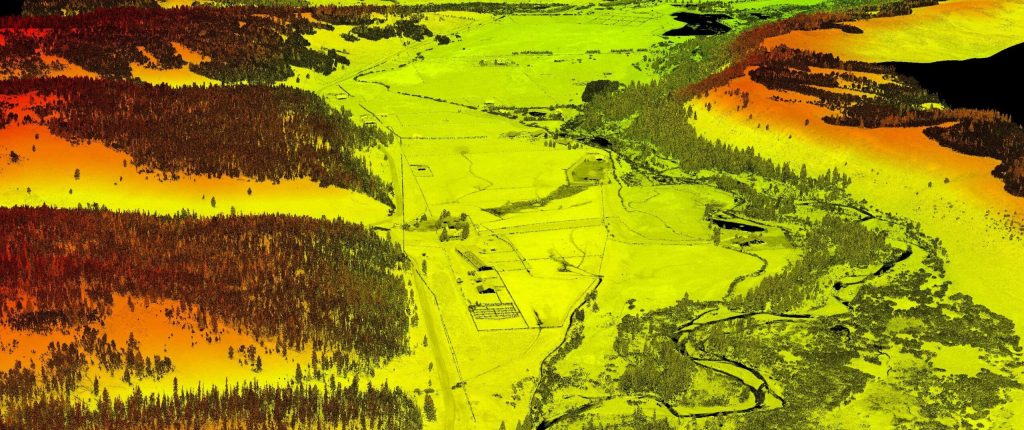
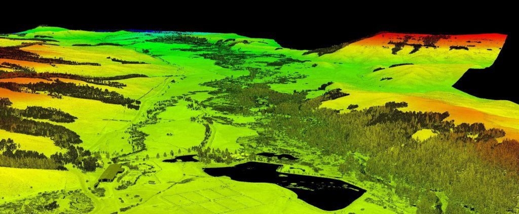
SkySkopes completed a wide area mapping pre-construction survey in the foothills of the Rocky Mountains with a scope of 12,000 acres. Taking the size of the project into consideration, as well as the complex and challenging mountainous terrain, their team selected a Bell 407 helicopter with a RANGER-XL. The RANGER-XL’s long ranging capability allowed the team to safely and efficiently collect data at 1,200ft above the ground, flying at a ground speed of 60 knots, all while meeting and exceeding the project’s point density requirement of 30 points per square meter.
Results
The SkySkopes team has reliably bid on and won numerous projects based off of the capabilities of their RANGER-XL LiDAR system. Utilizing the RANGER-XL solution in a variety of project types and industries allowed for a faster return on investment. Leveraging the ranging capabilities of the RANGER-XL combined with the endurance of the Bell 407, enables their team to safely, efficiently, and reliably map large areas while penetrating dense foliage.
PARAMETERS
Site: 2,000-acre pre-construction survey in the foothills of the Rocky Mountains
Solution: RANGER XL + Bell 407 Helicopter
AGL: 1200ft
Point Density: 30 points per square meter
Time: 5 hours
Point Density: 320 points per m^2
Height: 80 m AGL
Speed: 8 m/s
Data Acquisition Time: 7 minutes
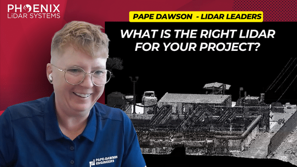
In this informative video, Angela Livingston from Pape-Dawson Engineers, a leading firm in civil engineering and LiDAR services, shares her extensive experience and insights. Pape-Dawson Engineers has been around for over 50 years, expanding their operations across various locations in Texas and Florida. Angela, with a strong background in photogrammetry, LiDAR, and GIS, explains how the company has integrated LiDAR technology into their workflows to enhance efficiency and accuracy in land development projects. The company now utilizes multiple UAVs and LiDAR scanners, including the Phoenix Recon XP, Ranger VUX, and Ranger Ultra, to cater to diverse project needs.
Angela dives into the decision-making process behind choosing specific LiDAR systems based on factors such as vegetation, site size, and project requirements. She explains the strategic use of both drones and helicopters for LiDAR data acquisition, depending on the project’s scope and environmental conditions. This flexibility allows Pape-Dawson to efficiently handle larger projects, such as wastewater treatment plant expansions, and significantly reduce time and costs compared to traditional terrestrial scanning methods. Angela emphasizes the importance of selecting the right tool for the job to achieve the best results.
The video also covers the crucial aspect of standardized workflows and data processing techniques that Pape-Dawson employs. Angela highlights how having a well-defined process ensures high-quality and accurate deliverables for engineering projects. She explains their method of using Phoenix’s Spatial Explorer and Inertial Explorer for navigation processing, followed by Terra Solid and MicroStation for point cloud fusion and feature extraction. This meticulous approach allows Pape-Dawson to maintain consistency and reliability in their data outputs, which is essential for supporting their engineers’ work.
Towards the end of the video, Angela expresses her appreciation for the support and collaboration with Phoenix LiDAR Systems, noting how their responsiveness to feedback has led to hardware and software improvements. She encourages viewers to reach out to her via email for advice on project collection and sensor selection. Angela’s expertise and willingness to share her experiences provide a valuable resource for anyone looking to enhance their engineering projects with advanced LiDAR technology. For those interested, Angela can be contacted through Pape-Dawson’s website or directly via email.
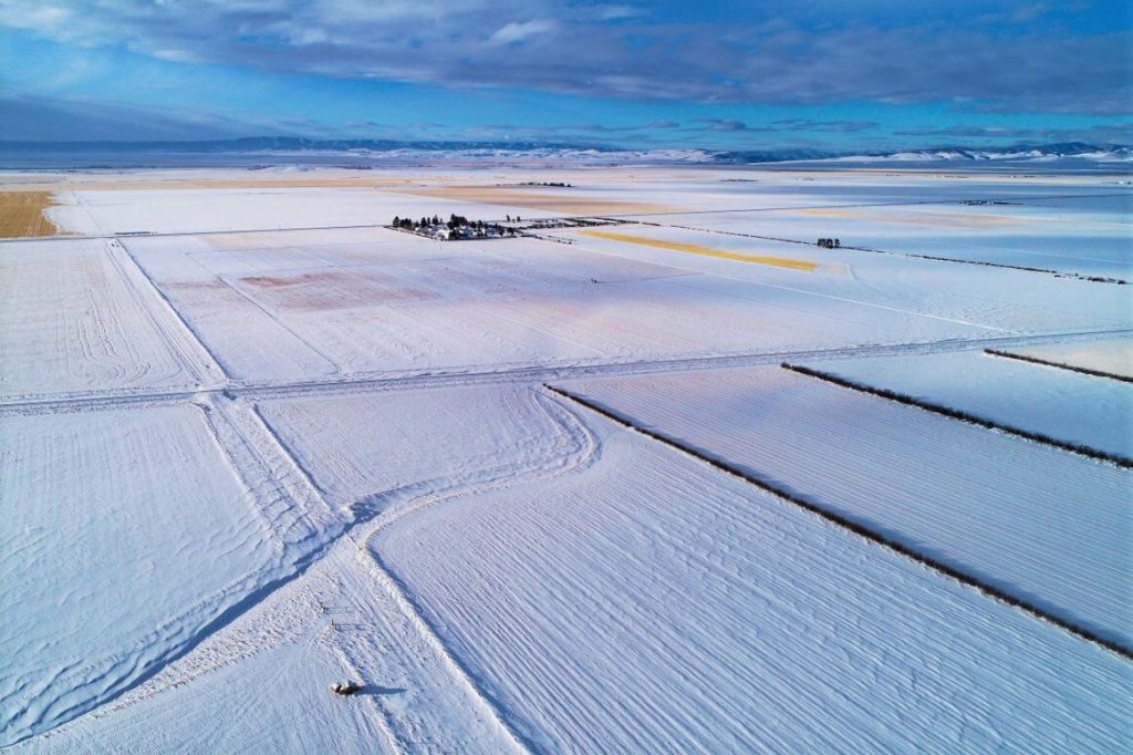
The December 2021 Phoenix LiDAR Systems webinar focused on LiDAR snow surface mapping for NASA’s SnowEx program. Jeff Rizza from DJ&A detailed a 2021 snow surface mapping project using high-resolution drone LiDAR to capture data in Montana’s prairie biome. Highlighting his experience with UAVs and LiDAR, Jeff discussed DJ&A’s collaboration with NASA and Montana State University to improve snow data collection methods.
The webinar covered Phoenix’s LiDAR systems, cold-weather challenges, and innovative survey methods for accurate snow surface mapping. Jeff showcased data insights on snow dynamics influenced by wind and vegetation and discussed processing challenges using Phoenix’s SpatialExplorer and Terascan software. The Q&A session addressed equipment, data processing, and unique SnowEx project aspects. Jeff also previewed an upcoming white paper comparing LiDAR and photogrammetry, highlighting LiDAR’s advantages in vegetation-dense areas.
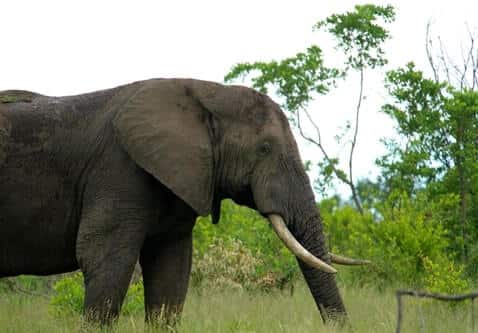
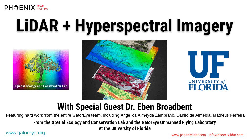
Discover the innovative use of LiDAR technology in animal landscape ecology with Phoenix LiDAR Systems’ November 2020 webinar. This session delves into how remote sensing technologies, like LiDAR, are revolutionizing ecological research, particularly in understanding animal-landscape interactions. Hosted by Kory Kellum, a top GIS engineer at Phoenix LiDAR, the webinar features insights from Evan Hawkeridge, a PhD student from Harvard University’s Davies Lab.
Learn about the role of ecosystem engineers, such as elephants and termites, and how their behaviors influence ecosystems on a regional scale. The discussion covers advanced data collection methods using drones equipped with LiDAR and thermal sensors, challenges faced in field operations, and groundbreaking research projects in Kruger National Park and the Republic of Congo.
Tune in to explore how these technologies provide unprecedented detail and accuracy in ecological studies, offering new perspectives on animal behavior and landscape changes. Perfect for ecologists, researchers, and tech enthusiasts, this webinar showcases the future of ecological monitoring and analysis.
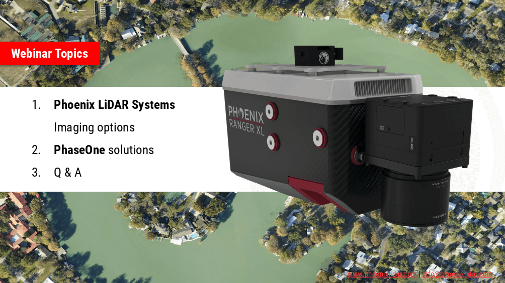
Join the Phoenix LiDAR Systems webinar on advanced imaging systems, held on April 21, 2021. Hosted by Conrad Conterno, Head of Post-Processing, and Justin Wyatt, VP of Sales at Phoenix LiDAR Systems, along with Nick Nelio, Inspection Sales Manager for Phase One, this session dives into how Phoenix LiDAR’s data collection tools integrate with Phase One’s cutting-edge imaging systems to enhance remote sensing capabilities.
Conrad Conterno opens with an overview of Phoenix LiDAR’s custom mapping solutions, emphasizing LiDAR sensor integration for superior data acquisition and analysis. He introduces various advanced camera options, including the lightweight custom A6K Light for UAV-based mapping, dual oblique cameras for enhanced colorization, multispectral solutions for detailed vegetation analysis, thermal mapping cameras for environmental monitoring, and hyperspectral sensors for precise spectral analysis.
Nick Nelio then showcases Phase One’s high-resolution, medium-format cameras, focusing on the 4-band solution that combines RGB and near-infrared imagery, ideal for crop analysis and environmental monitoring. He also presents the Phase One P3 payload for inspection applications and the IX Mach 5 controller designed for efficient geospatial missions.
Throughout the webinar, the benefits of direct geo-referencing and the seamless integration of multiple sensors into single payloads are highlighted. The hosts address audience questions on the accuracy of dual-camera systems, post-processing challenges, and the applications of hyperspectral imaging.
The session concludes with Justin Wyatt and Nick Nelio emphasizing their collaborative approach to delivering tailored solutions and inviting viewers to contact them for personalized consultations.
The high dimensionality of data generated by Unmanned Aerial Vehicle(UAV)-Lidar makes it difficult to use classical statistical techniques to design accurate predictive models from these data for conducting forest inventories. Machine learning techniques have the potential to solve this problem of modeling forest attributes from remotely sensed data. This work tests four different machine learning approaches – namely Support Vector Regression, Random Forest, Artificial Neural Networks, and Extreme Gradient Boosting – on high-density GatorEye UAV-Lidar point clouds for indirect estimation of individual tree dendrometric metrics (field-derived) such as diameter at breast height, total height, and timber volume.
We’re excited to announce the release of LiDARMill v2! LiDARMill v2 takes automated post-processing to the next level. In our recent webinar, we covered some of the new improvements and features including:
- Imagery Processing in LiDARMill
- Ground Control Reporting and Adjustments
- Robust Coordinate System Handling
- A Workflow Overview and Demonstration
- Multi-Mission Processing Support
- Advanced Point Cloud Filtering Options
- RGB Thermal & Fusion
- Accuracy Reporting
- Automated LiDAR and Camera Calibration Options
- Near-Real Time (NRT) Reference Station Positioning for Projects Requiring Less Than 24 Hour Turn-around Time
- Trajectory Post-Processing Without Reference Stations
If you have any questions or would like to learn more about LiDARMill v2, please don’t hesitate to get in touch. We’d be happy to help!