
@ 150m Range
OVERVIEW

AIRCRAFT OPTIONS


PRIMARY APPLICATIONS


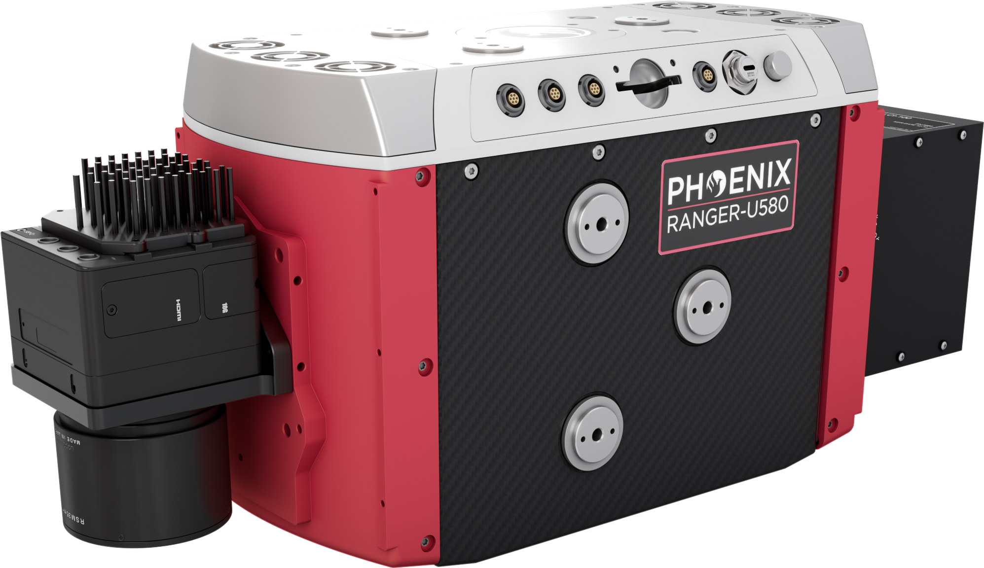
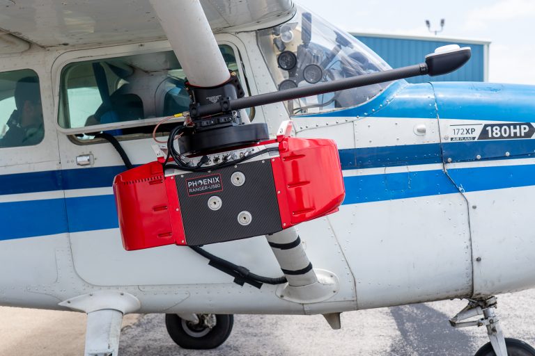
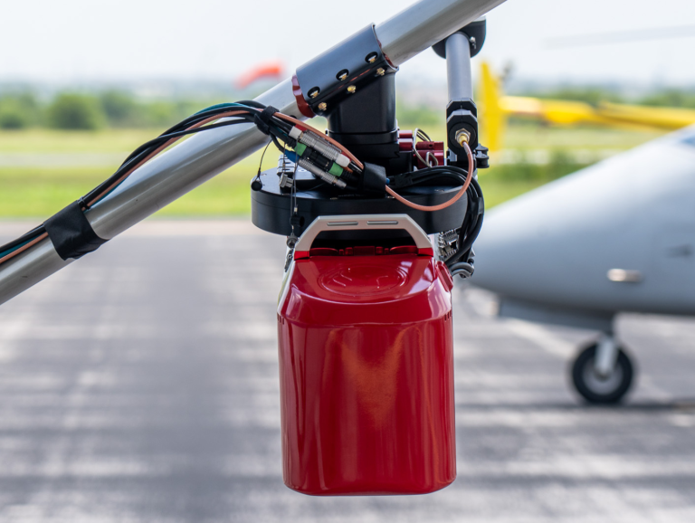
The RANGER-U580 is a compact manned airborne laser scanning system designed for mid-range flight altitude applications such as medium/wide-area mapping as well as corridor mapping. Featuring the compact and lightweight Riegl VQ-580II-S laser scanner, PhaseOne iXM-GS120 and the PLS FOG IMU-60, the RANGER-U580 is perfectly suited for integration into a wide range of manned aircrafts such as helicopters, small fixed-wing aircraft and ultralight aircraft.
With a measurement rate of up to 1,250,000 meas./sec, laser wavelength of 1052nm and a wide field of view of 75°, the RANGER-U580 perfectly meets the challenges of various special airborne surveying applications like corridor mapping, city modeling, snowfield mapping, glacier monitoring, agriculture and forestry.
Features:
- Increased measurement range of up to 2,450m (8,038ft)
- Perfectly linear and parallel scan lines
- Narrow 0.28 mrad beam divergence results in excellent accuracy & precision at long distances
- 1052nm laser wavelength enables measurements of wet and frozen surfaces, yields excellent results in snowfield mapping and glacier monitoring
aircraft integration options
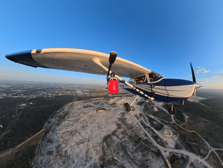
HB1 - HYBRID INTEGRATION SYSTEM
- Easily transferable between Heli & Fixed Wing aircraft
- Quick installation and removal
- Optional GPS antenna boom
- Optional integrated control box (NavBox)
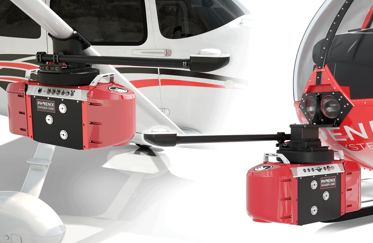
HB1 attached to Cessna 172
HB1 attached to R44 Helicopter
UP2 - ULTRAPOD INTEGRATION SYSTEM
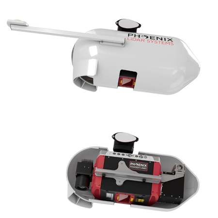
- Designed for Cessna 172-, 182-, and 206- series aircraft
- Quick installation and removal
- Easily transferred between Cessna aircraft
- Optional integrated control box (NavBox)
- 4-band (RGB/NIR) PhaseOne camera upgrade option
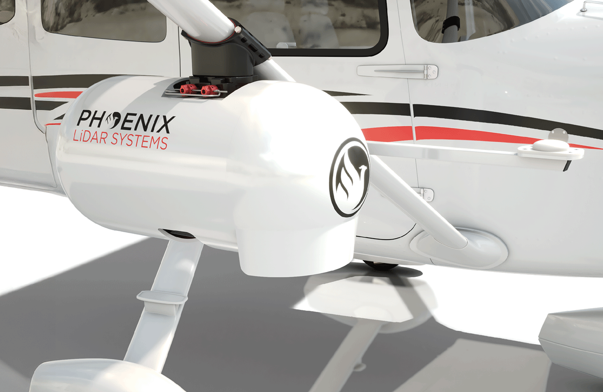
UP2 attached to Cessna 172
Full specifications
- The angular step width depends on the selected laser PRR
- The maximum angular step width is limited by the maximum scan rate
Airborne Acquisition performance
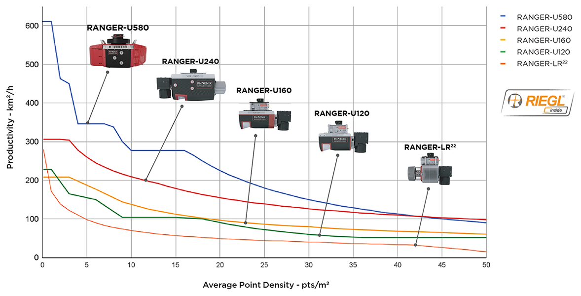
The following conditions are assumed for calculating Airborne Acquisition Performance:
- Min/max flying speed: 60 kn/120 kn min. flying height: 120m AGL
- RANGER-U120 and U160. FNB facets combined density. Optimization scope. “Best Practices”
- 20% reflectivity targets
- Riegl estimates generated by RiParameter 2.5.5
- RANGER-LR 22 max 90 degree FOV
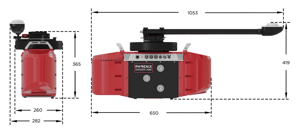
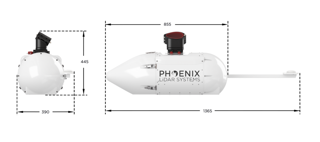
DIMENSIONS (mm)
ranger-u580 HB1 - dimensions
RANGER-U580 UP2 - DIMENSIONS


LiDARMill enables surveying teams to take advantage of precision laser mapping without investing in expensive software & training.