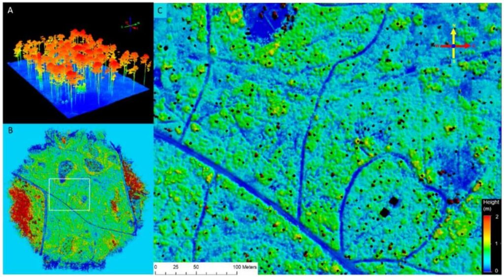
This whitepaper explores the application of high-density UAV-borne LiDAR technology for monitoring understory dynamics in the pine savannas of the southeastern United States, particularly in the context of prescribed fire management. Traditionally, understory characteristics such as height and biomass have been monitored through field sampling, but this study contrasts these conventional methods with advanced remote sensing techniques.
Utilizing the GatorEye UAV system, LiDAR data provided spatially explicit estimates of understory height and biomass before and after a prescribed fire. The results showed significant correlations between LiDAR-derived measurements and traditional field data, demonstrating the accuracy and efficiency of LiDAR technology.
Notably, LiDAR’s comprehensive spatial coverage revealed a smaller biomass reduction after the burn compared to in-situ measurements, highlighting the importance of capturing spatial variability. The findings underscore the potential of LiDAR as a powerful tool for land managers, offering enhanced spatial and temporal resolution in tracking understory biomass and its response to fire, ultimately supporting more effective ecosystem management practices.
