This whitepaper explores a groundbreaking framework for quantifying fuel load in fire-prone regions, focusing on the Brazilian tropical savanna (Cerrado biome), using NASA’s GEDI full-waveform spaceborne LiDAR sensor. Understanding fuel load is crucial for integrated fire management, preserving carbon stock, biodiversity, and ecosystem functioning, and assessing global climate regulation. Traditional remote sensing methods lack the capability to measure vertical vegetation structure accurately.
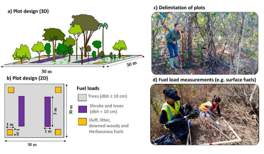
Our study leverages UAV-collected LiDAR data to simulate GEDI full-waveforms, from which we derive vegetation structure metrics. These metrics are then correlated with field-measured fuel load components using Random Forest models. The resulting models, which predict woody and total fuel loads with high accuracy (R² = 0.88 and 0.71, respectively), provide reliable estimates even for lower strata components.
This innovative approach allows for the creation of fuel load maps for the entire Cerrado and can be extended to other fire-prone regions, enhancing fire management and carbon monitoring efforts. This research showcases the potential of spaceborne LiDAR to revolutionize environmental management and climate initiatives in tropical savannas and beyond.