SpatialExplorer
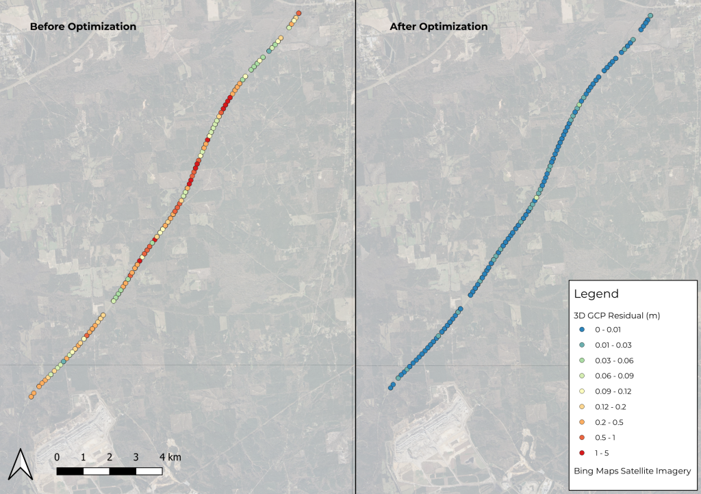
Phoenix LiDAR’s SpatialExplorer’s LiDARSnap strip alignment tool was tested using a challenging mobile LiDAR dataset collected along a rural state road, Natchez Trace Parkway, near Mathiston, Mississippi. Approximately 17.5 km of the parkway was mapped using the RANGER Flex dual-head mobile LiDAR mapping system.
Of the total mapped area, nearly 85% was covered by a dense tree canopy, which posed a significant accuracy challenge due to the limited availability of GNSS signals. LiDARSnap was utilized not only to calibrate the relative accuracy of the two passes but also to georeference the scan in relation to leveled control.
This paper discusses the processing workflow, results, and capabilities of LiDARSnap in challenging, GNSS-denied environments.
Join the May 2021 Phoenix LiDAR Systems webinar, hosted by Senior GIS Engineer Ira Monkfold, as he dives into survey-grade calibration and accuracies from point cloud data. This insightful session focuses on the LiDAR Snap 4 calibration tool within the SpatialExplorer software. Learn about the essential requirements for achieving precise point cloud data and how Phoenix LiDAR Systems can help you create survey-grade data effortlessly.
Ira explains the critical importance of precise system calibration, covering accurate measurements of lever arms and the alignment of laser, GNSS, and IMU components. He highlights the necessity of mission-specific optimization to address in-flight anomalies, ensuring data accuracy. The integration of surveyed ground control points is emphasized as a vital step for achieving geospatial accuracy, with LiDAR Snap 4 providing comprehensive calibration and reporting tools.
LiDAR Snap 4 revolutionizes the calibration process by combining multiple steps into a single, user-friendly software interface, significantly reducing complexity and time. The software features advanced capabilities such as encoder calibrations and trajectory optimizations, offering users reliable survey-grade point cloud data. The webinar also includes a Q&A session, addressing software capabilities, processing times, and compatibility with various LiDAR systems and platforms.
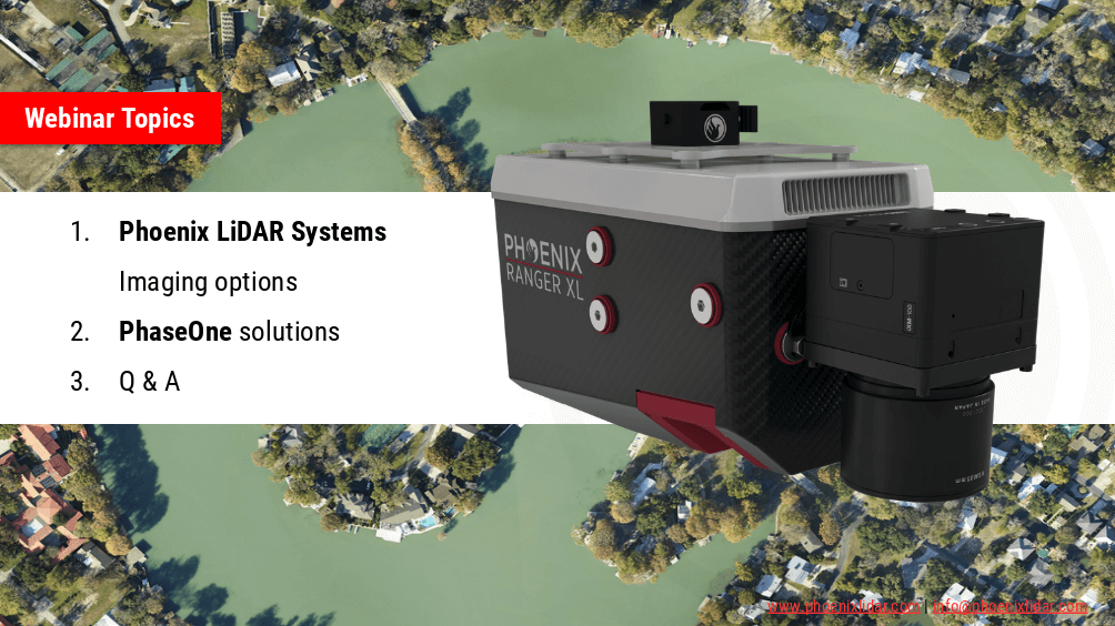
Join the Phoenix LiDAR Systems webinar on advanced imaging systems, held on April 21, 2021. Hosted by Conrad Conterno, Head of Post-Processing, and Justin Wyatt, VP of Sales at Phoenix LiDAR Systems, along with Nick Nelio, Inspection Sales Manager for Phase One, this session dives into how Phoenix LiDAR’s data collection tools integrate with Phase One’s cutting-edge imaging systems to enhance remote sensing capabilities.
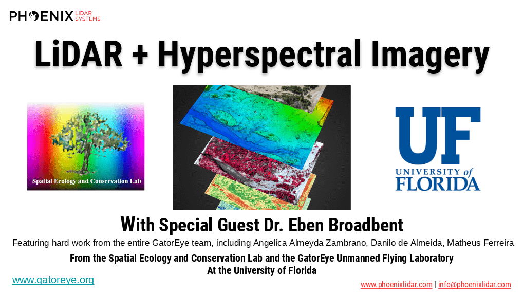
Conrad Conterno opens with an overview of Phoenix LiDAR’s custom mapping solutions, emphasizing LiDAR sensor integration for superior data acquisition and analysis. He introduces various advanced camera options, including the lightweight custom A6K Light for UAV-based mapping, dual oblique cameras for enhanced colorization, multispectral solutions for detailed vegetation analysis, thermal mapping cameras for environmental monitoring, and hyperspectral sensors for precise spectral analysis.
Nick Nelio then showcases Phase One’s high-resolution, medium-format cameras, focusing on the 4-band solution that combines RGB and near-infrared imagery, ideal for crop analysis and environmental monitoring. He also presents the Phase One P3 payload for inspection applications and the IX Mach 5 controller designed for efficient geospatial missions.
Throughout the webinar, the benefits of direct geo-referencing and the seamless integration of multiple sensors into single payloads are highlighted. The hosts address audience questions on the accuracy of dual-camera systems, post-processing challenges, and the applications of hyperspectral imaging.
The session concludes with Justin Wyatt and Nick Nelio emphasizing their collaborative approach to delivering tailored solutions and inviting viewers to contact them for personalized consultations.
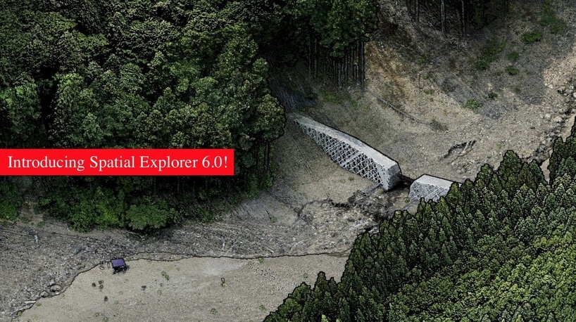
Join Phoenix LiDAR Systems in their March 2021 webinar as they unveil their latest software releases, Spatial Explorer 6 and 6 Pro. Hosted by Terry Owens from the sales team and Conrad Conterno, head of post-processing, this informative session provides an in-depth overview of Phoenix LiDAR’s innovative multi-platform solutions and industry-leading advancements.
Learn about the comprehensive features of Spatial Explorer 6 and 6 Pro, from basic sensor control and data export to advanced calibration and post-processing tools. Discover how the new A-to-Z workflow integrates NavLab for seamless trajectory processing, and explore enhanced features like automated bore sighting, LiDARSnap, and CameraSnap for optimized data accuracy.
The webinar also includes a detailed Q&A session, addressing compatibility, geoid applications, and software comparisons, with insights from CTO Ben Adler. Don’t miss this opportunity to see how Spatial Explorer 6 Pro can streamline your LiDAR data processing and deliver superior results.
The high dimensionality of data generated by Unmanned Aerial Vehicle(UAV)-Lidar makes it difficult to use classical statistical techniques to design accurate predictive models from these data for conducting forest inventories. Machine learning techniques have the potential to solve this problem of modeling forest attributes from remotely sensed data. This work tests four different machine learning approaches – namely Support Vector Regression, Random Forest, Artificial Neural Networks, and Extreme Gradient Boosting – on high-density GatorEye UAV-Lidar point clouds for indirect estimation of individual tree dendrometric metrics (field-derived) such as diameter at breast height, total height, and timber volume.
We’re excited to announce the release of LiDARMill v2! LiDARMill v2 takes automated post-processing to the next level. In our recent webinar, we covered some of the new improvements and features including:
- Imagery Processing in LiDARMill
- Ground Control Reporting and Adjustments
- Robust Coordinate System Handling
- A Workflow Overview and Demonstration
- Multi-Mission Processing Support
- Advanced Point Cloud Filtering Options
- RGB Thermal & Fusion
- Accuracy Reporting
- Automated LiDAR and Camera Calibration Options
- Near-Real Time (NRT) Reference Station Positioning for Projects Requiring Less Than 24 Hour Turn-around Time
- Trajectory Post-Processing Without Reference Stations
If you have any questions or would like to learn more about LiDARMill v2, please don’t hesitate to get in touch. We’d be happy to help!
We’re happy to announce the release of SpatialSuite 5.0! Make sure to check out our webinar led by Post Processing Manager, Conrad Conterno, to learn about the many, powerful new tools and features. In this webinar we cover:
- The .cloud format
- LiDARSnap Plugin
- CameraSnap Plugin
- Classification/Point Filtering Plugin
- Exporting Vector and Raster Products
- System Visualization Tools
- Other New Features (i.e. RXP to SDCX converter, LAS Viewer, and more.)