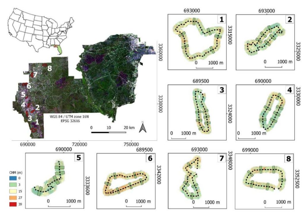
This whitepaper examines the efficiency and accuracy of UAV-borne LiDAR, specifically the GatorEye system, for high-resolution forest data acquisition, comparing it to traditional aircraft-borne LiDAR in the Apalachicola National Forest, USA. The study assesses the effectiveness of single-pass flight plans for generating digital terrain models (DTMs) and canopy height models (CHMs).
Results indicate that DTMs derived from UAV LiDAR showed less than 1 meter difference compared to aircraft-derived DTMs within a 145° field of view (FOV). CHMs provided reliable treetop detection, though tree height underestimations occurred at distances over 175 meters from the flight line. Crown segmentation was effective within a 60° FOV, but shadowing effects hindered its accuracy beyond this range.
The study identifies optimal quality thresholds for various LiDAR products, supporting the development of efficient, cost-effective UAV flight plans for forest monitoring. These findings highlight the potential of UAV-borne LiDAR for detailed, multi-temporal forest structure assessment, offering valuable insights for forest management and conservation strategies.
