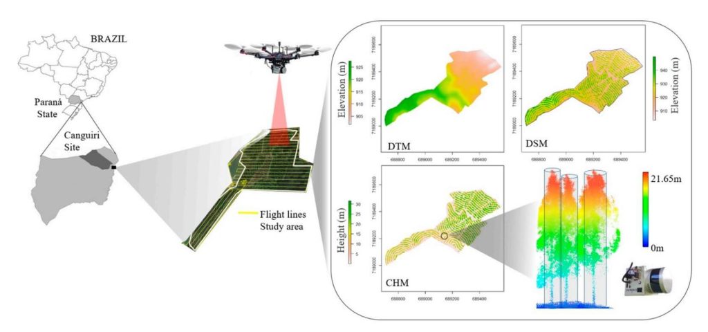
This whitepaper examines the potential of UAV-borne LiDAR technology, specifically the GatorEye system, for measuring essential forest parameters such as diameter at breast height (DBH) and total tree height. Traditionally, these parameters are measured manually using level gauges and hypsometers in sample plots, a process that is laborious, expensive, and spatially limited. Terrestrial laser scanning (TLS) has been used for remote DBH measurement, offering high-density point clouds for accurate inventory but facing spatial limitations due to manual deployment and field access challenges.
The study demonstrates the effectiveness of UAV-LiDAR in providing higher density point cloud data compared to aircraft-borne systems. Focusing on an integrated crop-livestock-forest system with Eucalyptus benthamii plantations, 63 trees were georeferenced and measured in the field. Algorithms typically used for TLS were applied to the UAV-LiDAR point cloud for automatic individual tree detection and measurement.
The UAV-LiDAR-derived DBH and total height showed strong correlations with field measurements, with correlation coefficients of 0.77 and 0.91, and RMSEs of 11.3% and 7.9%, respectively. This study underscores the potential of UAV-LiDAR systems to efficiently measure forest plantations on a broad scale, reducing field effort and enhancing forest management decision-making. Further exploration in diverse tree plantations and forest environments is recommended.