This whitepaper details the use of unmanned aerial vehicle (UAV) LiDAR missions conducted in the Maya Lowlands between June 2017 and June 2018 to develop effective methods, procedures, and standards for drone LiDAR surveys of ancient Maya settlements and landscapes.
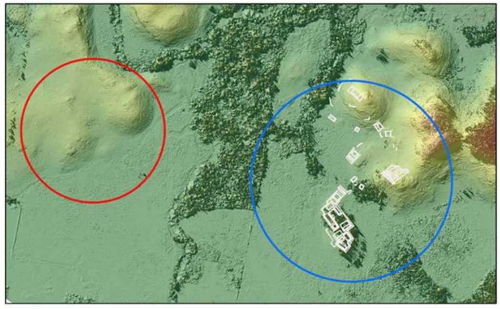
Testing at three site locations in the upper Usumacinta River region—Piedras Negras in Guatemala (2017) and Budsilha and El Infiernito in Mexico (2018)—provided a diverse range of natural and cultural contexts to evaluate the technology’s field utility. The study’s results, based on standard digital elevation and surface models, demonstrate the effectiveness of drone LiDAR for documenting ancient landscapes and settlements across the Maya Lowlands and Latin America.
This approach is adaptive, cost-effective, and suitable for targeted documentation, though it requires careful planning and sample evaluation. Future research will further refine the methods and techniques for data filtering and processing.