This whitepaper explores the challenges of obtaining high-quality forest structure information in tropical forests, particularly those in difficult-to-access areas. Traditional field-based approaches are often costly and time-consuming, prompting the use of LiDAR technology for efficient and comprehensive structural parameter estimates.
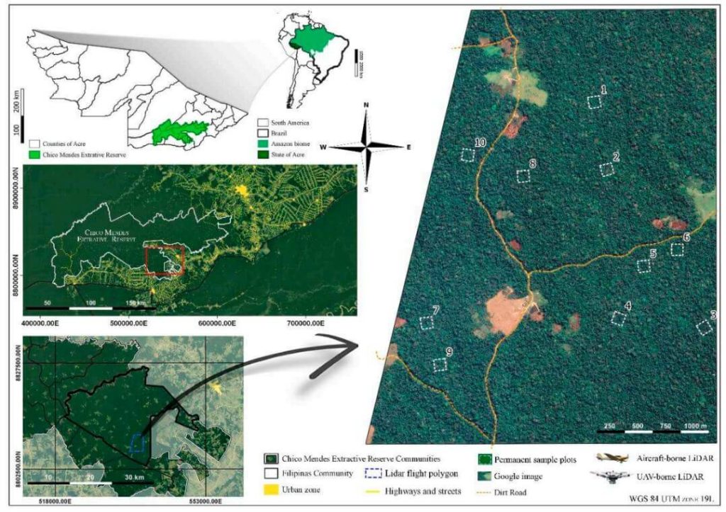
The study compares aboveground biomass (AGB) estimations and products from aircraft-borne LiDAR data collected in 2015 with data from the UAV-borne GatorEye Unmanned Flying Laboratory in 2017 across ten forest inventory plots in the Chico Mendes Extractive Reserve in Acre, southwestern Brazilian Amazon.
Findings indicate that both platforms produce comparable LiDAR products, with the GatorEye system demonstrating higher point density due to its lower and slower flight and increased returns per second. Despite these differences, ground point density remained similar between the systems.
Both sensors yielded analogous results for digital elevation models and estimated AGB. This study validates the effectiveness of UAV-borne LiDAR sensors in accurately quantifying AGB in dense tropical forests and highlights the potential for detailed analyses of crown structure and leaf area density distribution using dense point clouds from UAV systems.

