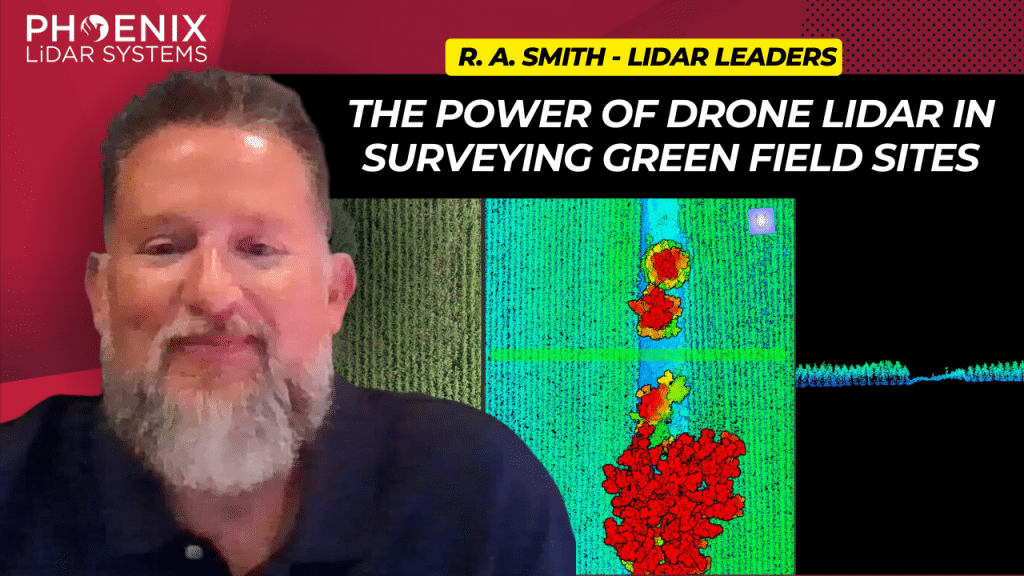
This video delves into the transformative impact of the Phoenix MiniRanger 3 on raSmith’s aerial survey operations, a leading name in civil engineering and surveying based in Brookfield, Wisconsin.
Adopted to enhance the efficiency of surveying expansive greenfield sites, the MiniRanger 3 overcomes challenges posed by dense vegetation like corn, soybeans, and alfalfa, using advanced LiDAR technology.
This state-of-the-art aerial LiDAR system stands out for its high vertical accuracy, robust point density, and reliable GPS integration, making it ideal for detailed and obstructed terrains.
RaSmith’s integration of the Phoenix MiniRanger 3 has not only streamlined their aerial survey workflow but also allowed them to tackle labor shortages, diversify into corridor work, and expand scanning services for public utilities.
Backed by Phoenix’s exceptional technical support, this adoption highlights a significant shift towards more resource-efficient and precise surveying methods. The video underscores the system’s role in pushing the boundaries of civil engineering and surveying, paving the way for future advancements in LiDAR technology.
