Point Density: 1050 points per m^2
Height: 120 m AGL
Speed: 10 m/s
Data Acquisition Time: 3 minutes
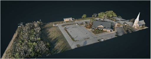
RANGER-U120 | UAS Powerline Corridor Mapping
Fill Out the Form to Download the Resource
Table of Contents
Related Posts

LiDAR Mapping Through Vegetation
January 11, 2023Mapping accurately through vegetation is challenging. And while photogrammetry can be used for bare earth mapping, it is not nearly…
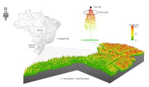
High-Density UAV-LiDAR in an Integrated Crop-Livestock-Forest System: Sampling Forest Inventory or Forest Inventory Based on Individual Tree Detection (ITD)
February 16, 2022Forest plantation area is constantly increasing across the globe, and the goods and services provided by these forests are becoming tremendously…The LIDAR System Transforming R.A. Smith’s Workflows
November 22, 2023In the rapidly evolving world of surveying and civil engineering, technology plays a pivotal role in determining the efficiency and…

