Point Density: 582 points per m^2
Height: 120m AGL (approx.)
Speed: 12m/s (approx.)
Data Acquisition Time: 3 minutes
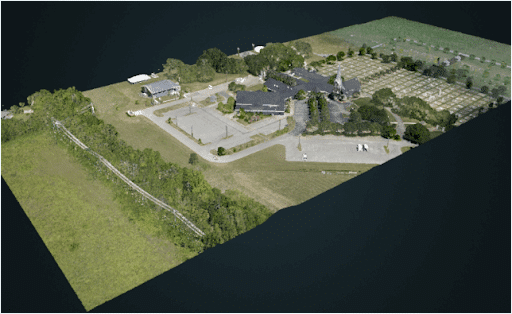
RANGER-U120┃ UAS Mapping Mission
Fill Out the Form to Download the Resource
Table of Contents
Related Posts


LiDAR in Oil & Gas Applications – A Panelist Discussion
October 8, 2021This webinar features two fascinating Phoenix clients who are delivering impressive data within the oil and gas space: Measurement Sciences,…
Industries That Use LiDAR To Improve Everyday Life
September 19, 2022Did you know that LiDAR plays a role in how you drive, how you communicate, and even the delivery of…
