Survey
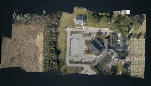
Speed: Walking pace for SLAM. 6 m/s UAV flight
Point density: thousands of points/m²
AGL: 80 during UAV flight
Acquisition time: ~2 hours
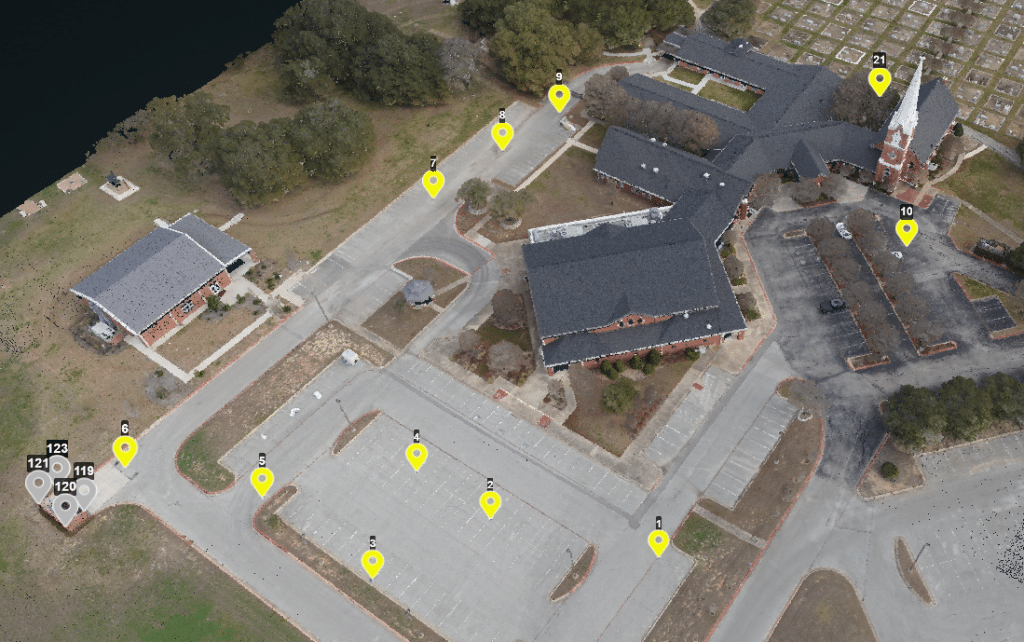
Speed: 6 m/s
Point Density: 200 points/m² per flight line
AGL: 120 m
Acquisition time: 10 minutes
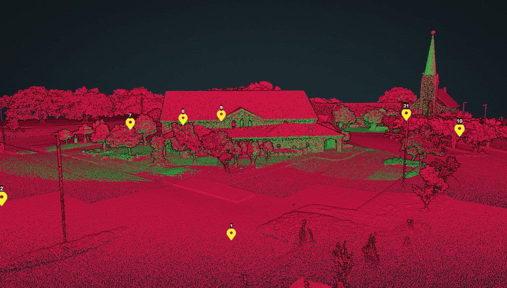
Point Density: 510 points per m^2
Height: 80 m AGL
Speed: 6 m/s
Data Acquisition Time: 3 minutes
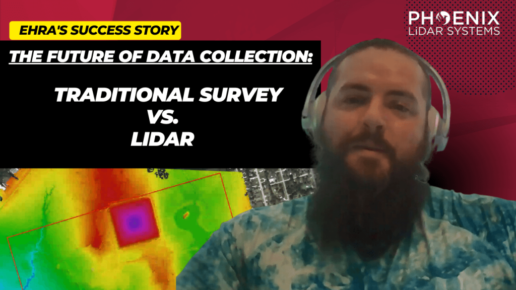
Explore the transformative role of LiDAR technology in urban development through EHRA’s use of the Mini-Ranger LiDAR system. This video highlights how EHRA, a leading engineering firm, utilizes drone LiDAR to revolutionize urban planning and project management.
The Mini-Ranger system, acclaimed for its precision in terrain and vegetation data collection, enables efficient project execution and detailed site analysis, ensuring cost-effective management and enhanced flood prevention strategies.
Join Aaron Kelsey, EHRA’s Senior Survey CAD Tech and Drone Program Manager, as he discusses the system’s capacity to survey extensive areas swiftly, reducing both time and labor costs significantly.
The reliability and high-quality data collection of the Mini-Ranger system have proven essential in multiple large-scale projects, supported by the excellent customer service from Phoenix LiDAR.
This session also covers the evolution from traditional survey methods to advanced LiDAR technology, underscoring its accuracy and the objective data crucial for drainage studies and boundary surveys. Celebrate Phoenix LiDAR’s decade of innovation and discover how their technology is pivotal in advancing urban engineering practices.
Discover the revolutionary impact of LiDAR technology in urban development with EHRA’s utilization of the Mini-Ranger LiDAR system. In this video, learn how EHRA, a leading engineering firm, leverages drone LiDAR for advanced urban planning and project management.
The Mini-Ranger system is celebrated for its precision in terrain and vegetation mapping, facilitating rapid and accurate data collection that drives efficient, cost-effective project outcomes.
Join Aaron Kelsey, EHRA’s Senior Survey CAD Tech and Drone Program Manager, as he discusses the system’s transformative effects on large-scale surveying—reducing both time and labor costs significantly. He also highlights its crucial role in flood prevention by providing detailed elevation data for effective drainage and water flow management.
The video also explores the evolution of surveying from traditional methods to cutting-edge GPS and LiDAR technologies, enhancing the reliability of data collection. With Phoenix LiDAR’s support, EHRA continues to push boundaries in urban engineering, making significant strides in project accuracy and efficiency.
Discover the groundbreaking impact of LIDAR technology in urban development with EHRA’s innovative use of the Mini-Ranger LIDAR system. In this insightful video, we delve into how EHRA, a leading engineering firm, leverages the power of Drone LIDAR and the MiniRanger system to revolutionize urban planning and project management.

In this informative video, Angela Livingston from Pape-Dawson Engineers, a leading firm in civil engineering and LiDAR services, shares her extensive experience and insights. Pape-Dawson Engineers has been around for over 50 years, expanding their operations across various locations in Texas and Florida. Angela, with a strong background in photogrammetry, LiDAR, and GIS, explains how the company has integrated LiDAR technology into their workflows to enhance efficiency and accuracy in land development projects. The company now utilizes multiple UAVs and LiDAR scanners, including the Phoenix Recon XP, Ranger VUX, and Ranger Ultra, to cater to diverse project needs.
Angela dives into the decision-making process behind choosing specific LiDAR systems based on factors such as vegetation, site size, and project requirements. She explains the strategic use of both drones and helicopters for LiDAR data acquisition, depending on the project’s scope and environmental conditions. This flexibility allows Pape-Dawson to efficiently handle larger projects, such as wastewater treatment plant expansions, and significantly reduce time and costs compared to traditional terrestrial scanning methods. Angela emphasizes the importance of selecting the right tool for the job to achieve the best results.
The video also covers the crucial aspect of standardized workflows and data processing techniques that Pape-Dawson employs. Angela highlights how having a well-defined process ensures high-quality and accurate deliverables for engineering projects. She explains their method of using Phoenix’s Spatial Explorer and Inertial Explorer for navigation processing, followed by Terra Solid and MicroStation for point cloud fusion and feature extraction. This meticulous approach allows Pape-Dawson to maintain consistency and reliability in their data outputs, which is essential for supporting their engineers’ work.
Towards the end of the video, Angela expresses her appreciation for the support and collaboration with Phoenix LiDAR Systems, noting how their responsiveness to feedback has led to hardware and software improvements. She encourages viewers to reach out to her via email for advice on project collection and sensor selection. Angela’s expertise and willingness to share her experiences provide a valuable resource for anyone looking to enhance their engineering projects with advanced LiDAR technology. For those interested, Angela can be contacted through Pape-Dawson’s website or directly via email.
Evolving the Capabilities of LiDAR
With the introduction of the RECON series, Phoenix LiDAR Systems is removing barriers to widespread LiDAR remote sensing adoption. The RECON series combines low-cost hardware with Phoenix LiDAR Systems industry leading software, LiDARMill, and is empowering a new generation of professionals like never before.
The RECON series features higher accuracies than competing products (that are based on Applanix or DJI navigation systems), while offering extremely simple, automated post-processing solutions to extract maximum value from each dataset.
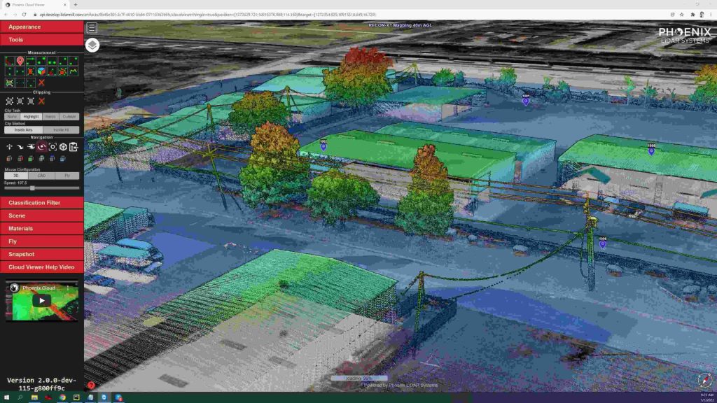
Utilizing the LiDARMill online, automated processing platform, raw datasets can be imported straight from a USB drive, with reference and optional ground control data seamlessly integrated. Simple wizards enable advanced processing options like trajectory optimization, LiDAR and camera calibration, AI classification, smart decimation and the creation of high-quality deliverables (contours, DTM/DSM/CHM, pointcloud tiling etc.). A fully registered, colorized pointcloud is produced that is accurate in both relative and absolute terms. Project reports then summarize project performance and verify system accuracy.
Phoenix Lidar Systems is committed to designing the world’s most advanced, complete LiDAR solutions. With the RECON + LiDARMill combination, users can deploy a simple toolkit that is able to derive accurate and reliable datasets in a matter of hours. Powerful, affordable, and comprehensive…the RECON series by Phoenix Lidar Systems is now available, and sure to disrupt the remote sensing industry.
In the July 2021 Phoenix LiDAR Systems webinar, Senior Geomatics Engineer Kory Kellum discussed aerial surveys with high-performance LiDAR technology. Phoenix LiDAR Systems, based in Austin, Texas, specializes in custom UAV LiDAR solutions. The webinar highlighted the practical applications of UAV-based LiDAR in aerial surveying and engineering through insights from Pape-Dawson Engineers, Angela Livingston, and David Trotter. They shared their use of the Phoenix Ranger with the VUX1 UAV scanner, emphasizing benefits like high-resolution data, speed, vegetation penetration, and access to difficult sites.
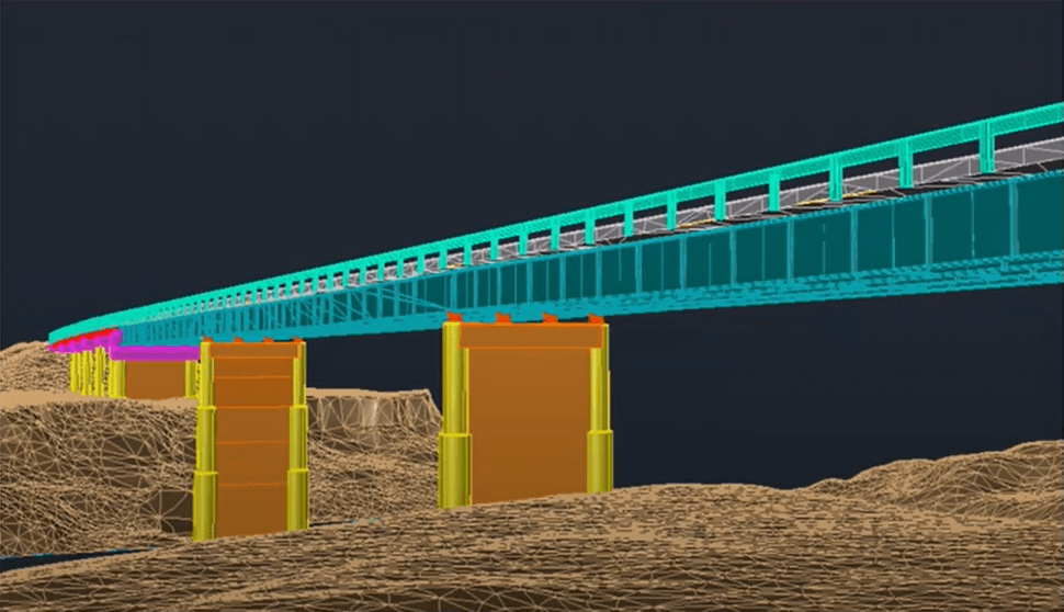
The webinar covered workflows from site assessment to data processing, showcasing detailed and accurate point clouds for extracting data products like contours and infrastructure details. Examples included aerial survey mapping a railroad bridge and a riverbank. The Q&A session addressed flight planning, check shots under canopies, and data processing software.
This is a panel discussion featuring two Surveying and Engineering Design service providers: EHRA and Wood Rodgers. We will discuss how they are leveraging Phoenix LiDAR’s systems to perform the heavy lifting in order to provide both the fastest data acquisition and best data deliverables to their clients. You won’t want to miss hearing their many compelling successes throughout their LiDAR-based Surveying and Engineering Design workflows.