This whitepaper outlines the objectives and results of a test campaign aimed at evaluating the accuracy of point clouds generated by Phoenix LiDAR Systems in a realistic survey mission scenario. The study also tested the performance of Terrasolid software, running on MicroStation CONNECT Edition, for calibrating and enhancing the data.
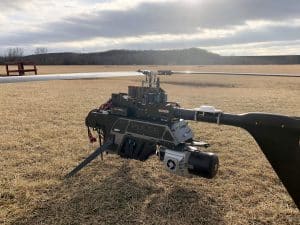
Data sets were acquired using a Camflight FX8HL UAS platform and pre-processed into trajectory and point cloud files using Phoenix LiDAR Systems software. The findings demonstrate the effectiveness of these technologies in producing accurate and reliable data for various survey applications, highlighting the potential for improved data calibration and processing with the integrated software solutions.
This report provides valuable insights into the capabilities and performance of UAV-based LiDAR systems for high-precision surveying and mapping tasks.