
Resource Type
Industry
Product Group
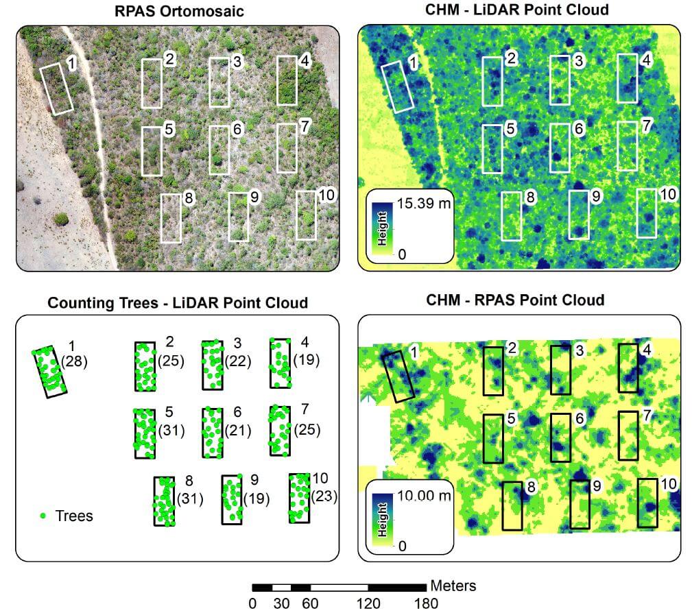
The Cerrado, the most biologically diverse savanna in the world, is threatened by anthropogenic activities, and requires development of effective environmental policies spanning local to global scales. Remotely Piloted Aircraft Systems (RPAS) can dramatically reduce the costs and time of surveys and evaluation of these regions. The objective of this article is to demonstrate the potential of visual (RGB) and Light Detection and Ranging (LIDAR) sensors on RPAS for physical characterization of landscapes in the Cerrado biome. Analyses on vegetation structure were performed, with the number of trees automatically counted. The average height of the trees obtained with the RGB sensor was significantly lower than the obtained by LIDAR, demonstrating the limitation of Structure from Motion data in representing the landscape with denser vegetation. Automatic counting of trees with LIDAR data were equal to 1825 on the whole study area, and 245 inside the ecological study area parcels.
Over recent years, light detection and ranging (lidar) sensor technology has rapidly evolved and miniaturized. The reduced sensor size and weight have opened more doors for lidar sensors to be carried onboard unmanned aircraft systems (UASs). Compared with traditional airborne lidar mapping, UAS platforms offer more flexibility in terms of flight design and data collection, rapid response capabilities, and potentially cost at local mapping scales.
UAS-based lidar studies have primarily been focused on monitoring vegetation structure, simultaneous localization and mapping (SLAM) and so forth. A comparison between UAS and terrestrial laser scanning (TLS)-derived plant height for crop monitoring was made in. Descriptive statistics derived from polygon grids were analyzed and a correlation R2 = 0.91 was found in plant height derived from both methods. A lidar-based perception and guidance system was built on a helicopter to perform obstacle detection and avoidance, terrain following, and close-range inspection, and a high success rate was claimed by the authors.
Phoenix TerraHawk fixed-wing VTOL UAV LiDAR systems help surveyors collect dense data at high speeds and altitudes. Challenging use cases discussed include power line corridor scanning, dense vegetation penetration, and wide area mapping.
One of Phoenix LiDAR’s post-processing engineers will lead a discussion on UAV LiDAR post-processing best practices, and give an overview of Phoenix LiDARMill, the first cloud LiDAR post-processing platform. Our first webinar covered common UAV LiDAR use cases, the second covered planning and piloting best practices, and our third will cover post-processing.
Phoenix LiDAR’s Chief Pilot, Sam Girardi, discusses best practices for planning and piloting drone LiDAR mapping flights. He reviews the Phoenix Flight Planner and joins the team in answering questions from the audience.
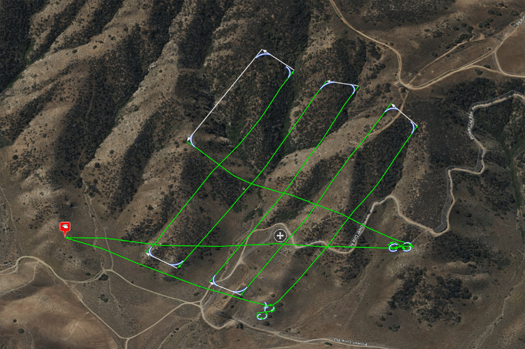
Under task order G17PD01249: Alaska Critical Infrastructure UAV Airfield Obstruction Survey the Dewberry team was tasked to perform a test of the sensors that would be utilized in the survey of the Kiana and Nulato Airfields. As part of this testing our partners Compass Data and Phoenix LiDAR performed the acquisition and post processing of the LiDAR data using two (2)
sensors each flown at two different heights above ground. These parameters were designed in order to determine each of the following items:
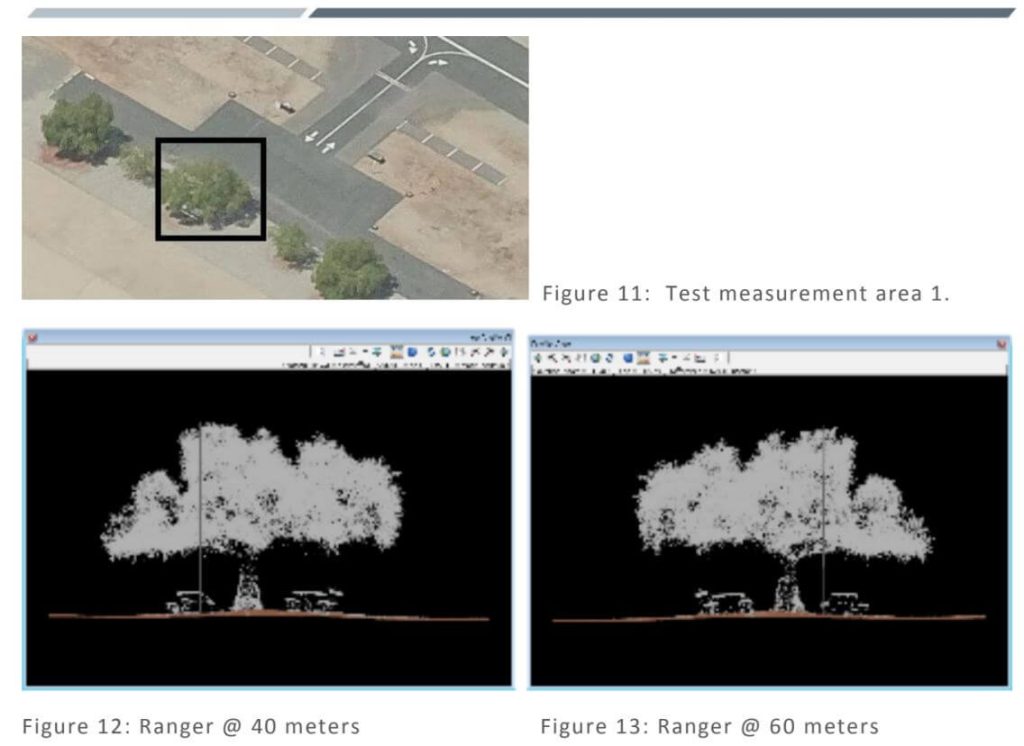
General Ability to meet project specifications – These tests were used to determine if each sensor could meet the general project requirements for data formatting and LAS point cloud data. Items like smooth surface repeatability, relative accuracy, intensity values, and other were tested for each sensor and flying height.
LiDAR Density – Because we are utilizing a UAS based approach the intent was to determine what sensor and flying height would yield an appropriate density of points to determine the heights of obstructions.
Geometric Calibration – Tested to determine if each sensor was providing accurate and repeatable measurements from the two different flying heights.
Radiometric Testing – Tested to determine if each sensor was capable of identifying small or low-reflectance obstructions such as poles or antennas.
Measurement Consistency – This was tested across each of the 4 flights to determine how consistently the maximum elevation could be determined on the test apparatus as well as on trees and other vertical features in the AOI.
The following report documents the calibration testing performed by the Dewberry team.
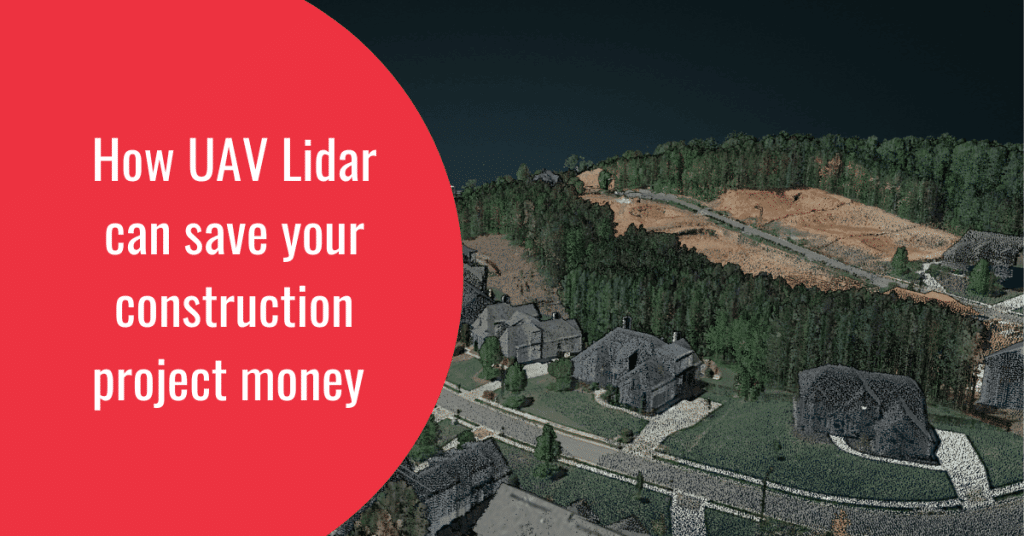
Drone Lidar have been disrupting various industries for years, but the construction industry has perhaps seen the greatest potential for drone technology. With its complex and lengthy process involving multiple phases and tasks, the construction industry has been ripe for disruption. Early adopters saw the potential for drones to streamline old processes, cut costs, and improve efficiency and safety. But there are still many untapped use cases for construction and engineering firms.
In this article, we’ll focus on how drone lidar can be used in the design, building, and delivery phases of a construction project.
Using Drone Lidar in Design & Engineering
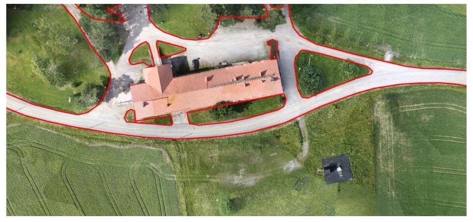
Capturing land images with drones is just the beginning of the value they offer a construction firm. By feeding raw sensor data into software like Spatial Explorer and LidarMill , you can create value that can be packaged and sold under various pricing structures. Although these applications are powerful, they cannot fully replace surveying. By combining drone Lidar data and standard surveying tools, however, you can offer clients a wider range of services, such as the ability to measure cut and fill, or create a 3D rendering of the site and track the project’s progress.
Drones on the Construction Site
Drones have been readily embraced by the construction industry, and for good reason. They provide a safer and more cost-effective way to perform survey and as-is engineering models, as well as collect data and footage from the job site. Here are a few more use cases for drones on the construction site:
Job Site Documentation: By obtaining permits and proving safe processes, you can fly UAVs over job sites to cut down on waste. This site documentation can be used with your customers and also your legal team if your project manager needs to show progress or the state of a project any time in its cycle.
Cut and Fill: With Earthwork, gradealls, and GPS precision, having a highly accurate model to do precision earth work is critical A Drone lidar can map 40 acres in less that 30 minutes and deliver a 3 to 5 cm accurate surface in less than 2 hours. For large area projects this can be a huge savings.
Some of the best lidar for on site are
Objective
The objectives of the test campaign were:
– evaluating the accuracy of point clouds from Phoenix Aerial Systems in a realistic survey mission scenario
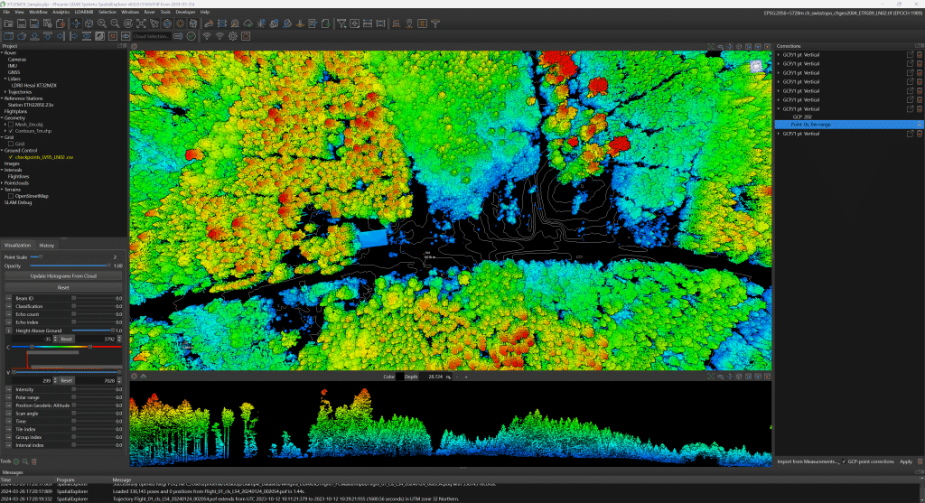
– testing the performance of Terrasolid software running on top of MicroStation CONNECT Edition, for calibration and further improvement of the data
The data sets were acquired with a Camflight FX8HL UAS platform and pre-processed to a trajectory file and to a point cloud file with Phoenix LiDAR Systems software. [register below to download full whitepaper]