SERVICES DIVISION

Phoenix established the Services Division in 2024 to provide a trusted acquisition and post-processing partnership option to our existing and future customer base.
Why Phoenix?
Our services and post-processing teams acquire and process LiDAR data with our own hardware and software. This allows us the ability pair the appropriate sensor/camera configuration, collection methods and post-processing software to offer customized mapping services that meet the diverse needs of our customers.
Each project is supported by Licensed Pilots, Certified LiDAR Specialists, Data Scientists and Surveyors with decades of experience collecting and processing geospatial data.
BENEFITS OF LIDAR

PRECISE
Precise, survey-grade data combining laser accuracy with powerful post-processing for true 3D representation
REAL TIME
Real-time 3D point cloud visualization enables you to adjust flight parameters and analyze data while in the field
LASER TECHNOLOGY
Leverage laser technology to penetrate vegetation or identify challenging infrastructure, such as power lines and other utilities
FLEXIBLE
All Phoenix LiDAR packages are flexible and can be mounted to
manned aircraft, UAVs, vehicles, vessels, backpacks, and more
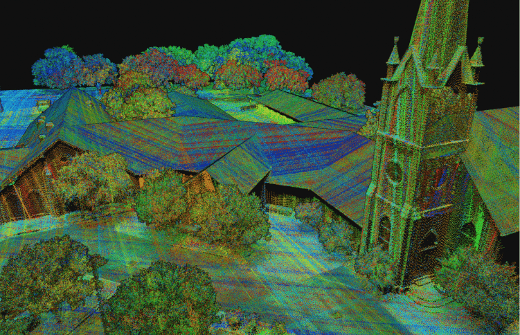
AERIAL LIDAR SERVICES
Advantages of collecting LiDAR data from the air include the ability to cover large areas quickly and efficiently, access remote or difficult-to-reach locations, create orthomosaics, and capture high-resolution, accurate data. Aerial LiDAR systems can penetrate vegetation, providing detailed ground surface information beneath forest canopies and areas of dense vegetation, and collect ground data beneath the water’s surface up to 2 Secchi Depths.
Phoenix utilizes drones, helicopters, and airplanes for aerial acquisition to ensure flexibility, safety, and cost-effectiveness for various project scales and environments.
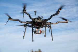
Using drones for LiDAR collection offers numerous benefits, including increased accessibility, cost-effectiveness, and efficiency on small to midsize projects.
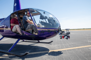
Helicopters offer unparalleled power and versatility for LiDAR collection, especially in large or rugged areas where other methods fall short or are not permitted.

Wide area mapping is made easy by Phoenix by combining our most powerful LiDAR systems with the speed and efficiency of a fixed wing airplane.
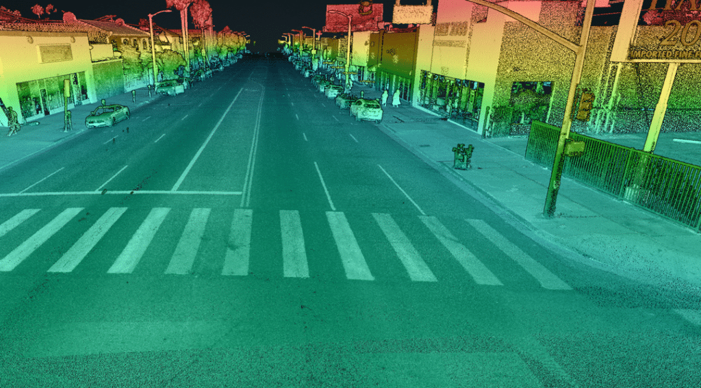
MOBILE LIDAR SERVICES

Mobile LiDAR can offer significant advantages on corridor collection, particularly in terms of efficiency, versatility and point density. Mounted on vehicles, mobile LiDAR systems can rapidly capture detailed 3D data of extensive road networks, urban areas, and infrastructure in real-time.
The point clouds derived from mobile data at ultra dense and are captured at high speeds which is mobile collection is the preferred method on large roadways projects
This method reduces the need for prolonged road closures and minimizes disruption, making it ideal for projects requiring continuous, high-speed data acquisition.
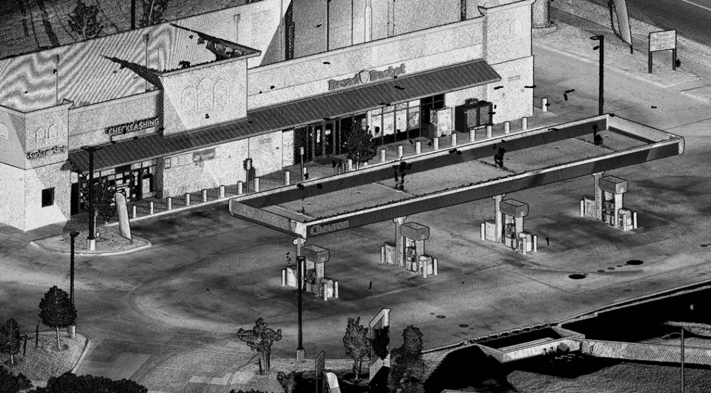
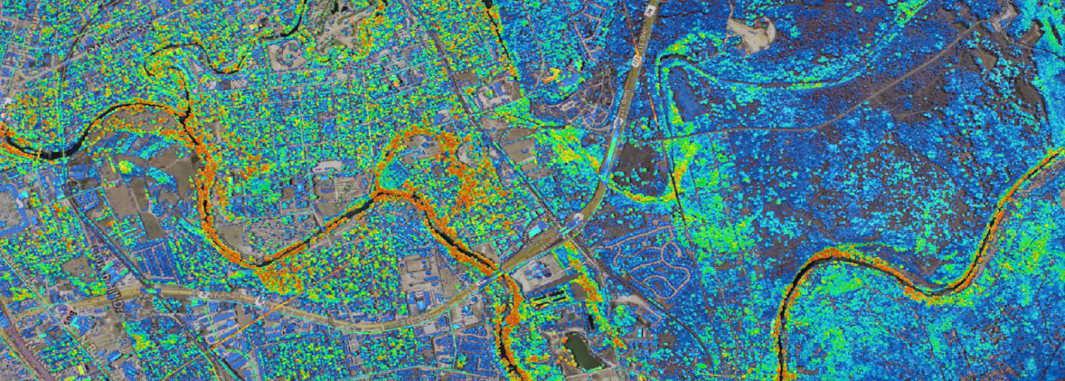
DATA PROCESSING AND DELIVERABLES
We pioneered drone-based LiDAR processing from its inception, leading the way in this innovative technology since day one.
Phoenix’s data processing and analysis capabilities are unparalleled, offering our customers robust and precise geospatial insights. Utilizing our own cutting-edge software and algorithms, Phoenix transforms raw LiDAR and imagery data into actionable intelligence and deliverables, including:
LiDAR Post-Processing Services
- Point Cloud registration, calibration, classification and RBG colorization
- Feature extraction and data cleanup
Imagery Post-Processing Services
- Still imagery geotagging
- Camera calibration and aerial triangulation.
- Ground control point identification and measurements
- RGB Orthorectification and geometric corrections.
- Image mosaic and color balancing
- Quality control & Accuracy assessments
Deliverables
- Calibrated and Registered Point Cloud
- Classified Point Cloud (Ground, Vegetation, Buildings, etc.)
- RGB Encoded Colorized Point Cloud
- Digital Terrain Model (DTM)
- Bare Earth Digital Elevation Model (DEM)
- Digital Surface Model (DSM)
- Georectified RGB Orthomosaic
- 2D Planimetrics
- PLS-CAD.bak file
- Interactive Web Based Point Cloud Viewer
Classification

Raster Products

Vector Products

INDUSTRIES SERVED


PROJECTS
ROCKDALE, TEXAS SINKHOLE IMPACT AERIAL MAPPING
Market: Reclamation & Mining
Service: UAV Aerial LiDAR & Photogrammetry
Location: Milam County, Texas
LiDAR System: RANGER-LR22 LITE
Challenge
Milam County, Texas, is currently facing significant challenges with sinkholes, primarily due to extensive mining activities in the region. The mining operations, particularly those involving subsurface extraction, have led to ground instability, causing the formation of sinkholes. These sinkholes pose a threat to infrastructure, agricultural land, and local communities, creating safety hazards and potential economic losses. The situation is compounded by the region’s geological characteristics, which make the area particularly susceptible to such occurrences. Addressing these challenges requires comprehensive geological assessments and the implementation of effective mitigation strategies to ensure the safety and stability of the affected areas.
Solution
Phoenix’s primary objective was to acquire high density LiDAR data and high resolution nadir photogrammetry considering shadow angles and the leaf-on tree cover. Phoenix completed the 3 areas in 5 flights utilizing a UAV.
The deliverables to the client included a calibrated and registered RBG encoded point cloud, classified to ground, and raw nadir imagery with supporting files.
