In the ever-evolving realm of remote sensing, the study and understanding of our natural environment have taken leaps and bounds. Leading this revolution is the integration of LiDAR technology with drones, a combination that is redefining the way we perceive and analyze forests. This video delves deep into the advancements in forest analysis, particularly focusing on the groundbreaking work of Eben Broadbent and his research program, GatorEye.
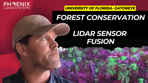
Revolutionizing Forest Analysis with Drone Sensor Fusion and LiDAR Technology
Fill Out the Form to Download the Resource
Table of Contents
Related Posts

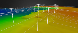
Power Line Surveys!
October 8, 2021Watch this webinar for an in-depth case study of power line right of way aerial surveying! We'll walk you through…
The Benefits of Laser Scanning in Geospatial Engineering
November 22, 2023LiDAR technology, a groundbreaking innovation in the realm of surveying and remote sensing, has been a game-changer for many industries.…
How to Choose a LiDAR Payload
October 8, 2021Not all LiDAR sensors are created equal. Choosing a LiDAR payload for your application can be complex and confusing. There…

