KEY FEATURES


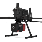
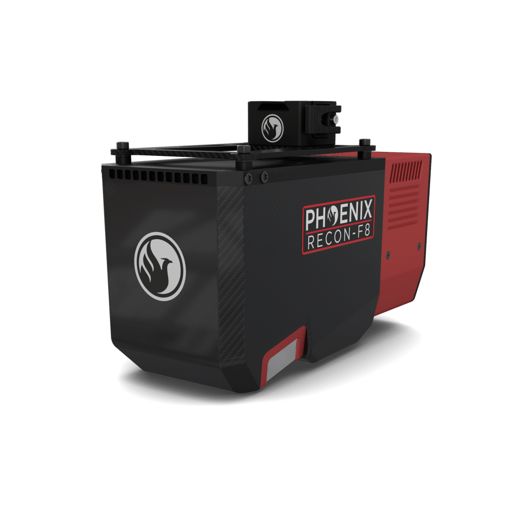
The RECON-F8 is an advanced, lightweight aerial LiDAR surveying solution designed specifically for small to mid-size drones such as the DJI M350. The RECON-F8 seamlessly combines cutting edge lightweight LiDAR technology with a high-accuracy drone optimized GNSS-INS system and an industrial-grade full-frame orthophoto camera all in a compact survey-grade 3D laser mapping solution. Combined with Phoenix LiDAR flight planning and post processing software, the RECON-F8 an efficient and cost effective solution for 3D data acquisition and processing.
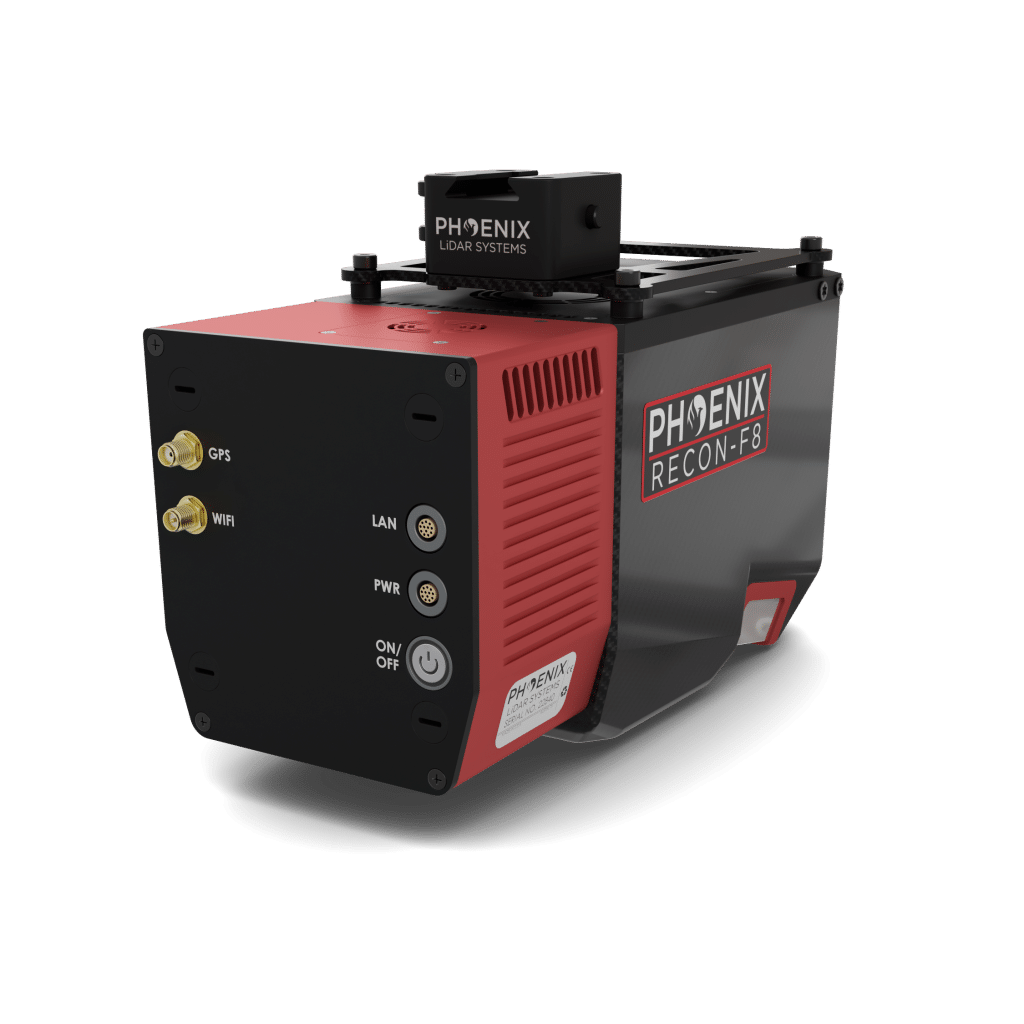
Weighing in at just 2.2 kg, the Recon-F8 is ideal for small to midsize drones such as the DJI M350
• Integrated 45 MP full-frame calibrated orthographic RGB camera provides high resolution image mapping textures for efficient 3D model reconstruction with realistic point cloud colorization
• The powerful laser range capability combined with a wide 100° horizontal field yields a 30% – 40% increase in data acquisition efficiency over competing solutions with a narrow 75° FOV
Full specifications
(1) Approximate values based on PLS test methods described at
https://docs.phoenixlidar.com/accuracy-standards-and-quantification.
(2) Using a 100° max downward field of view.
(3) Expected RMSEz when following the PLS recommended acquisition
& processing workflow and ASPRS check point guidelines.
(4) Flat surfaces with >20% reflectivity at the laser’s wavelength.
(5) Estimated post-processed accuracy with IMU-27.
(*) Laser accuracy is the degree of conformity of a measured quantity to its actual (true) value.
(**) Laser precision is the degree to which further measurements show the same results.
Accessories & Options
Dimensions
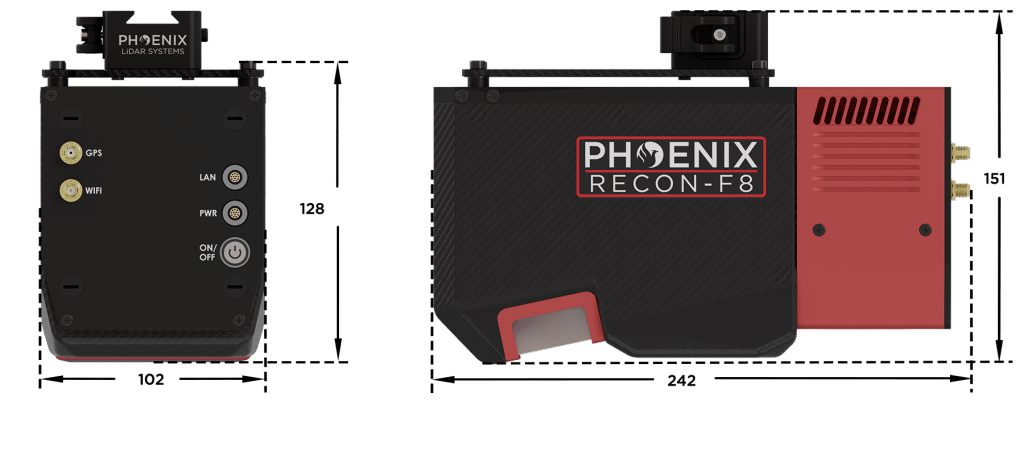
FRONT
FRONT
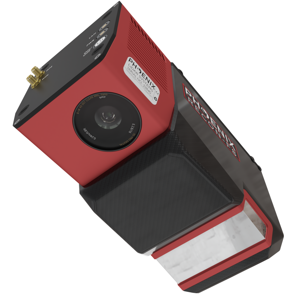
Laser Scanner
Quick Release Mount
REAR
REAR
Power Button
Status LED
GPS Antenna
WiFi Antenna
Camera
M300/M350 Integration


LiDARMill enables surveying teams to take advantage of precision laser mapping without investing in expensive software & training.