Customize Consent Preferences

We use cookies to help you navigate efficiently and perform certain functions. You will find detailed information about all cookies under each consent category below.

The cookies that are categorized as "Necessary" are stored on your browser as they are essential for enabling the basic functionalities of the site. ... 

Always Active

Necessary cookies are required to enable the basic features of this site, such as providing secure log-in or adjusting your consent preferences. These cookies do not store any personally identifiable data.

No cookies to display.

Functional cookies help perform certain functionalities like sharing the content of the website on social media platforms, collecting feedback, and other third-party features.

No cookies to display.

Analytical cookies are used to understand how visitors interact with the website. These cookies help provide information on metrics such as the number of visitors, bounce rate, traffic source, etc.

No cookies to display.

Performance cookies are used to understand and analyze the key performance indexes of the website which helps in delivering a better user experience for the visitors.

No cookies to display.

Advertisement cookies are used to provide visitors with customized advertisements based on the pages you visited previously and to analyze the effectiveness of the ad campaigns.

No cookies to display.

Log In
Login to Phoenix LiDar System
HydroRANGER

NEW Bathymetric LiDAR System, the HydroRANGER

Reading time: 1 minutes
Date: June 7, 2022

Now more than ever, there is an urgent need for consistent bathymetric mapping in highly dynamic coastal shorelines. To fulfill this industry-wide need, Phoenix LiDAR Systems has decided to offer the ultimate high-resolution land/water interface mapping solution! 
Near-shore topobathymetric digital elevation models are essential for navigation and ocean science and imperative for a wide range of applications; from studying the effects of climate change and generating hydrodynamic models to creating nautical charts and assisting in coral habitat conservation.

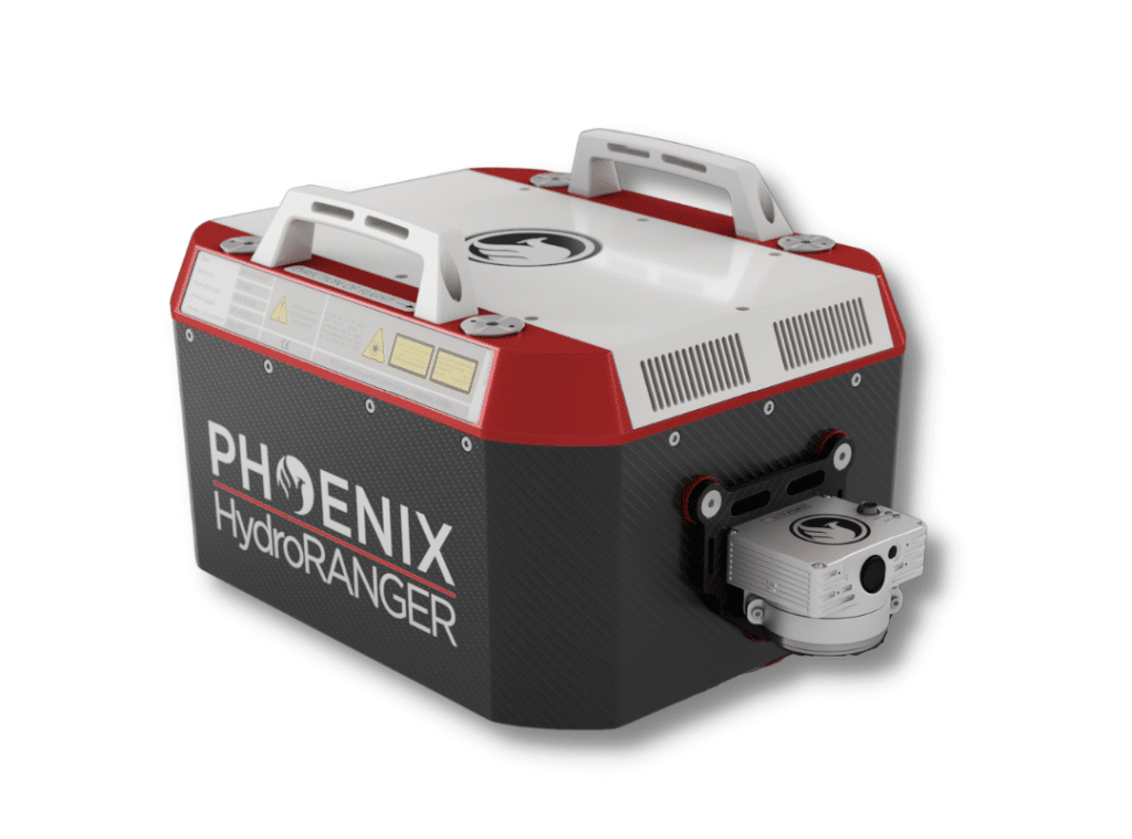
The Phoenix LiDAR HydroRANGER provides dual purpose topographic and bathymetric measurements for full scene mapping of shoreline systems. Utilizing a visible green spectrum laser with an elliptical scan pattern and measurement rates up to 200 kHz, the HydroRANGER provides a combination of high spatial resolution and spatial accuracy. Capable of reaching beyond 2 Secchi depths, this is the ideal solution for mapping land-water interface environments along rivers, reservoirs, oceans and more!

Watch the HydroRANGER in Action

Fill Out the Form to Download the Resource

Related Posts