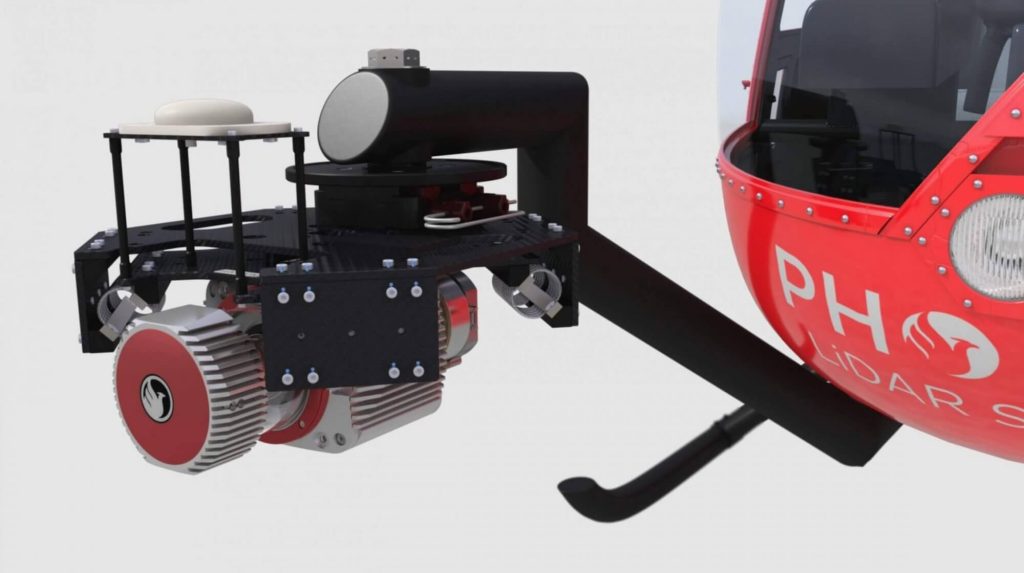
Discover the innovative vehicle-flexible systems by Phoenix LiDAR Systems, as presented by senior post-processing engineer Kory Kellum in the February 2021 webinar. Phoenix LiDAR Systems, a leader in UAV-based LiDAR technology, offers 3D mapping systems adaptable to various vehicles, including UAVs, cars, backpacks, and helicopters.
These multi-vehicle LiDAR payloads are crucial for industries like construction, mining, forestry, and utilities. Kory Kellum delves into the benefits of transferring payloads between vehicles, utilizing UAVs for site accessibility and dense data collection, cars for roadside asset mapping, and helicopters for wide-area coverage. Learn about the importance of system mounts, custom cables, and calibration for seamless transitions, as well as tackling challenges like sensor orientation and precise measurements.
The webinar also provides practical examples of combining different vehicles and LiDAR systems for comprehensive mapping. Concluding with a Q&A session, Kory addresses questions on LiDAR systems, data collection, and tailored solutions, highlighting Phoenix LiDAR Systems’ commitment to customized support and training.
