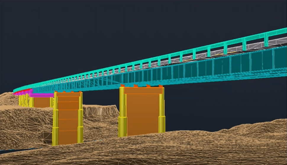
In the July 2021 Phoenix LiDAR Systems webinar, Senior Geomatics Engineer Kory Kellum discussed aerial surveys with high-performance LiDAR technology. Phoenix LiDAR Systems, based in Austin, Texas, specializes in custom UAV LiDAR solutions. The webinar highlighted the practical applications of UAV-based LiDAR in aerial surveying and engineering through insights from Pape-Dawson Engineers, Angela Livingston, and David Trotter. They shared their use of the Phoenix Ranger with the VUX1 UAV scanner, emphasizing benefits like high-resolution data, speed, vegetation penetration, and access to difficult sites.
The webinar covered workflows from site assessment to data processing, showcasing detailed and accurate point clouds for extracting data products like contours and infrastructure details. Examples included aerial survey mapping a railroad bridge and a riverbank. The Q&A session addressed flight planning, check shots under canopies, and data processing software.