Log In
Login to Phoenix LiDar System

RANGER-U240

Longest ranging sensor made to densely map wide areas from high altitudes
1.5 - 3 cm @ 120 m
RMSEz System Accuracy
1.5 cm @ 120 m
RMSDz Instraswath Precision
890 m
Max AGL @ 20% Reflectivity 
4.7 kg
Weight
75°
Field of View
RANGER XL
Scan Angle(s)
RANGER XL

OVERVIEW

AIRCRAFT OPTIONS
Heli
Fixed Wing
UAV
VTOL
PRIMARY APPLICATIONS
Utilities
Rail
Construction
Mapping
Oil & Gas
Agriculture & Forestry

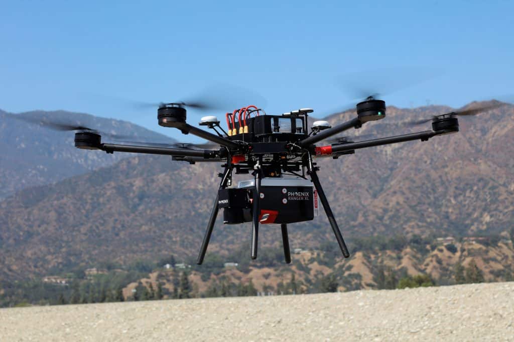
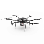
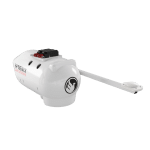
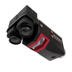
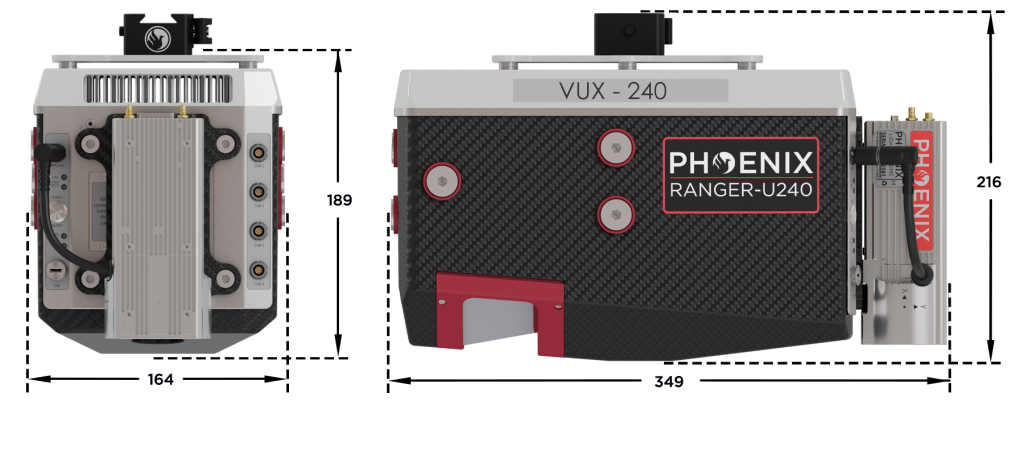
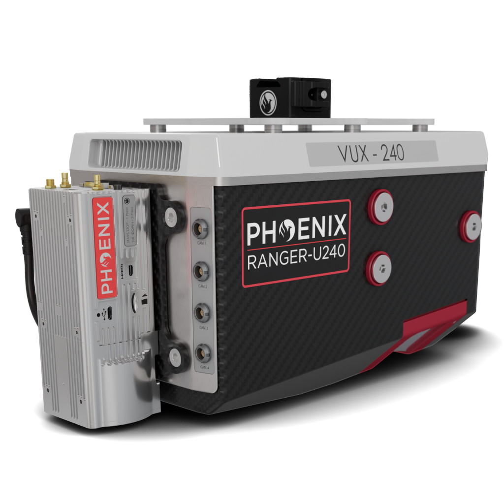
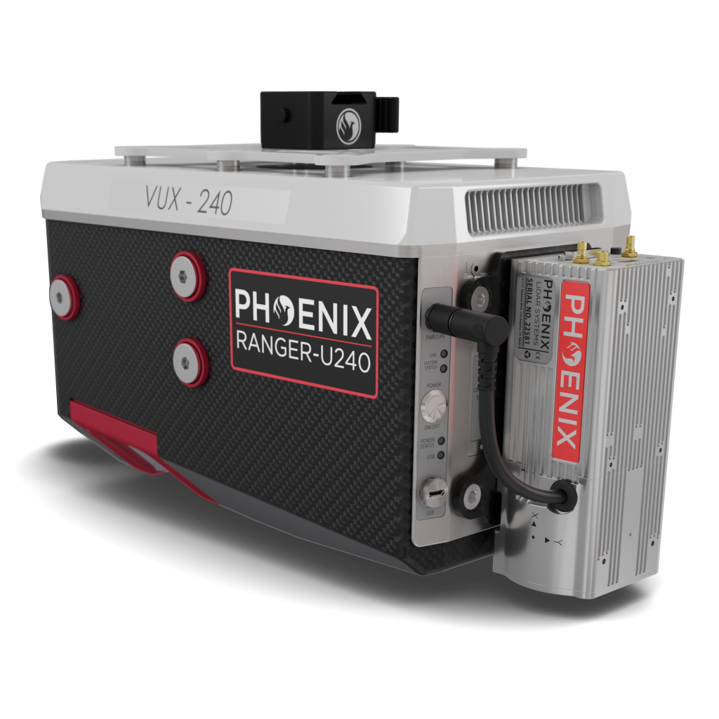
The RANGER-U240 is a lightweight airborne laser scanner designed specifically for use on UAS and small manned airplanes or helicopters. Featuring the RIEGL VUX-240 24, it offers a wide 75-degree field of view and an extremely fast data acquisition rate of up to 2400 kHz. The system is ideally suited for high point density corridor mapping applications, including power line, railway track, and pipeline inspection. 

Phoenix offers several RANGER-U240 camera accessories, as well as UAV and manned aircraft attachment options. Please contact us to learn more about this amazing number of the RANGER series. 

Features: 

  • Easily mountable to unmanned platforms (UAVs) and to
    helicopters, gyrocopters, and other small manned aircrafts.
  • Operating flight altitude up to 1,430 m / 4,700 ft
  • Scan speed up to 600 lines/second
Ranger XL LiDAR System on Harris Drone
The RANGER-U240 in aerial configuration easily integrates on the HARRIS CARRIER and other large mutli-rotor drones.

Full specifications

Platform specs
Performance
Operating Voltage
20-28 V DC
Power Consumption
85 W typical
Operating Temps
32° - 104° F
LiDAR Sensor specs
Performance
Laser Wavelength
1550 nm
Range Minimum
5 m
Range Maximum
1200 m  @ 20% reflectivity, 300 kHz
Max Effective Measurement Rate
up to 2,000,000 meas./sec
Scan Speed
40 - 600 lines/second
Beam Divergence
0.35 mrad
Field of View
75°
Laser Accuracy
0.01 m (1 σ @150 m)
Laser Precision
15 mm
Laser Safety
Class 3R ENOHD 3.5 m

(1 ) Rounded average PRR.
(2) Typical values for average conditions and average ambient brightness. In bright sunlight, the max. range is shorter than under an overcast sky.
(3) The maximum range is specified for flat targets with size in excess of the laser beam diameter, perpendicular angle of incidence, and for atmospheric visibility of 23 km. Range ambiguities have to be resolved by multiple-time-around processing.
(4) Effective FOV 75°, additional roll angle ± 5°.
(5) If the laser beam hits, in part, more than one target, the laser‘s pulse power is split accordingly. Thus the achievable range is reduced.

Accessories & Options

Harris Aerial H6 Drone with Ranger Ultra LiDAR System
Drone Kits
Cessna Pod Accessory
ULTRAPOD UP1
Ranger XL LiDAR Camera Accessory
Camera Options
Ranger XL IMU
IMU Upgrades
Ranger XL LiDAR Accessory for Helicopter Integration
Heli Mount

DIMENSIONS (mm)

Rear/Right

REAR
Air NavBox

RIGHT
Accessory Mounts
SD Card
USB

Rear/Left

REAR
Air NavBox

LEFT
Accessory Mounts
Power Button
Status LED
GPS Antenna 1-2
WiFi

Automated Post-Processing in the Cloud
CAPTURE | POST-PROCESS | ANALYZE | SHARE
Meet LiDARMill, the first cloud-based, LiDAR platform for post-processing, reporting, and hosting.

LiDARMill enables surveying teams to take advantage of precision laser mapping without investing in expensive software & training.