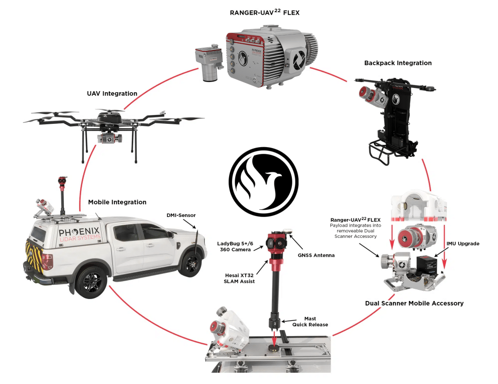
Log In
Login to Phoenix LiDar System

RANGER-UAV22 FLEX

FLY IT, DRIVE IT, MOUNT IT ANYWHERE - THE MOST ADAPTABLE MAPPING SYSTEM
1.5-3.0 cm @ 120 m
RMSEz System Accuracy
2.0 cm
RMSDz Instraswath Precision
490 m
Max AGL @ 20% Reflectivity 
4.7 kg
Weight
360°
Field of View
RANGER UAV FLEX
Scan Angle(s)
RANGER UAV FLEX

KEY FEATURES

AIRCRAFT OPTIONS
UAV
BACKPACK
VEHICLE
VTOL
PRIMARY APPLICATIONS
Utilities
Rail
Transportation Infrastructure Mapping
General Mapping
Construction

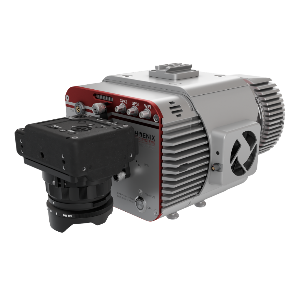
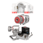
The RANGER-UAV²² FLEX is our most versatile system, capable of seamlessly integrating into various platforms such as backpacks, UAVs, and dual-head mobile scanning solutions. The high pulse rate measurement capability ensures exceptional precision in data collection. Whether you’re embarking on high-density UAS missions, tackling detailed mobile mapping projects, or conducting surveys with low-altitude piloted aircraft, the RANGER-UAV²² FLEX is up to the task.

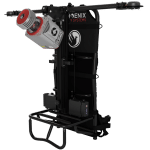
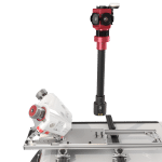
This system is available in UAV, VTOL, vehicle, backpack, and our ALL NEW RANGER FLEX DUAL MOBILE SYSTEM accessory configurations, depending on your needs.

Full specifications

PAYLOAD SPECS
Overall Dimensions (L x W x H) (cm)
RANGER FLEX: 27.9 x 20.9 x 17.3 
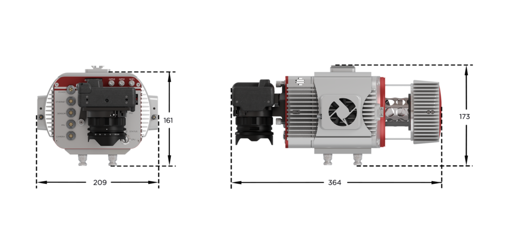
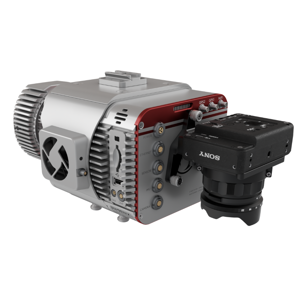
RANGER-FLEX W/CAMERA: 36.4 x 20.9 x 17.3
Power Consumption

RANGER FLEX: 75 W typical
RANGER FLEX W/CAMERA: 85 W typical
Weight
RANGER FLEX: 4.7 kg / 10.3 lbs
RANGER FLEX W/CAMERA: 5.9 kg /13.0 lbs
Operating Temperature
32° - 104° F
Operating Voltage
14 - 28 VDC
LiDAR SENSOR SPECS
Laser Wavelength
1550 nm
Range Minimum
1.5 m at ≥1 MHz PRR
Range Max
755 m at 20% reflectivity, 50 kHz PRR
Pulse Repetition Frequency
Up to 1200 kHz
Scan Speed
10 - 200 lines/second
Max Return Count
15
Beam Count
1 facet rotating mirror
Beam Divergence
0.35 mrad @ 1/e
Horizontal FOV
360°
Laser Accuracy
10 mm One sigma @ 150 m
Laser Safety
CLASS 1

Accessories & Options

Ranger UAV 22 Flex with Drone Integration
Drone Kits
Camera Options
Backpack
Ranger UAV 22 FLex
Dual Mobile
360 Camera

DIMENSIONS (mm)

REAR/RIGHT

REAR
Power Button
GPS 1-2
Wifi
Status LED
Camera Mounting

RIGHT
Cooling Fan

REAR/LEFT

REAR
Power Connection
Ethernet
Dual LiDAR Sensor Port
IMU
Camera Port

LEFT SIDE
DMI
SD Card
Cooling Fan

Automated Post-Processing in the Cloud
CAPTURE | POST-PROCESS | ANALYZE | SHARE
Meet LiDARMill, the first cloud-based, LiDAR platform for post-processing, reporting, and hosting.

LiDARMill enables surveying teams to take advantage of precision laser mapping without investing in expensive software & training.