LiDARMill
The first cloud-based LiDAR platform for post-processing, reporting, and hosting
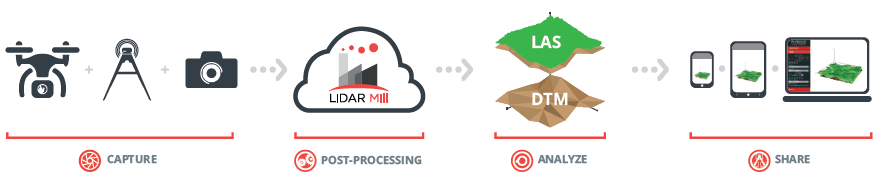
LiDAR acquisition is only half the job. Our goal is to decrease the time and cost for users to process their raw data into accurate geospatial products. Meet LiDARMill, the original cloud-based LiDAR post-processing platform that simplifies the complex data processing task and make precision laser mapping more easily achievable for all users.
LiDARMill helps simplify processes, improve accuracy, maintain consistency, reduce turnaround time, and lower project costs. View your data, track project status, and invite clients to view the results – all from your LiDARMill dashboard. LiDARMill can be customized to serve any size organization, from small survey teams to government departments with heavy data throughput needs.
KEY FEATURES

Project Management and Data Storage
- Convenient project level data organization
- Multi-mission project processing
- Coordinate Reference System wizard
- Automatic project overview maps
- Ground control and project boundary inclusion
- 5 TB storage, with options to increase
- Email alerts of process completion
Navlab Pipelines
- Unlimited trajectory processing
- Automatic reference station position estimation
- Satellite based corrections* when no reference station exists
- Lever arm estimation
Data Sharing
- CloudViewer for shareable web based point cloud viewing
- Direct download links for clients
Fuser Pipelines
- Automatic flightline detection
- LiDARSnap for sensor calibration and trajectory optimization
- CameraSnap for camera calibration and pose correction
- Pointcloud colorization
- Classification: noise, ground, moving objects
- AI classification (Beta version)
- CloudClean outlier removal
- DEM, DSM, CHM, Contours, LandXML
- Alternative optimization pipelines for .las input
- Quality control reports
LEARN HOW
FAQs
How do I sign up for LiDARMill?
LiDARMill is a subscription cloud service for LiDAR post-processing. To subscribe or learn more, contact us and we’ll help you find the best LiDARMill Tier for your team.
What licensing options are available?
LiDARMill Unlimited, Data Hosting only, and extra storage are the current products offered. Please contact our sales team for more details.
Does LiDARMill work with non-Phoenix LiDAR Systems
LiDARMill can process raw data straight from many third-party systems. Not sure if your system is compatible? Just get in touch and we’ll help you check.
Can LiDARMill process my .las file?
Yes, if you have an accompanying trajectory that fully covers the .las temporally, then with a dedicated subscription type you can run an optimization pipeline to calibrate, classify, create products and generate a cloudviewer.
Is there a setup fee?
All Phoenix LiDAR systems are automatically compatible with LiDARMill, so no setup or setup fee is necessary. While we’re constantly working to increase compatibility with third-party LiDAR systems, some systems will require extra time for custom configuration. If that’s necessary, our team will let you know how much it might cost.
Can I cancel or modify my subscription?
You can conveniently cancel you subscription through your accounts page.