-
RMSEz System Accuracy
6 cm @ 750 m
RMSDz Instraswath Precision
1600 m / 2754 m
Max AGL @ 20% Reflectivity
~15 kg
Weight
80°
Field of View
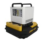
HALO V
0°
Scan Angle(s)
HALO V
KEY FEATURES


Airplane

Oil & Gas

Utilities
Construction

Mapping

Forestry

Quick Release

Air NavBox

SE8
The HALO series LiDAR scanners are made for high-altitude, high-efficiency mapping. City-scale LiDAR projects are easily achievable with swath widths reaching 5,150 m. Selectable measurement rates up to 1600 kHz and line speed up to 250 per second can be tuned to meet challenging pulse density specifications.
The HALO-V is available in two different models; the HALO-15V and the longer-range HALO-30V.
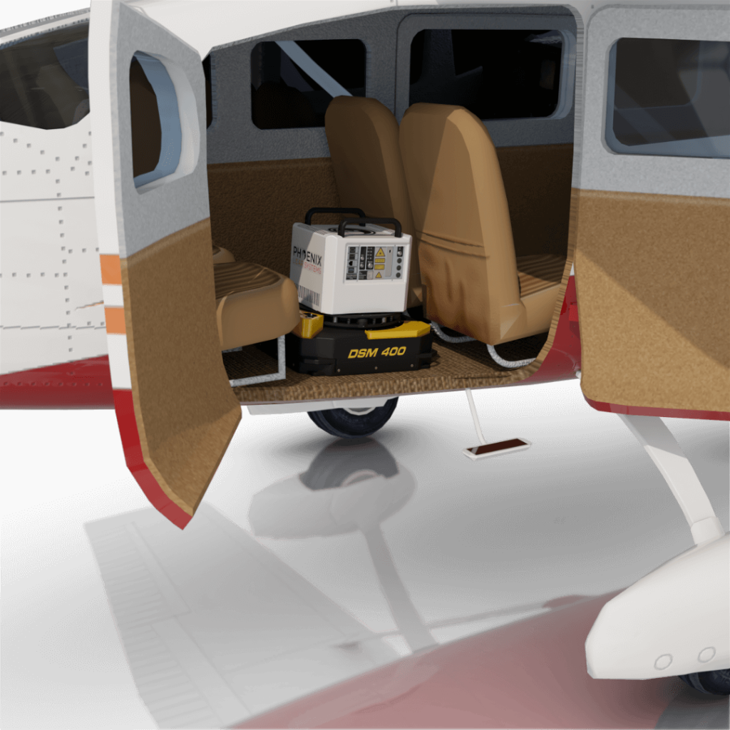
The HALO V in aerial configuration easily integrates into the CESSNA 206 and other small single engine aircraft.
Full specifications
Specification
Performance
Pulse Repetition Rate (PRR)
1600 kHz
Scan Rate
20 - 250 lines/second
Field of View
80°
Laser Wavelength
1030 nm
Constellation Support
GPS, GLONASS, BEIDOU, GALILEO
Max Echoes/ Returns per pulse
Virtually Unlimited
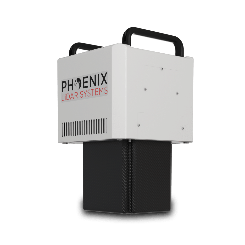
Dimensions
30.4 x 29.4 x 47.3 cm
Operating Voltage/ Power
18-28 VDC / 155 W
Operating Temps
0 - +40° C
Beam Divergence
0.3 mrad
Sensor Precision
-
Laser Scanner Model
Geolas ELMAP-V
(1) 100% laser power
(2) 80° field of view
(3) NOHD & ENOHD determined for non-overlapping beam footprints.
Accessories & Options
Aircraft Gimbal
IMU Upgrade
PLS Care
DIMENSIONS (mm)
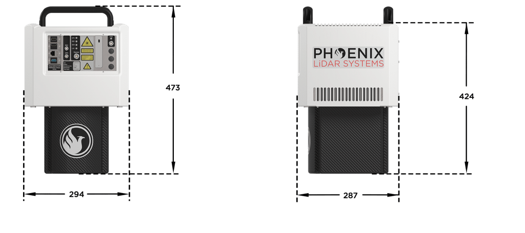
FRONT/LEFT
BOTTOM
Laser Scanner
LEFT SIDE
Power Button
CPU Status LED
Antenna 1/2
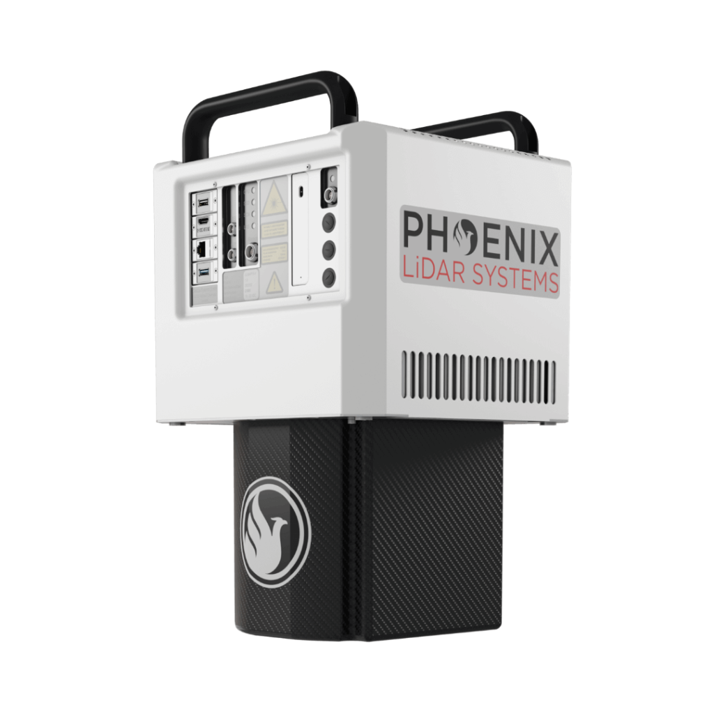
REAR/RIGHT
REAR
Power Button
Status LED
GPS Antenna 1-2
USB
Ethernet


Automated Post-Processing in the Cloud
CAPTURE | POST-PROCESS | ANALYZE | SHARE
Meet LiDARMill, the first cloud-based, LiDAR platform for post-processing, reporting, and hosting.
LiDARMill enables surveying teams to take advantage of precision laser mapping without investing in expensive software & training.
LiDARMill enables surveying teams to take advantage of precision laser mapping without investing in expensive software & training.