Customize Consent Preferences

We use cookies to help you navigate efficiently and perform certain functions. You will find detailed information about all cookies under each consent category below.

The cookies that are categorized as "Necessary" are stored on your browser as they are essential for enabling the basic functionalities of the site. ... 

Always Active

Necessary cookies are required to enable the basic features of this site, such as providing secure log-in or adjusting your consent preferences. These cookies do not store any personally identifiable data.

No cookies to display.

Functional cookies help perform certain functionalities like sharing the content of the website on social media platforms, collecting feedback, and other third-party features.

No cookies to display.

Analytical cookies are used to understand how visitors interact with the website. These cookies help provide information on metrics such as the number of visitors, bounce rate, traffic source, etc.

No cookies to display.

Performance cookies are used to understand and analyze the key performance indexes of the website which helps in delivering a better user experience for the visitors.

No cookies to display.

Advertisement cookies are used to provide visitors with customized advertisements based on the pages you visited previously and to analyze the effectiveness of the ad campaigns.

No cookies to display.

Log In
Login to Phoenix LiDar System

RECON-XT / XT-A

GREAT VALUE MEETS GREAT PERFORMANCE
Recon XT LiDAR System
2-5 cm @ 80 m
RMSEz System Accuracy
4.5 cm @ 80 m
RMSDz Instraswath Precision
80 m
Max AGL @ 10% Reflectivity 
1.8 kg
Weight
360°
Field of View
RECON XT
Scan Angle(s)
RECON XT

KEY FEATURES

UAV
SLAM
Vehicle
Backpack
Utilities
Rail
Construction
Mapping
Forestry
Oil & Gas
Quick Release
SE8

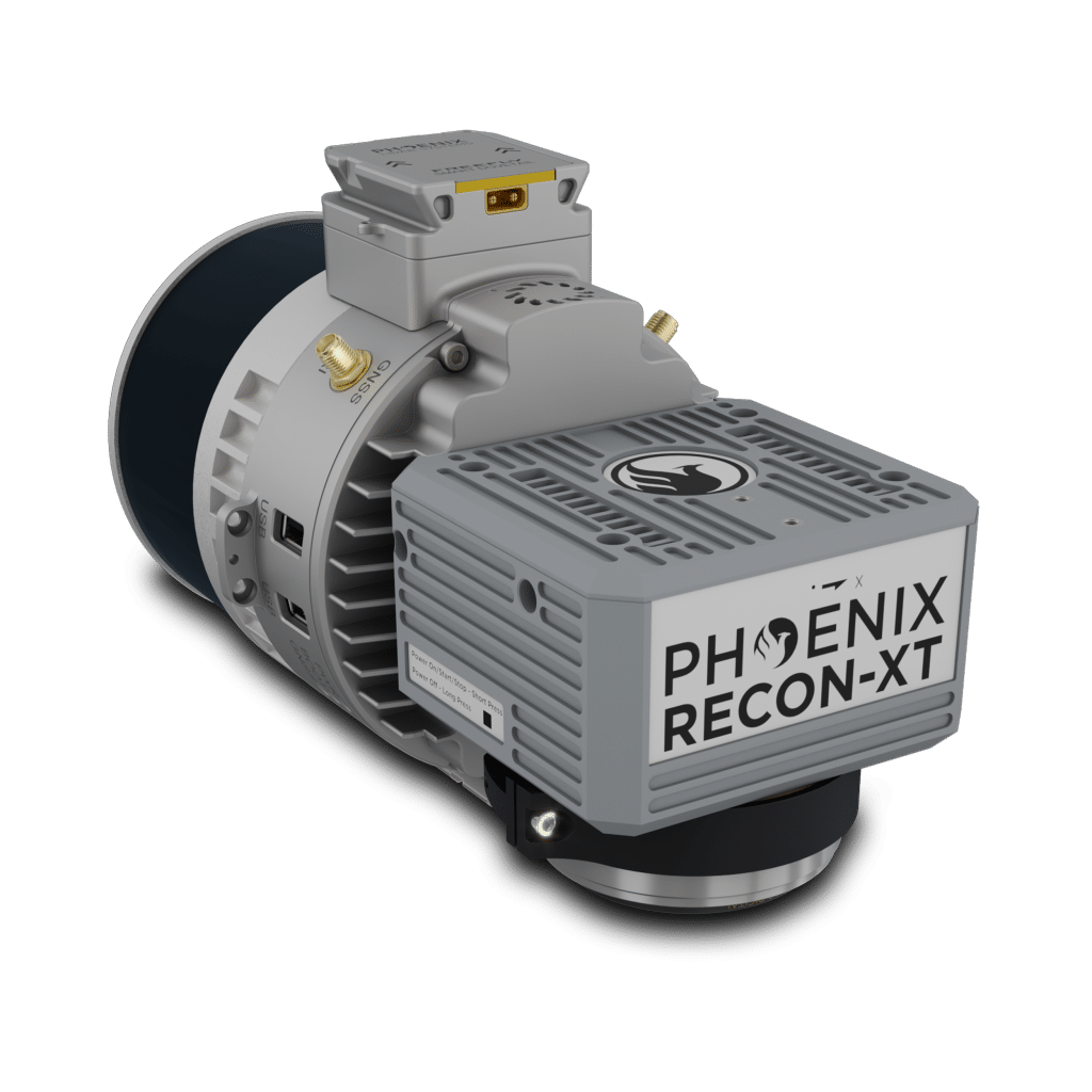
The RECON-XT is the ultimate value, entry-level system for the DJI Matrice 350. A strong fit for smaller scan areas and teams on a budget. The RECON-XT is designed to grow and adapt with your business.

Available in two variants for the two most popular mid-size drones.

  • Recon-XT – DJI M300 and M350
  • Recon-XT-A – Freefly Astro

Flexibility in mounting options is a key benefit of this Phoenix system. The RECON-XT is designed to fly on UAVs, and can also be deployed for mobile mapping applications.

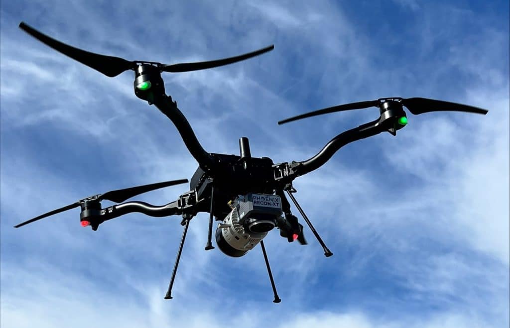
Recon XT LiDAR System on Drone
The RECON-XT-A in aerial configuration easily integrates on the ASTRO and other medium mutli-rotor drones.

Full specifications

Specification
Performance
Pulse Repetition Rate (PRR)
640 kHz
Scan Rate
600
Field of View
+15° -16° V / 360° H
Laser Wavelength
905 nm
Constellation Support
GPS, GLONASS, BEIDOU, GALILEO
Max Echoes/ Returns per pulse
2
Dimensions
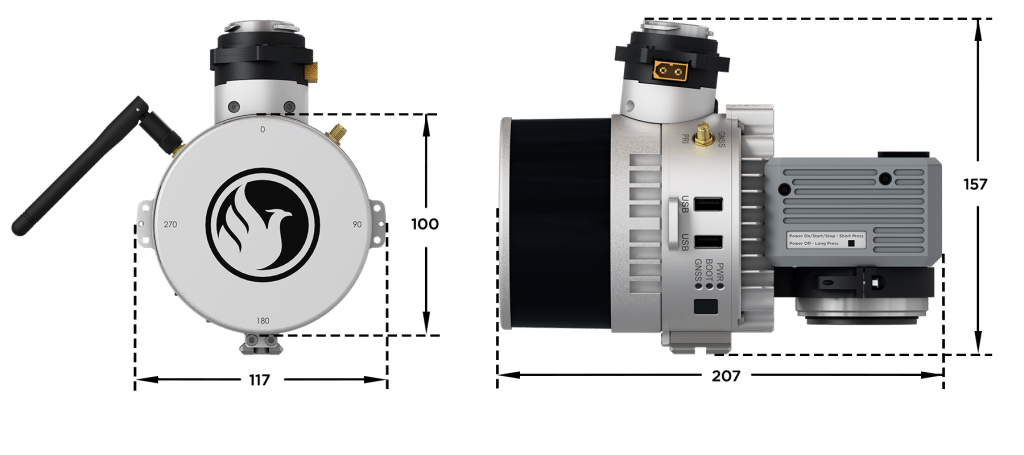
20.7 x 11.7 x 15.7 cm
Operating Voltage/ Power
12-28 VDC / 20 W
Operating Temps
-20 - +40° C
Beam Divergence
2.29 mrad / 1.52 mrad
Sensor Precision
2-4 cm
Laser Scanner Model
Hesai XT32

(1) Approximate values based on PLS test condition.
(2) Using a 90° downward field of view.
(3) Range of elevation values on flat surfaces with >20% reflectivity at the laser’s wavelength.
(4) Expected RMSEz when following the PLS recommended acquisition & processing workflow and ASPRS checkpoint guidelines.

Accessories & Options
Recon XT UAV Integration
M350 Recon-XT
Freefly Astro UAV with Recon XT LiDAR System
Astro Recon-XT-A
Universal Suction Mount LiDAR Accessory for Vehicles
Vehicle Mount
Dual Antenna backpack Accessory for with Recon XT LiDAR System
Backpack

DIMENSIONS (mm)

Recon XT Render with Dimensions
FRONT/LEFT

FRONT
Camera

LEFT SIDE
WiFI
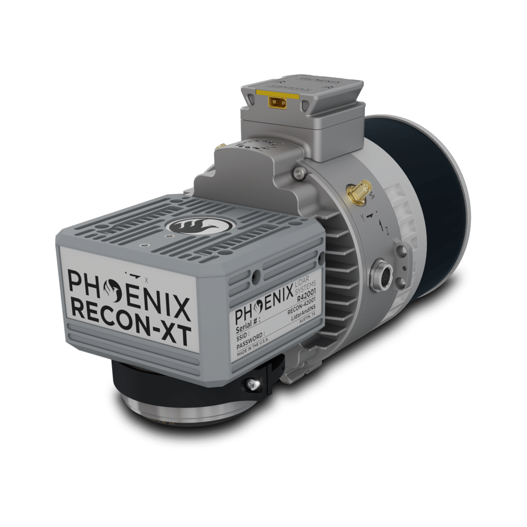
Recon XT LiDAR System
Recon XT LiDAR System Right side
FRONT/RIGHT

REAR
Laser Scanner

RIGHT SIDE
USB
Memory Card
Status Lights
Power Button
GPS Antenna

Automated Post-Processing in the Cloud
CAPTURE | POST-PROCESS | ANALYZE | SHARE
Meet LiDARMill, the first cloud-based, LiDAR platform for post-processing, reporting, and hosting.

LiDARMill enables surveying teams to take advantage of precision laser mapping without investing in expensive software & training.