Join Kory Kellum, Senior Geomatics Engineer at Phoenix LiDAR Systems, in this February 2022 webinar as he introduces flexible LiDAR mapping solutions tailored to diverse customer needs. Since 2013, Phoenix LiDAR has pioneered innovations like the first commercial UAV LiDAR system and the LiDARMill cloud-based post-processing platform.
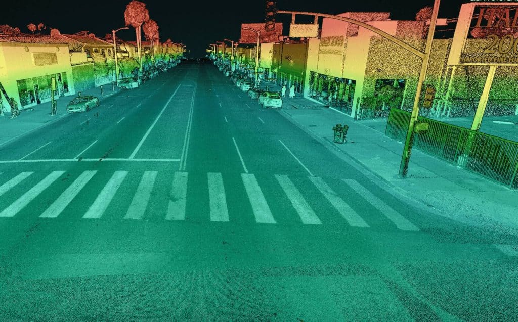
Kory highlights the new mobile data processing features in SpatialExplorer 7, emphasizing its high data density, accuracy, and efficiency. Ideal for applications like roadway design, bridge surveys, and asset inventory, mobile LiDAR mapping offers detailed data collection without lane closures or traffic disruptions.
SpatialExplorer 7 provides comprehensive mobile LiDAR processing with robust automated camera and LiDAR calibration, supporting multiple platforms to integrate mobile and aerial data seamlessly. The software includes mission guidance tools for complete data collection, navigation data processing options, and LiDAR Snap 4 for trajectory optimization.
Camera Snap 2 offers automated calibration of 360-degree imagery from the Ladybug camera, featuring custom mask creation and improved RGB extraction. The software generates various quality control reports, ensuring data accuracy and saving users time.
Corey demonstrates a mobile processing workflow in Spatial Explorer 7, covering trajectory clipping, point cloud generation, and calibration. The video concludes with examples of point cloud optimization and classification.
In the Q&A session, Kory and Dr. Ben Adler discuss the capabilities of Phoenix LiDAR’s systems, their applications, data processing options, and integration with other tools. They also highlight the flexibility of Spatial Explorer 7 in handling various data types and supporting different coordinate systems.
