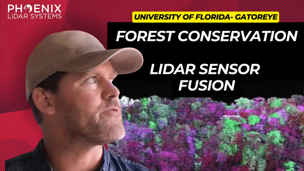
Discover the future of forest analysis with drone and LiDAR technology in this video. Led by Evan Braubin, an associate professor at the University of Florida, the GatorEye research program is revolutionizing how we study forests. Using the Harris Aerial H6 platform and the high-resolution GatorEye XTR system, drones equipped with LiDAR and hyperspectral sensors provide unparalleled insights into forest structure and species distribution.
The video highlights the integration of sensor fusion, combining visual, auditory, and temperature data for a comprehensive understanding of the forest environment. Learn about the Phoenix SpatialExplorer algorithm, which enhances data density and accuracy by meticulously calibrating flight parameters.
Braubin’s collaboration with Phoenix LiDAR has propelled his research, developing advanced systems like the OrkCS and Orca CS ground stations. This innovative approach is transforming forest analysis, uncovering the intricate impact of vegetation on animal movement and distribution.
Explore the groundbreaking advancements in remote sensing and forest analysis in this video, featuring keywords such as LiDAR technology, drone sensor fusion, GatorEye, hyperspectral sensors, Harris Aerial, and Phoenix SpatialExplorer. Welcome to the future of forest analysis!

