
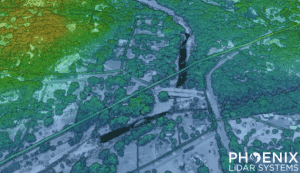
In this video, Kory Kellum from Phoenix LiDAR Systems introduces SpatialExplorer (SE) and its Pro plugin (SE Pro). SE is a powerful desktop software that simplifies LiDAR and image processing. SE Pro includes tools for trajectory processing, LiDAR and camera calibrations, point cloud classification, and generating raster and vector products.
He explains how SpatialExplorer Pro streamlines workflows from selecting a coordinate reference system to post-processing trajectories with NavLab tools. The software allows for precise point cloud creation and refinement, utilizing features like LiDAR Snap for accuracy. It also offers advanced point cloud colorization and classification tools.
SE Pro generates detailed reports and deliverables, saving time for service providers and providing transparency for end users. Additional tools include change detection and application-specific exports. Watch to learn how SE Pro can enhance your LiDAR projects and request a free trial from Phoenix LiDAR Systems.

