Webinar
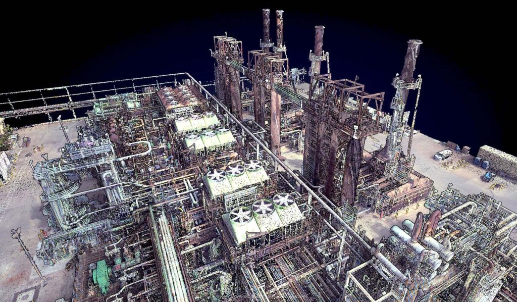
In this webinar, hosted by Kory Kellum of Phoenix LiDAR Systems, we explore the innovative use of LiDAR technology in oil and gas applications. Featuring insights from Ryan McMann and Andrew Healy of Measurement Sciences Inc. (MSI) and Scott McGowan of Precision Aerial Compliance Solutions, this session delves into the benefits of Phoenix’s survey-grade LiDAR mapping systems for UAVs and helicopters.
Learn how MSI transitioned from traditional land surveying to LiDAR, achieving efficient and detailed pipeline mapping and river-crossing surveys. Discover how Precision Aerial leverages LiDAR for refinery expansions, pipeline planning, and environmental assessments, significantly improving accuracy and efficiency. The discussion covers challenges in drone-based LiDAR surveys, data management strategies, and the integration of sonar and LiDAR for comprehensive results.
This video also explores potential applications in other industries, such as dam integrity and power line inspections. The webinar concludes with a Q&A session, addressing key questions about LiDAR technology’s capabilities and future developments. Don’t miss this insightful look at how LiDAR is revolutionizing the oil and gas industry.
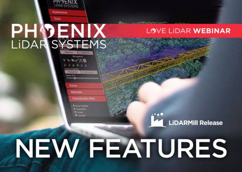
In this Phoenix LiDAR Systems webinar, hosted by Conrad Conterno, discover the latest features and updates in their cloud processing software, LiDARMill, for early 2021. Phoenix LiDAR Systems specializes in comprehensive mapping solutions, covering the entire data collection and finalization process. Conrad introduces LiDARMill, a cloud-based automated data processing software designed to streamline workflows and maximize accuracy. This powerful tool handles navigation data, LiDAR data calibration, point cloud creation, and includes built-in QC tools along with an online data viewer.
The webinar highlights several new features in LiDARMill, including an overhauled coordinate reference system (CRS) wizard that ensures accuracy from the beginning, enhanced ground control point (GCP) handling which allows designation of points as control or check, and improved accuracy reporting based on these checkpoints. There is also a new option for generating tiled results, particularly useful for managing large projects, and comprehensive documentation to guide users. Additionally, the deployment of the new SpatialExplorer 6 core significantly enhances data quality and calibration precision.
A major upcoming feature is a machine learning-based automated classification pipeline, currently in beta testing and tailored for utility data sets. This AI classifier aims to save time and increase classification accuracy by automatically identifying various features in point cloud data.
Conrad demonstrates these features within the LiDARMill interface, highlighting the importance of setting the correct CRS and using the updated GCP configuration tool. He also showcases the new tiled data download option and the ease of accessing online documentation.
During the Q&A session led by Dr. Ben Adler, various topics are addressed, including support for third-party systems, mobile LiDAR processing, reference station-less processing, and manual classification. Ben discusses the handling of large data sets, the new AI classification pipeline, and the visualization of reference stations within the cloud viewer.
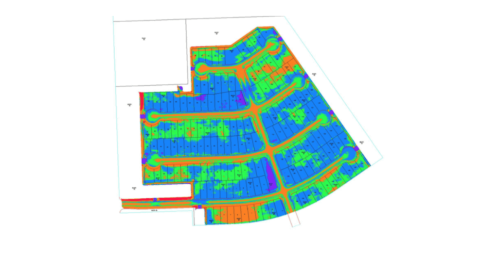
This is a panel discussion featuring two Surveying and Engineering Design service providers: EHRA and Wood Rodgers. We will discuss how they are leveraging Phoenix LiDAR’s systems to perform the heavy lifting in order to provide both the fastest data acquisition and best data deliverables to their clients. You won’t want to miss hearing their many compelling successes throughout their LiDAR-based Surveying and Engineering Design workflows.

Discover the innovative use of LiDAR technology in animal landscape ecology with Phoenix LiDAR Systems’ November 2020 webinar. This session delves into how remote sensing technologies, like LiDAR, are revolutionizing ecological research, particularly in understanding animal-landscape interactions. Hosted by Kory Kellum, a top GIS engineer at Phoenix LiDAR, the webinar features insights from Evan Hawkeridge, a PhD student from Harvard University’s Davies Lab.
Learn about the role of ecosystem engineers, such as elephants and termites, and how their behaviors influence ecosystems on a regional scale. The discussion covers advanced data collection methods using drones equipped with LiDAR and thermal sensors, challenges faced in field operations, and groundbreaking research projects in Kruger National Park and the Republic of Congo.
Tune in to explore how these technologies provide unprecedented detail and accuracy in ecological studies, offering new perspectives on animal behavior and landscape changes. Perfect for ecologists, researchers, and tech enthusiasts, this webinar showcases the future of ecological monitoring and analysis.
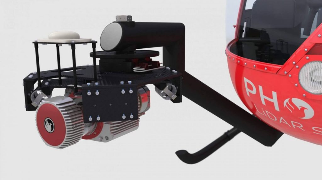
Discover the innovative vehicle-flexible systems by Phoenix LiDAR Systems, as presented by senior post-processing engineer Kory Kellum in the February 2021 webinar. Phoenix LiDAR Systems, a leader in UAV-based LiDAR technology, offers 3D mapping systems adaptable to various vehicles, including UAVs, cars, backpacks, and helicopters.
These multi-vehicle LiDAR payloads are crucial for industries like construction, mining, forestry, and utilities. Kory Kellum delves into the benefits of transferring payloads between vehicles, utilizing UAVs for site accessibility and dense data collection, cars for roadside asset mapping, and helicopters for wide-area coverage. Learn about the importance of system mounts, custom cables, and calibration for seamless transitions, as well as tackling challenges like sensor orientation and precise measurements.
The webinar also provides practical examples of combining different vehicles and LiDAR systems for comprehensive mapping. Concluding with a Q&A session, Kory addresses questions on LiDAR systems, data collection, and tailored solutions, highlighting Phoenix LiDAR Systems’ commitment to customized support and training.
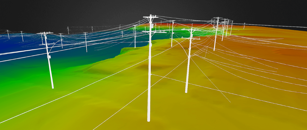
Join Iram Unfold from Phoenix LiDAR Systems as he delves into the transformative power of LiDAR and UAV technology for power line surveys. This comprehensive webinar covers every aspect of a survey project, from initial client interactions and RFP responses to precise data acquisition, post-processing, and final deliverables.
Discover how Phoenix LiDAR Systems’ compact, customizable LiDAR mapping systems, known for their high accuracy and 3D imaging capabilities, can revolutionize utility industry applications. Learn through a fictional case study about “Stuart’s Utility Company” and explore key considerations for sensor specifications, mission planning, and the integration of weather station data for accurate wire loading models.
Iram emphasizes the importance of accurate data acquisition, effective post-processing, and the generation of actionable insights. The session also includes a Q&A segment addressing ground control points, trajectory matching, and sensor recommendations.
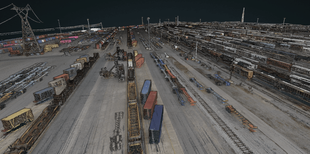
Join Kory Kellum in this insightful Phoenix Lidar Systems webinar featuring experts from CSX and American Rail Engineers (ARE) as they discuss the transformative use of mobile and UAV-based LiDAR in rail applications. Phoenix LiDAR Systems, a leader in commercial UAV LiDAR technology, offers custom LiDAR mapping systems for various platforms. This webinar explores how CSX and ARE leverage these advanced systems for asset inventory, change management, vegetation management, hydrology mapping, and more.
CSX representatives Steve Carmody and Tony Boise share their journey from manual data collection to utilizing mobile LiDAR units (Scout 16s) and permanently installed units (HDL 32s), significantly enhancing efficiency and safety. They also discuss plans to expand their capabilities with aerial LiDAR for complex environments like railroad yards.
ARE experts Steven Ushak, Taylor Engel, and Sam Johnson highlight their successful use of the Mini Ranger system for projects such as coastal resilience studies and PTC vegetation cutback planning. They emphasize LiDAR’s ability to penetrate vegetation and collect data in challenging conditions, including nighttime operations, and discuss future upgrades to larger systems for broader coverage and higher resolution.
The webinar underscores the critical improvements LiDAR technology brings to the rail industry, showcasing various applications and the potential for further advancements with aerial LiDAR and beyond visual line of sight operations. Concluding with a Q&A session, the discussion addresses data accuracy, field-to-office workflows, and operational challenges in diverse environments.
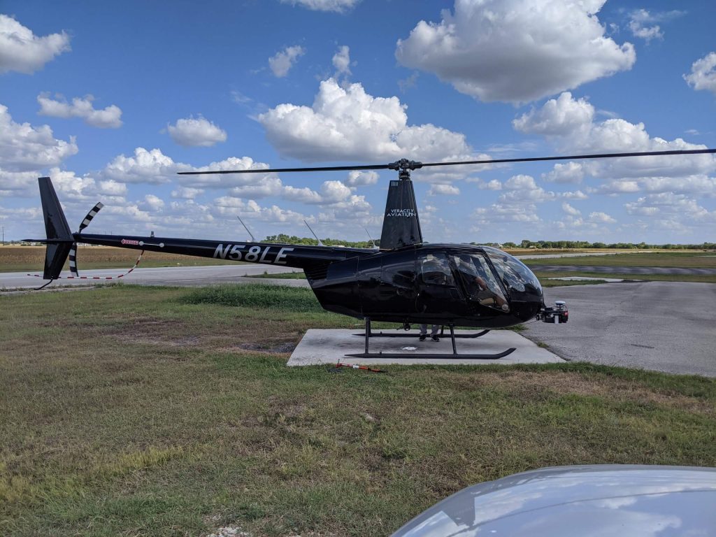
Join the Phoenix LiDAR Systems September 2021 webinar, hosted by Conrad Conterno and Ben Adler, focusing on airborne LiDAR data acquisition with manned aircraft. This session highlights the advantages of using fixed-wing aircraft and helicopters for LiDAR mapping, including increased flight speed, height, and the ability to cover large areas efficiently. Conrad Conterno, the post-processing manager, and Ben Adler, CTO and co-founder, introduce the new mission guidance feature of SpatialExplorer, a software that enhances real-time flight mission execution.
Learn about the different mission types available in the flight planner, such as wide-area mapping, corridor mapping, and line points mode. Discover how to incorporate various sensor types and models for accurate planning, ensuring optimal density, overlap, and resolution. The webinar includes a detailed demonstration of MissionGuidance, showcasing tools like dynamic whiskers for real-time navigation and the touch-and-go mode for pilot-initiated flight lines.
Understand the importance of precise flight planning and execution for high-quality LiDAR data and efficient post-processing. The session concludes with a Q&A, addressing flight plan creation, altitude calculations, and system adaptability. Explore the future of LiDAR mapping with Phoenix LiDAR Systems’ advanced technology and mission guidance capabilities.
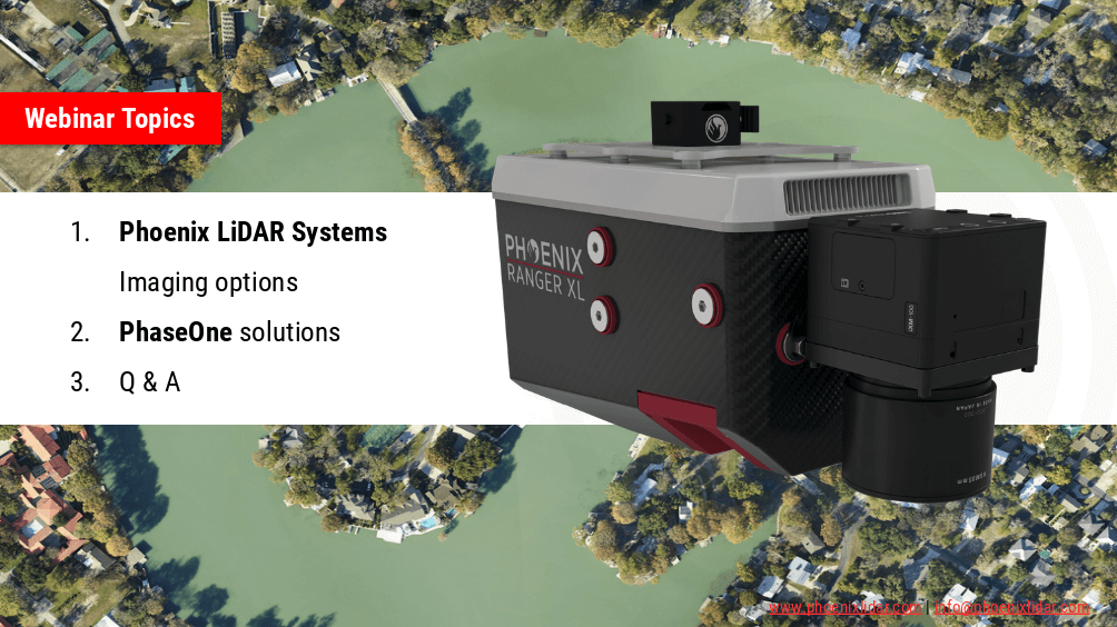
Join the Phoenix LiDAR Systems webinar on advanced imaging systems, held on April 21, 2021. Hosted by Conrad Conterno, Head of Post-Processing, and Justin Wyatt, VP of Sales at Phoenix LiDAR Systems, along with Nick Nelio, Inspection Sales Manager for Phase One, this session dives into how Phoenix LiDAR’s data collection tools integrate with Phase One’s cutting-edge imaging systems to enhance remote sensing capabilities.
Conrad Conterno opens with an overview of Phoenix LiDAR’s custom mapping solutions, emphasizing LiDAR sensor integration for superior data acquisition and analysis. He introduces various advanced camera options, including the lightweight custom A6K Light for UAV-based mapping, dual oblique cameras for enhanced colorization, multispectral solutions for detailed vegetation analysis, thermal mapping cameras for environmental monitoring, and hyperspectral sensors for precise spectral analysis.
Nick Nelio then showcases Phase One’s high-resolution, medium-format cameras, focusing on the 4-band solution that combines RGB and near-infrared imagery, ideal for crop analysis and environmental monitoring. He also presents the Phase One P3 payload for inspection applications and the IX Mach 5 controller designed for efficient geospatial missions.
Throughout the webinar, the benefits of direct geo-referencing and the seamless integration of multiple sensors into single payloads are highlighted. The hosts address audience questions on the accuracy of dual-camera systems, post-processing challenges, and the applications of hyperspectral imaging.
The session concludes with Justin Wyatt and Nick Nelio emphasizing their collaborative approach to delivering tailored solutions and inviting viewers to contact them for personalized consultations.