Search
Resource Type
Industry
Products
Sort
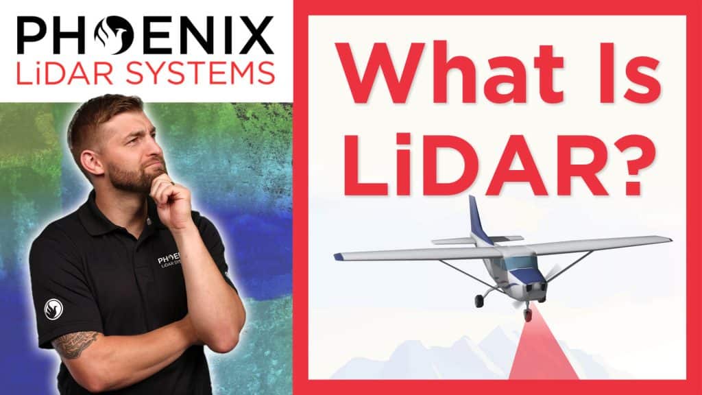
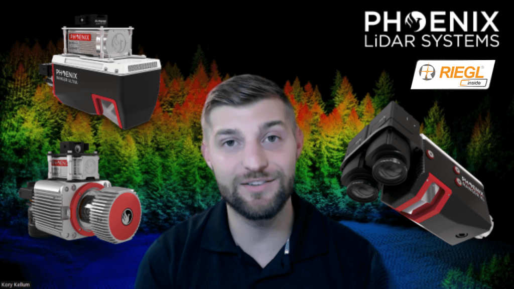
In this video, Kory Kellum from Phoenix LiDAR Systems introduces the fundamentals of LiDAR technology. You’ll learn about the purpose of LiDAR, its applications, how it works, and its components. LiDAR, which stands for Light Detection and Ranging, is a remote sensing tool used to measure 3D features quickly and accurately. It’s widely used in vegetation mapping, utility management, roadway construction, mining, and bathymetric mapping.
The video explains how LiDAR emits laser pulses to measure distances, with the system recording the time it takes for the light to return. This data, combined with positioning and orientation information from GPS and IMU sensors, creates a detailed 3D point cloud. Multiple returns from a single pulse allow LiDAR to capture data through vegetation and other obstacles.
This video also highlights practical uses of LiDAR data, such as estimating tree height, measuring power line sag, and detecting changes in topography.
Interested in learning more about how LiDAR works? Read our more in depth article on LiDAR fundamentals.
CUAV Sep. 6-8, 2022︱Las Vegas
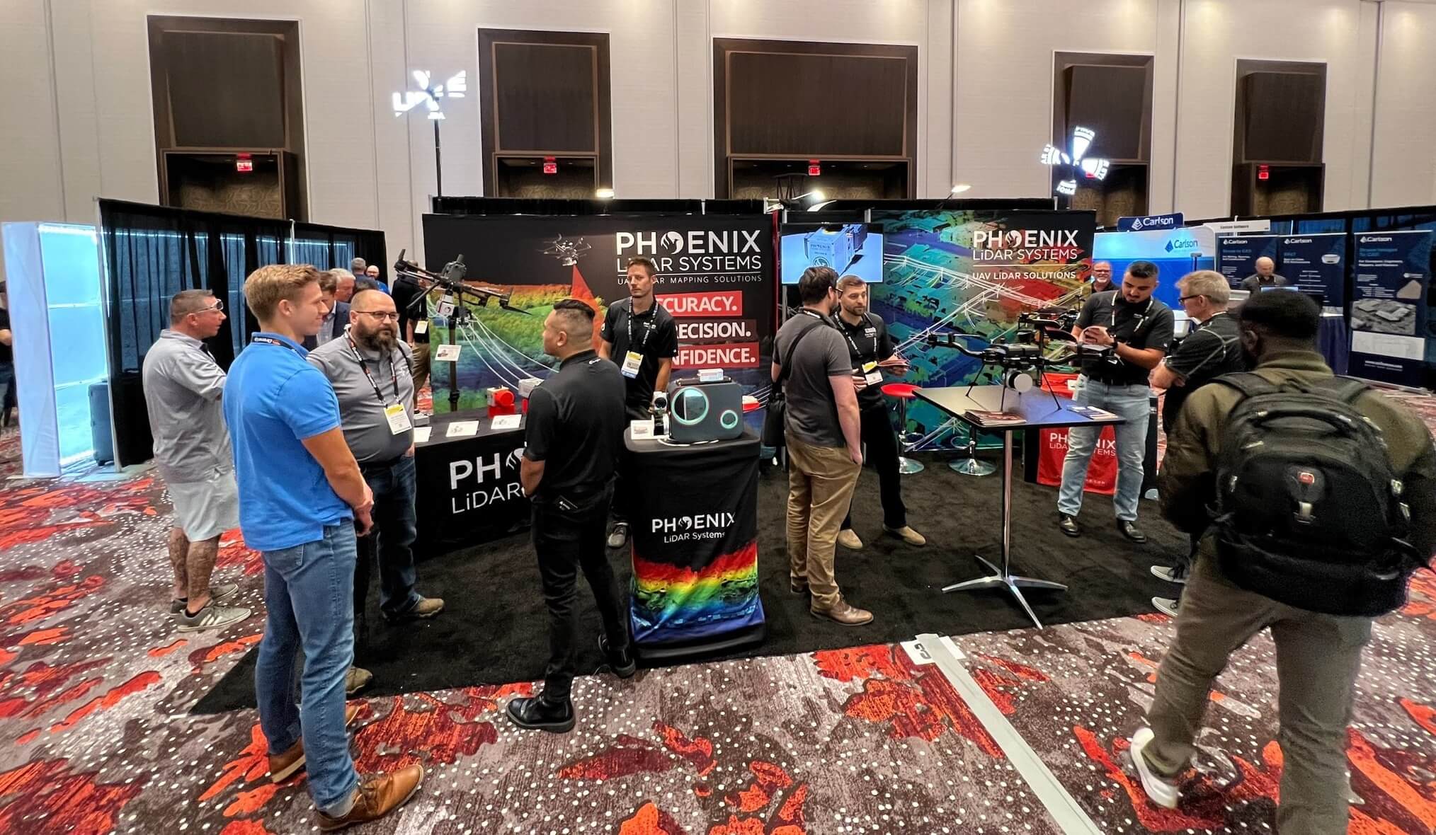
Phoenix LiDAR Systems came into Commercial UAV Expo 2022 in full force, bringing new innovations and product features that stirred up massive excitement amongst industry professionals.
CUAV Expo is the definitive event for professionals integrating or operating commercial UAS. With top-notch education, thousands of attendees, and more exhibitors than any other commercial drone event, it’s the best opportunity of the year for anyone who needs to keep up with commercial UAS technology, trends, and developments.
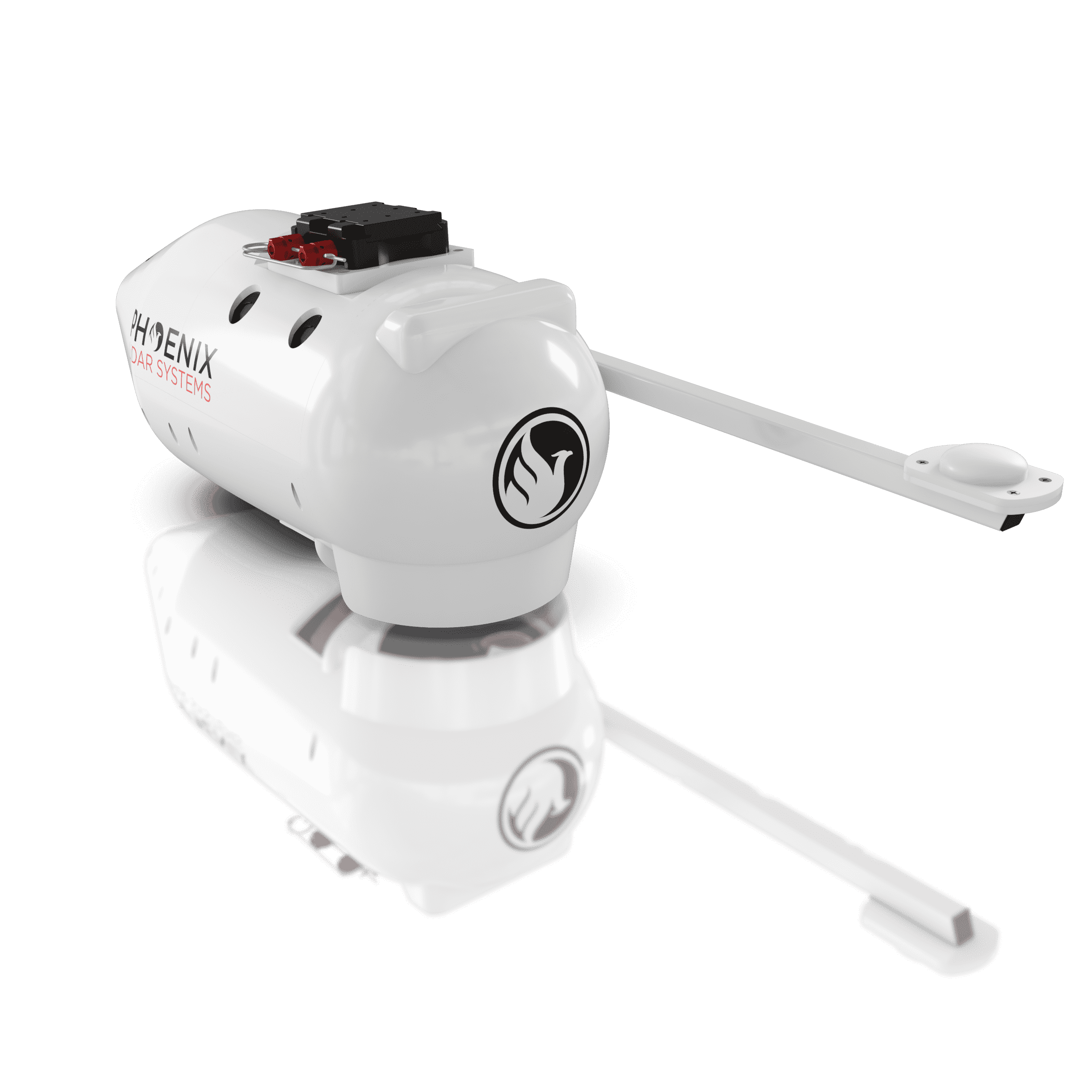
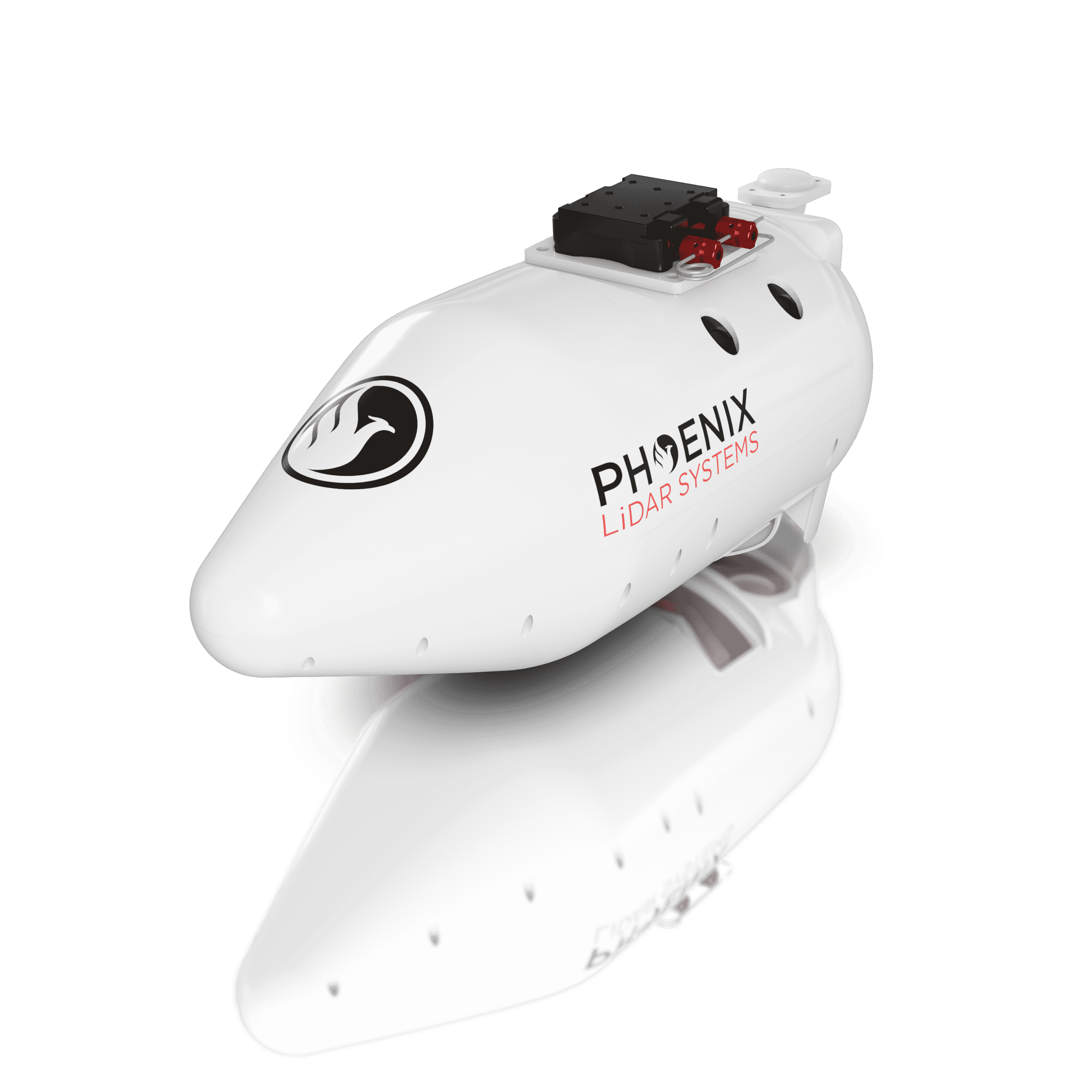
We announced our new and improved PIONEER-360 payload that boasted higher precision and accuracy than ever before. Our first bathymetric LiDAR system, the HydroRANGER was exhibited for the first time since its announcement back in June.
Phoenix LiDAR was selected to present the HydroRANGER in an exclusive annual event called “Pitch the Press.” A group of industry press representatives selected only 15 exhibitors to present a new cutting edge UAV solution in the exhibit hall. Selected exhibitors were given two minutes to present their new solution, followed by a one minute Q&A. The solutions chosen represented the groundbreaking solutions in reality capture, collaborative work and visualization tools.
An amazing event overall, with many wonderful new connections forged.
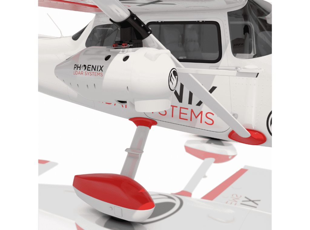
Enjoy a Light, Durable Cargo Pod, Aerodynamic and Efficient.
Looking to ensure your RANGER-XL LiDAR mapper is protected on its next mission? The Cessna Pod is the ultimate solution.
Elevate LiDAR Mapping with Our New Cessna Pod!
Leverage the sleek, aerodynamic pod for enhanced protection of your RANGER-XL. Seamlessly integrate on a variety of Cessna models – eliminating cumbersome installation and routing of an external GPS antenna.
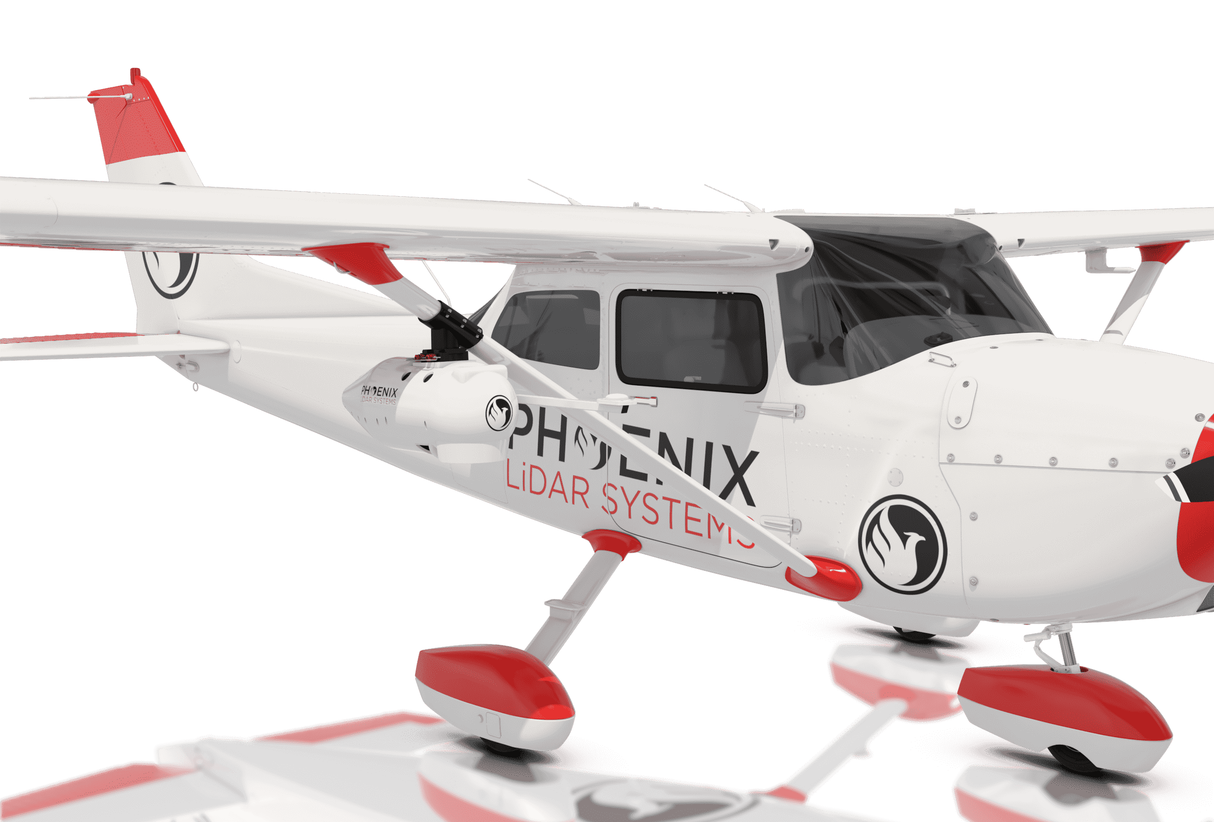
Reach out to our team to learn more about the advanced camera compatibility options!
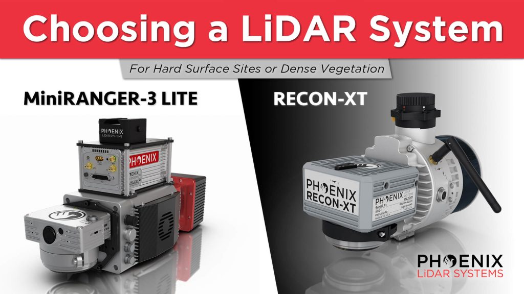
In this video, Kory Kellum from Phoenix LiDAR Systems guides viewers on choosing the right DJI M300 mountable LiDAR solution. He compares the Phoenix Recon XT and the MiniRanger 3, both of which are high-performance, survey-grade systems adaptable for UAV and mobile mapping applications. He also highlights the intrinsic differences between a higher-powered single laser system and a lower-powered multi-laser system to help users understand their specific use cases.
The video showcases real-world applications of these systems. It includes a detailed look at a project site where Scott McGowan from Kestrel Aerial uses the MiniRanger 3 Lite and the Recon XT. The MiniRanger 3 Lite, known for its precision and adaptability, excels in high-density point collection and meets USGS quality level 0 specifications. The Recon XT, valued for its performance in dense vegetation and its wide vertical field of view, is ideal for environments with heavy foliage.
Throughout the video, viewers see practical demonstrations of each system’s capabilities, including data visualization and analysis. The video concludes with a recap, emphasizing the importance of selecting the appropriate LiDAR system for specific project requirements, whether for land development, utility infrastructure, or vegetation mapping.
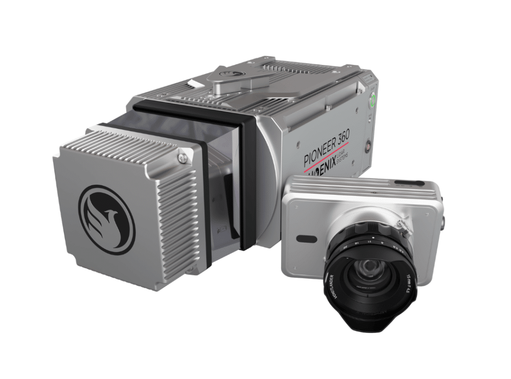
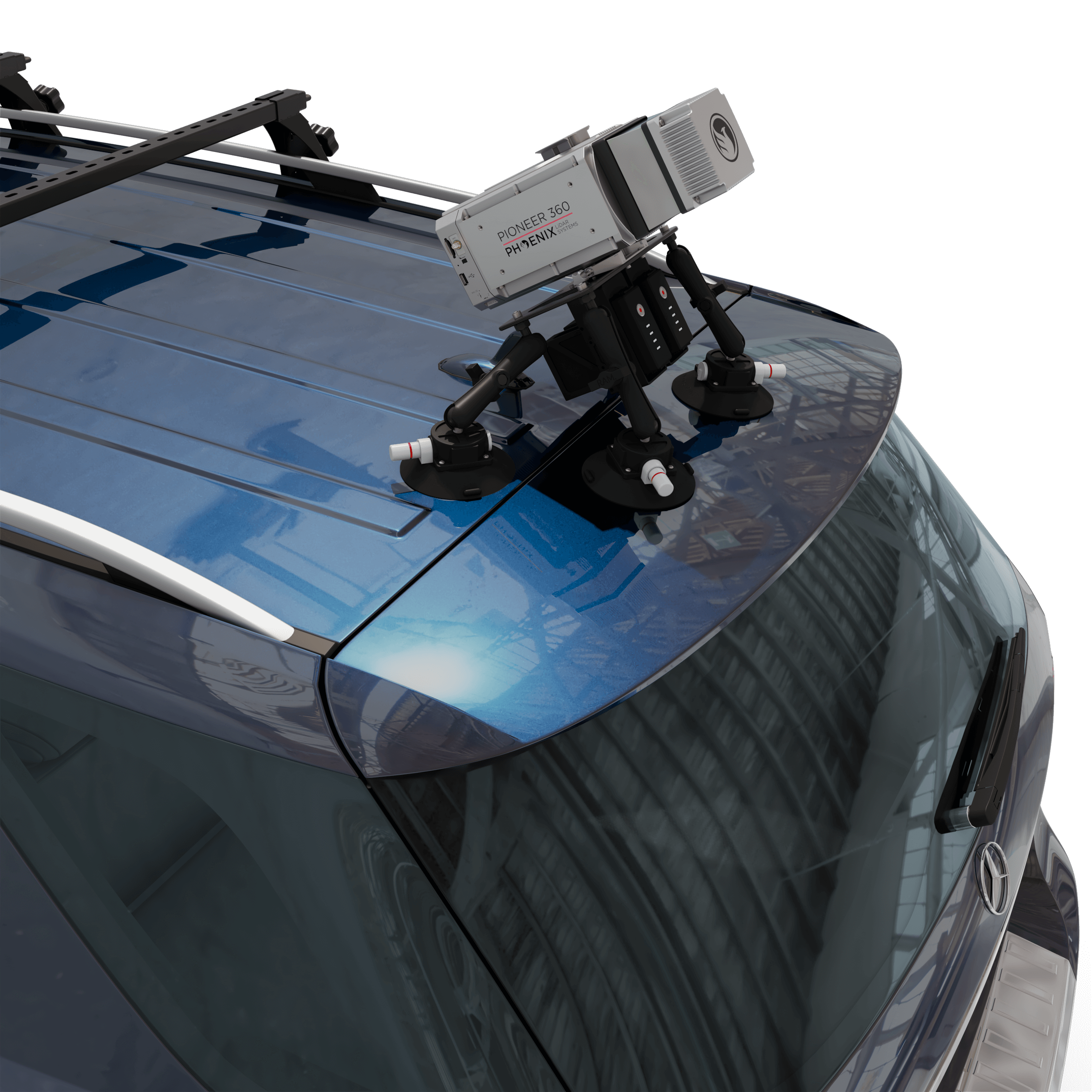
The PIONEER-360 is New and Improved!
The best-in-class universal survey grade LiDAR mapping system
The PIONEER-360 is the tool of choice for UAV and Mobile applications where there is no room for compromise in data quality. With a beam divergence of only 0.3 mrad, this system is designed for precision and confidence.
The PIONEER-360 supports selectable pulse repetition rates up to 500 kHz and line scan speeds up to 250 lines/second, allowing it to be optimized for various application and data requirements. A quick release system can accommodate a removable high-resolution, light-weight 61 MP camera.
Benefits:
- Most narrow beam divergence of any Phoenix LiDAR system for superior ground detection and canopy penetration
- Even point distribution at higher vehicle speeds
- Price and performance closes the gap between MiniRANGER and RANGER series systems
- Highly adaptable – capable of UAV, mobile, and backpack applications

Specifications:
- Narrow beam divergence of <0.3 mrad 1/e
- Shot-to-shot precision of <1cm for survey applications
- Up to 4 returns
- Laser Range: 290 m @ 20% Reflectivity
- Scan Rate: Up to 500 kHz
- Weight: 4.9 kg / 10.8 lbs including camera
- Scan speed of 250 lines per second
- 61 MP camera (optional)
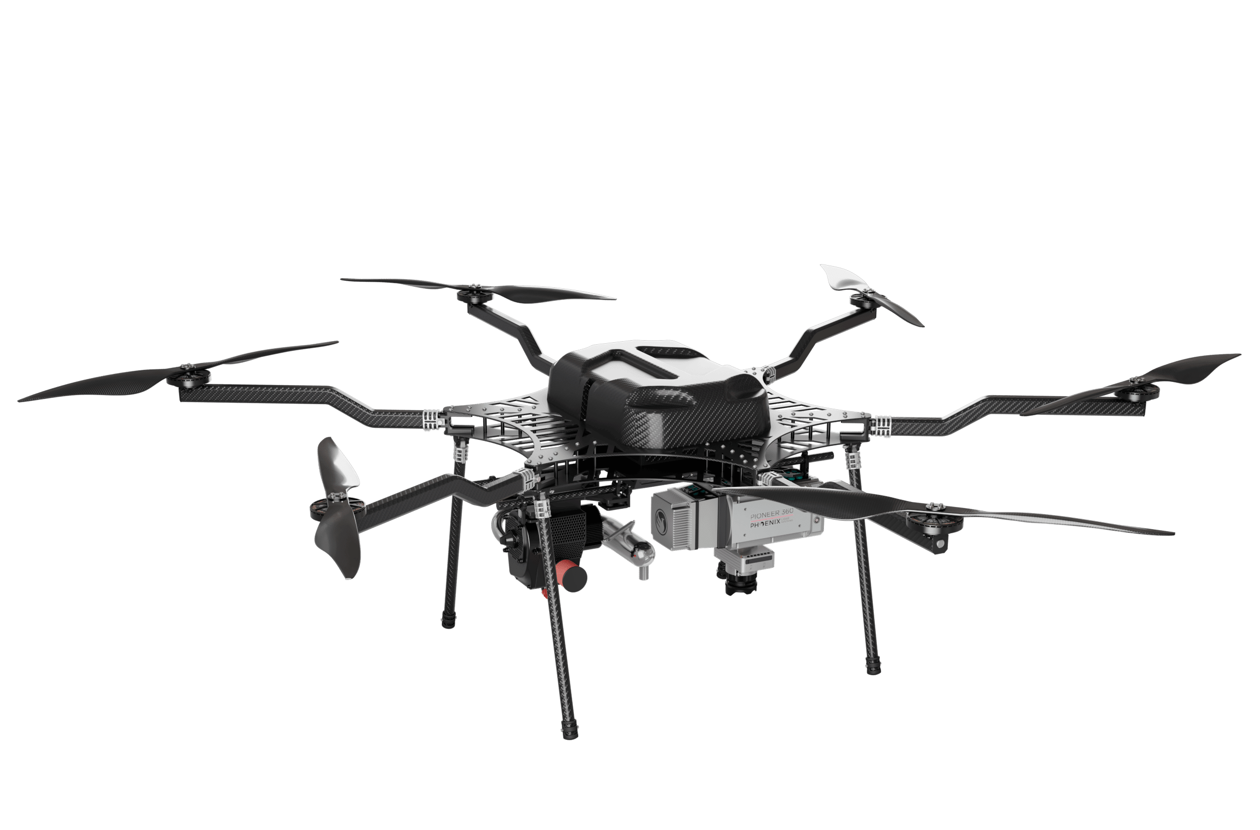
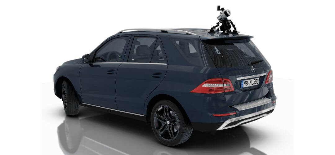
PIONEER-360 is Mobile Mapping Compatible!
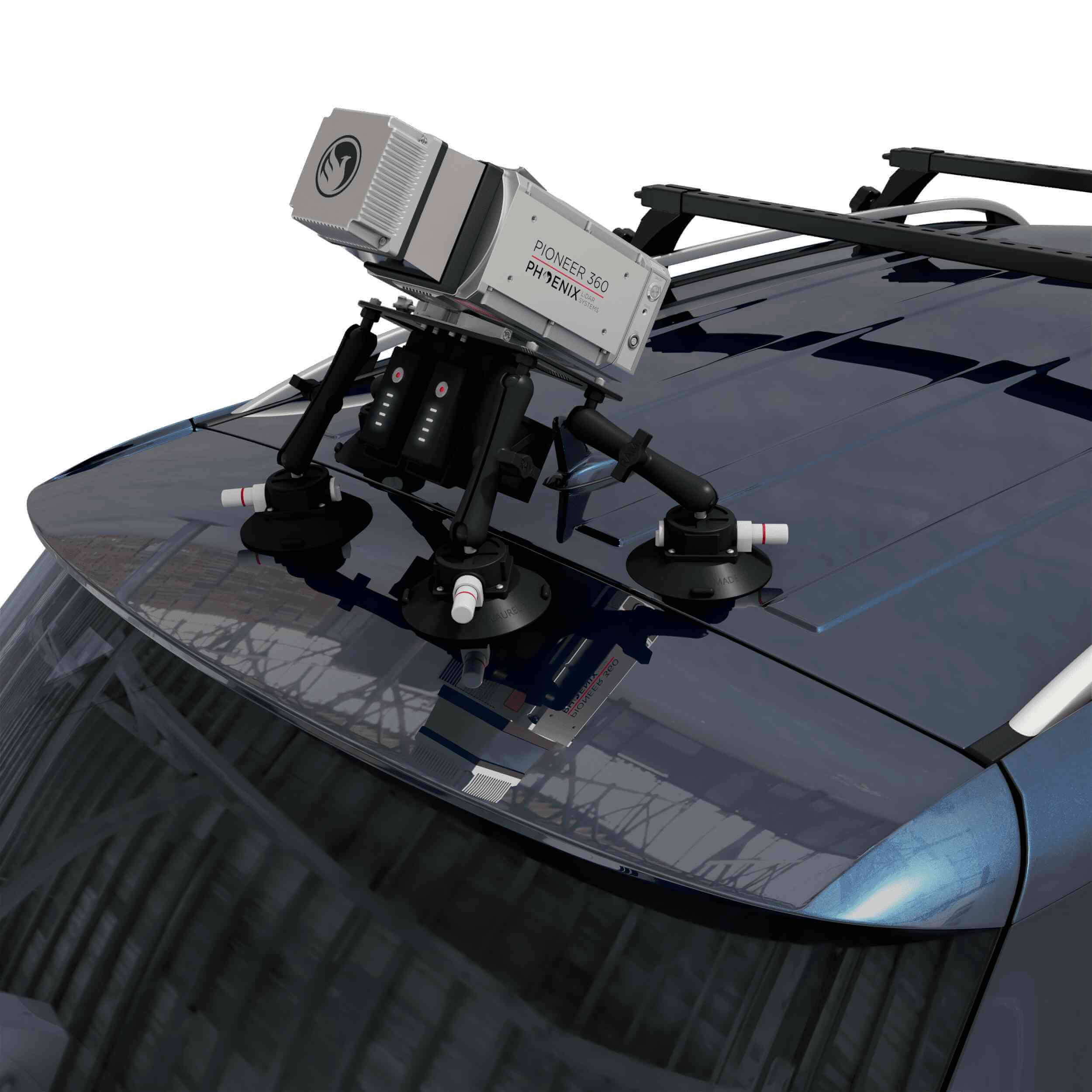
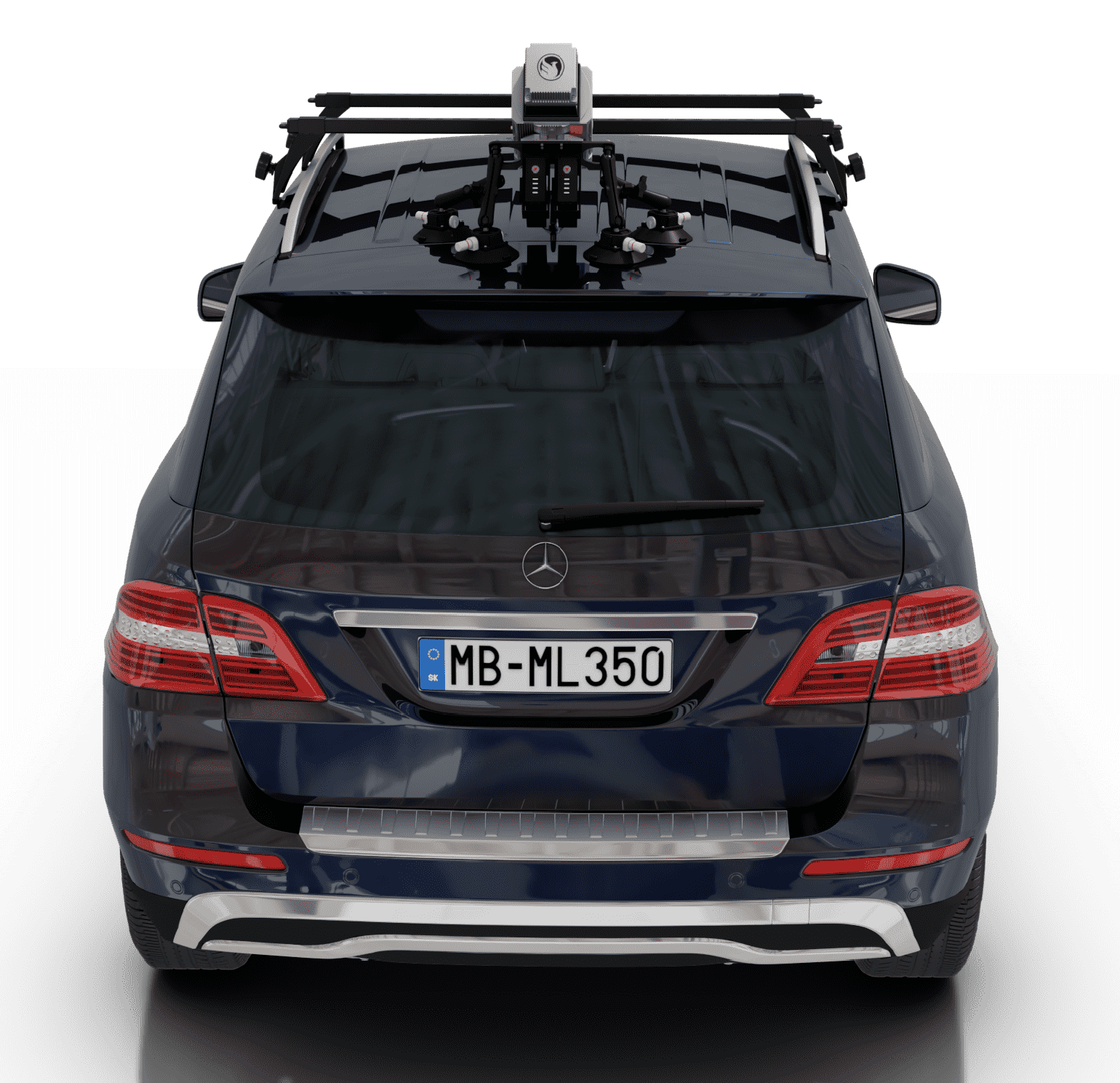
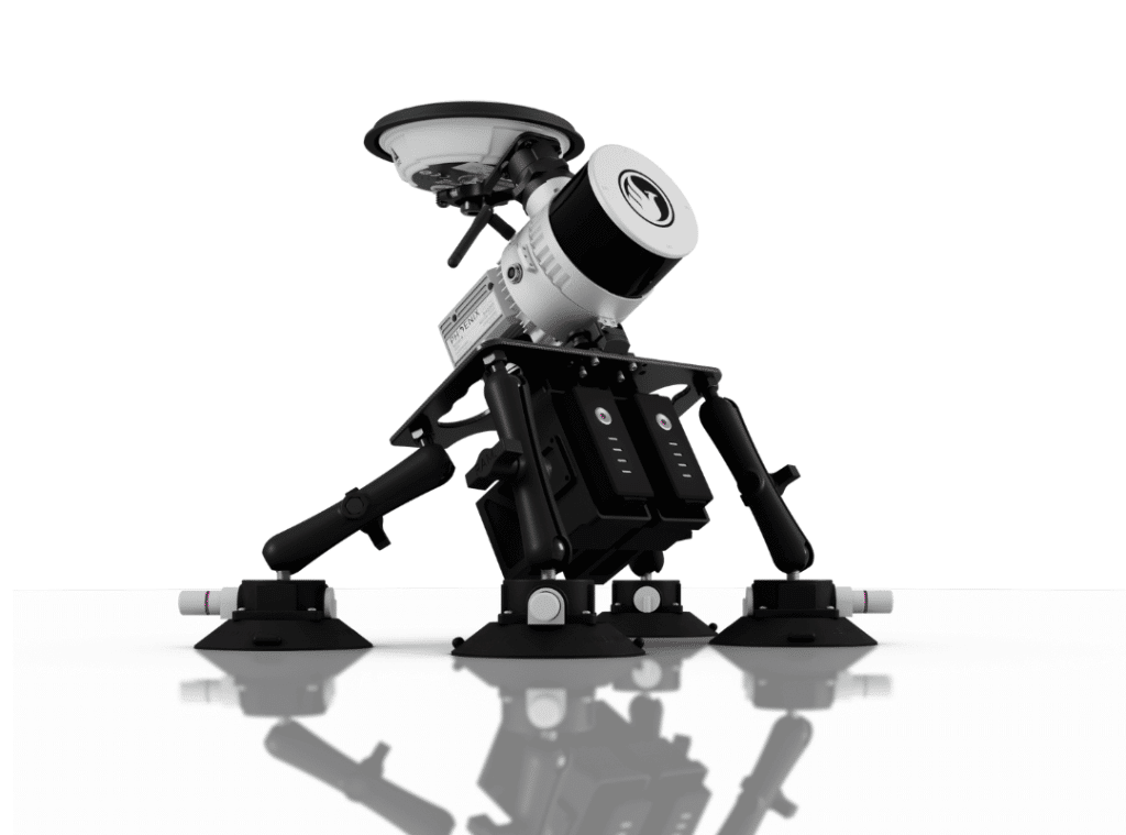
RECON-XT Now Mobile-Mapping Compatible with the Release of Our Universal Suction Mount!
Does your LiDAR system work seamlessly between UAV and mobile mapping-applications? The RECON-XT does. Why choose?
The RECON-XT is a breakthrough technology in complete LiDAR solutions. The system is capable of survey-grade accuracies, dense vegetation penetration, while retaining a minimalist, light-weight profile. While initially designed for seamless integration with the DJI M300 RTK airframe, Phoenix LiDAR Systems has made the RECON-XT compatible with a wide array of commercially available UAV.
Now, with the introduction of the Mobile Mapping Kit for RECON-XT, users can take their system from air to ground vehicle in a matter of minutes, giving operating teams the ability access to more data, more applications, and more versatility than ever before.
Request More Information
When coupled with Phoenix Software LiDARMill and Spatial Explorer software, users can take advantage of industry leading data processing functions that drive automated workflows, quality control, reporting, deliverables, and remote viewing capabilities to even the most novice of LiDAR users.
If you’re looking for an accurate, fast, lightweight, and versatile LiDAR system that is dependable and easy to use, the RECON-XT is one of the best choices available. We invite you to take a look at the sample data here, and contact our team for more information.
In this video, Kory Kellum from Phoenix LiDAR Systems discusses selecting the right tool for high altitude LiDAR mapping, focusing on the Ranger series. Phoenix LiDAR Systems offers the Ranger XL, Ultra, and Ranger LR, which excel in long-range capability, precision, accuracy, and point density. These systems are the lightest and highest performing on the market, capable of a 1.5 megahertz measurement rate, over a 750-meter range on 20% reflectance targets, and can produce up to 15 returns per pulse, meeting USGS quality level zero specifications.
Kory details the similarities of the Ranger systems, including their weight, performance, and compatibility with UAVs and crewed aircraft, before exploring their differences and specific use cases. The Ranger XL is ideal for high altitude mapping with a wide field of view and fast data acquisition, making it perfect for high point density corridor mapping such as power line, railway track, and pipeline inspection. It has the longest range in the Ranger lineup, suitable for high altitude projects with fixed-wing or rotorcraft.
The Ranger Ultra combines weight, range, accuracy, and pulse rate with a unique forward and rear-looking field of view to minimize laser shadowing. It features a three-faceted mirror for improved vertical surface mapping and is ideal for UAV-based high point density corridor mapping projects requiring precision and accuracy.
The Ranger LR is the most adaptable, designed for demanding mapping applications with a 360-degree field of view, making it compatible with mobile, UAV, and helicopter-based mapping. It can penetrate dense vegetation and offers unparalleled versatility.
Kory emphasizes that the Ranger series provides turnkey solutions for various mapping needs, whether for wide area, corridor, or adaptable mapping applications. He encourages viewers to like, subscribe, and contact the sales team to find the right tool for their specific needs.
Now more than ever, there is an urgent need for consistent bathymetric mapping in highly dynamic coastal shorelines. To fulfill this industry-wide need, Phoenix LiDAR Systems has decided to offer the ultimate high-resolution land/water interface mapping solution!
Near-shore topobathymetric digital elevation models are essential for navigation and ocean science and imperative for a wide range of applications; from studying the effects of climate change and generating hydrodynamic models to creating nautical charts and assisting in coral habitat conservation.
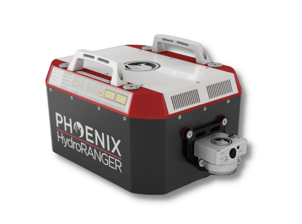
The Phoenix LiDAR HydroRANGER provides dual purpose topographic and bathymetric measurements for full scene mapping of shoreline systems. Utilizing a visible green spectrum laser with an elliptical scan pattern and measurement rates up to 200 kHz, the HydroRANGER provides a combination of high spatial resolution and spatial accuracy. Capable of reaching beyond 2 Secchi depths, this is the ideal solution for mapping land-water interface environments along rivers, reservoirs, oceans and more!
Watch the HydroRANGER in Action
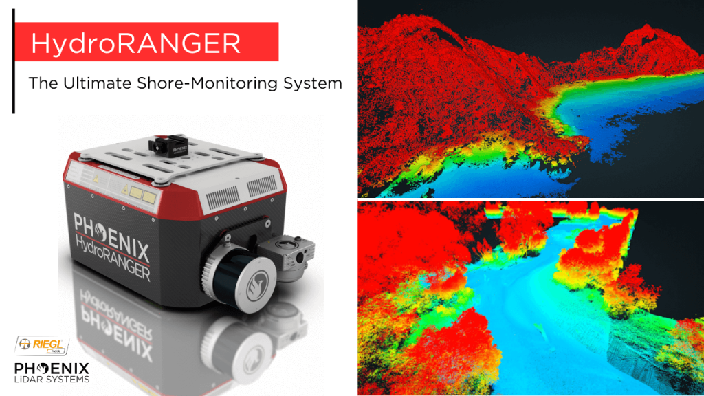
The Ultimate Shore Mapping LiDAR Solution – Phoenix LiDAR Systems’ HydroRANGER
The HydroRANGER is an evolution of mapping technology. This airborne topo-bathymetric (ATB) system provides dual purpose topographic and bathymetric measurements for full scene mapping of shoreline systems. Utilizing a visible green spectrum laser with an elliptical scan pattern and measurements rates up to 200 kHz, the HydroRANGER provides a combination of high spatial resolution and spatial accuracy. Capable of reaching beyond 2 Secchi depths, this is the ideal solution for mapping land-water interface environments, rivers, reservoirs, oceans, and more!
Join Kory Kellum, Senior Software Engineer at Phoenix LiDAR Systems, as he explores the advanced capabilities of Phoenix LiDAR’s mapping technology in their May 2022 webinar. Phoenix LiDAR specializes in compact, adaptable, survey-grade systems for various platforms like UAVs, cars, and backpacks, and offers robust post-processing software, including LiDARMill and SpatialExplorer Pro.
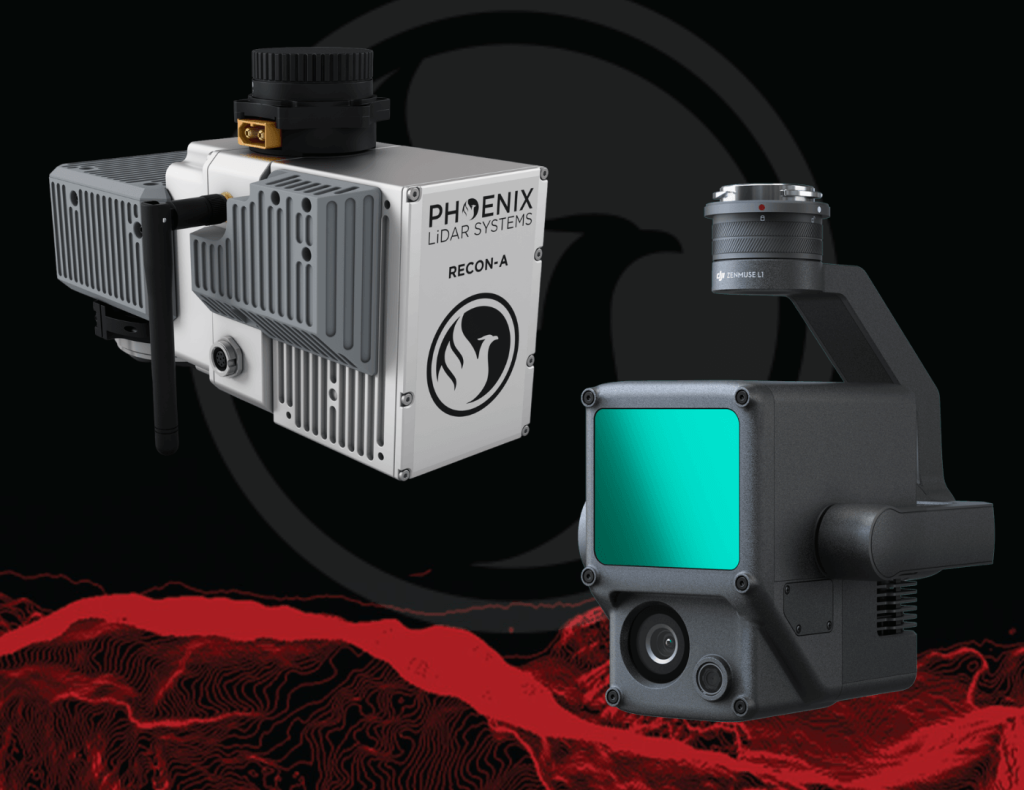
Phoenix LiDAR, based in Austin, Texas, contrasts with DJI’s recent entry into the LiDAR market. Phoenix offers comprehensive solutions, ensuring high-quality data acquisition and processing, supported by robust customer service. The Recon A system, with its superior APS-C camera sensor and vibration dampening kit, is compared to DJI’s Zenmuse L1, which is limited to the Matrice 300. The Recon A’s IMU is notably more accurate, reducing drift and improving data reliability.
Phoenix LiDAR’s LiDARMill offers advanced features like flight line splitting, ground control adjustments, AI classification, and detailed QC reports, which are not available in DJI’s Terra Pro. This comprehensive processing capability ensures high accuracy and quality in deliverable data products. A comparative analysis of data from DJI’s L1 and Phoenix LiDAR’s Recon A showcases significant differences in accuracy and precision. The Recon A system demonstrated superior performance, particularly in terms of reducing warping and improving overall data quality.
For those seeking accurate, high-quality LiDAR solutions, Phoenix LiDAR Systems provides a superior alternative with extensive support and advanced features.