
Resource Type
Industry
Product Group
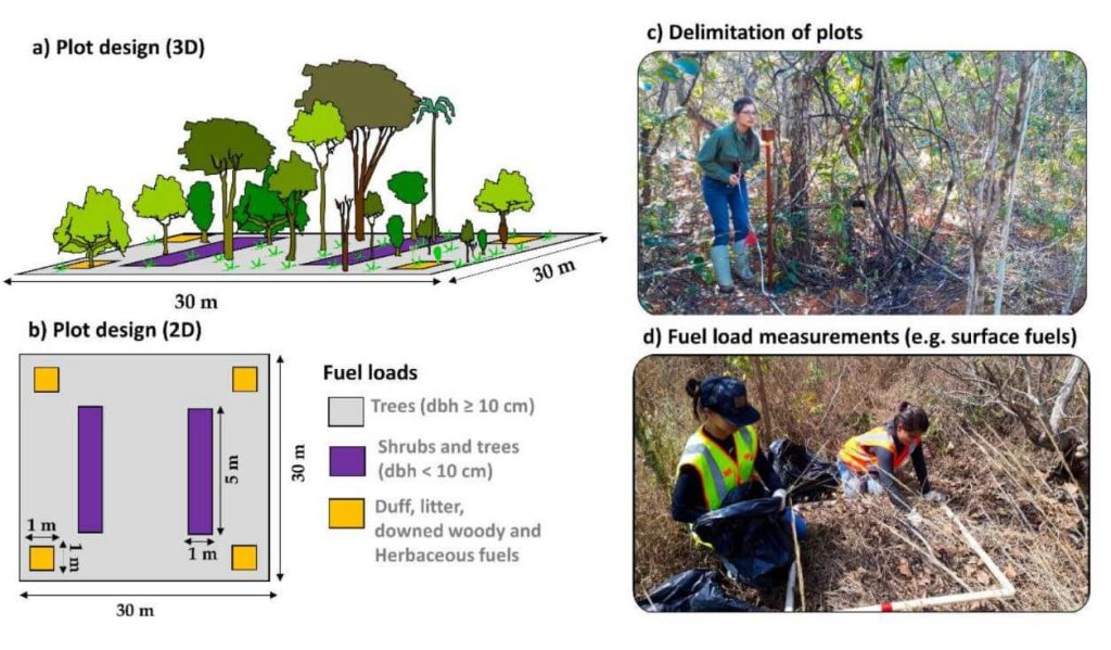
This whitepaper explores a groundbreaking framework for quantifying fuel load in fire-prone regions, focusing on the Brazilian tropical savanna (Cerrado biome), using NASA’s GEDI full-waveform spaceborne LiDAR sensor. Understanding fuel load is crucial for integrated fire management, preserving carbon stock, biodiversity, and ecosystem functioning, and assessing global climate regulation. Traditional remote sensing methods lack the capability to measure vertical vegetation structure accurately.
Our study leverages UAV-collected LiDAR data to simulate GEDI full-waveforms, from which we derive vegetation structure metrics. These metrics are then correlated with field-measured fuel load components using Random Forest models. The resulting models, which predict woody and total fuel loads with high accuracy (R² = 0.88 and 0.71, respectively), provide reliable estimates even for lower strata components.
This innovative approach allows for the creation of fuel load maps for the entire Cerrado and can be extended to other fire-prone regions, enhancing fire management and carbon monitoring efforts. This research showcases the potential of spaceborne LiDAR to revolutionize environmental management and climate initiatives in tropical savannas and beyond.
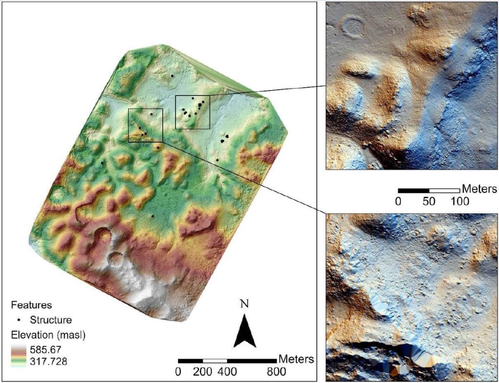
In recent years, airborne laser scanning has revolutionized the documentation of historic cultural landscapes, extending its applications from natural landscapes to built environments. The integration of unoccupied aerial vehicles (UAVs) with LiDAR systems is a transformative advancement, providing complementary data for precise mapping of targeted areas.
This whitepaper presents the findings from a 2019 study in the Maya Lowlands of Chiapas, Mexico, utilizing UAV LiDAR to capture and analyze data from six archaeologically significant areas. These areas, characterized by diverse environments, land cover, and archaeological features, were studied for their pre-Hispanic settlements and agrarian landscapes. The results confirm the immense potential of UAV LiDAR systems for high-precision archaeological mapping and underscore the importance of multidisciplinary collaboration.
The high-precision data acquired is invaluable for mapping archaeological features and understanding long-term land use and landscape changes in archaeological contexts.
Join Phoenix LiDAR Systems’ November 2021 webinar as we evaluate entry-level LiDAR systems for 2022, featuring the Recon A, Recon XT, and MiniRanger. Hosted by Conrad Conterno, this webinar offers an in-depth look at Phoenix’s custom mapping solutions, including hardware, support systems, processing software, and technical guidance.
Discover key attributes of LiDAR data quality such as precision, relative accuracy, and absolute accuracy, and see their impact on data evaluations. We compare data from three flights, showcasing each entry-level LiDAR system’s capabilities through visual and statistical analyses. Results reveal high-quality data from all three systems, each with unique precision levels and application suitability.
Explore factors influencing data quality, including laser intrinsic quality, pulse interaction with targets, and data processing workflows. Gain insights into vegetation penetration and utility infrastructure mapping, highlighting each scanner’s strengths.
The Q&A session addresses the advantages of different systems for applications like linear transmission line mapping and vegetation penetration. Learn why selecting the right LiDAR system depends on your specific use case, budget, and desired outcomes. Phoenix LiDAR Systems offers a range of sensors, providing unbiased recommendations tailored to your needs.
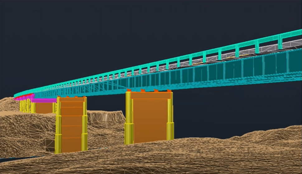
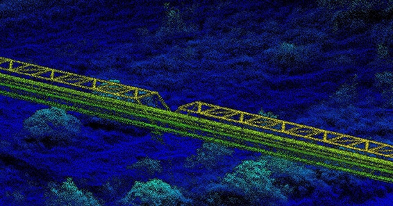
In the July 2021 Phoenix LiDAR Systems webinar, Senior Geomatics Engineer Kory Kellum discussed aerial surveys with high-performance LiDAR technology. Phoenix LiDAR Systems, based in Austin, Texas, specializes in custom UAV LiDAR solutions. The webinar highlighted the practical applications of UAV-based LiDAR in aerial surveying and engineering through insights from Pape-Dawson Engineers, Angela Livingston, and David Trotter. They shared their use of the Phoenix Ranger with the VUX1 UAV scanner, emphasizing benefits like high-resolution data, speed, vegetation penetration, and access to difficult sites.
The webinar covered workflows from site assessment to data processing, showcasing detailed and accurate point clouds for extracting data products like contours and infrastructure details. Examples included aerial survey mapping a railroad bridge and a riverbank. The Q&A session addressed flight planning, check shots under canopies, and data processing software.
Join the May 2021 Phoenix LiDAR Systems webinar, hosted by Senior GIS Engineer Ira Monkfold, as he dives into survey-grade calibration and accuracies from point cloud data. This insightful session focuses on the LiDAR Snap 4 calibration tool within the SpatialExplorer software. Learn about the essential requirements for achieving precise point cloud data and how Phoenix LiDAR Systems can help you create survey-grade data effortlessly.
Ira explains the critical importance of precise system calibration, covering accurate measurements of lever arms and the alignment of laser, GNSS, and IMU components. He highlights the necessity of mission-specific optimization to address in-flight anomalies, ensuring data accuracy. The integration of surveyed ground control points is emphasized as a vital step for achieving geospatial accuracy, with LiDAR Snap 4 providing comprehensive calibration and reporting tools.
LiDAR Snap 4 revolutionizes the calibration process by combining multiple steps into a single, user-friendly software interface, significantly reducing complexity and time. The software features advanced capabilities such as encoder calibrations and trajectory optimizations, offering users reliable survey-grade point cloud data. The webinar also includes a Q&A session, addressing software capabilities, processing times, and compatibility with various LiDAR systems and platforms.
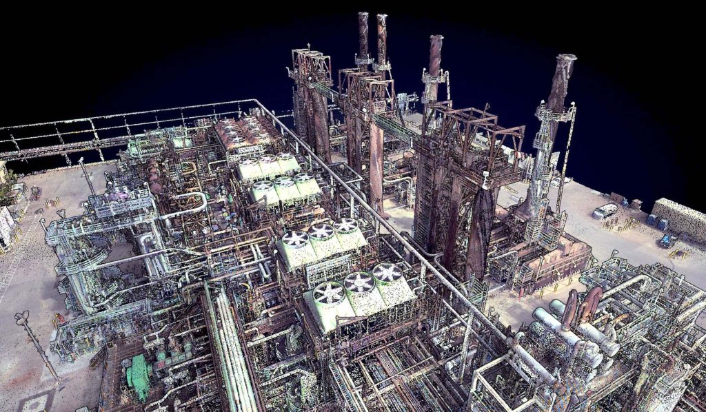
In this webinar, hosted by Kory Kellum of Phoenix LiDAR Systems, we explore the innovative use of LiDAR technology in oil and gas applications. Featuring insights from Ryan McMann and Andrew Healy of Measurement Sciences Inc. (MSI) and Scott McGowan of Precision Aerial Compliance Solutions, this session delves into the benefits of Phoenix’s survey-grade LiDAR mapping systems for UAVs and helicopters.
Learn how MSI transitioned from traditional land surveying to LiDAR, achieving efficient and detailed pipeline mapping and river-crossing surveys. Discover how Precision Aerial leverages LiDAR for refinery expansions, pipeline planning, and environmental assessments, significantly improving accuracy and efficiency. The discussion covers challenges in drone-based LiDAR surveys, data management strategies, and the integration of sonar and LiDAR for comprehensive results.
This video also explores potential applications in other industries, such as dam integrity and power line inspections. The webinar concludes with a Q&A session, addressing key questions about LiDAR technology’s capabilities and future developments. Don’t miss this insightful look at how LiDAR is revolutionizing the oil and gas industry.
In this Phoenix LiDAR Systems webinar, hosted by Conrad Conterno, discover the latest features and updates in their cloud processing software, LiDARMill, for early 2021. Phoenix LiDAR Systems specializes in comprehensive mapping solutions, covering the entire data collection and finalization process. Conrad introduces LiDARMill, a cloud-based automated data processing software designed to streamline workflows and maximize accuracy. This powerful tool handles navigation data, LiDAR data calibration, point cloud creation, and includes built-in QC tools along with an online data viewer.
The webinar highlights several new features in LiDARMill, including an overhauled coordinate reference system (CRS) wizard that ensures accuracy from the beginning, enhanced ground control point (GCP) handling which allows designation of points as control or check, and improved accuracy reporting based on these checkpoints. There is also a new option for generating tiled results, particularly useful for managing large projects, and comprehensive documentation to guide users. Additionally, the deployment of the new SpatialExplorer 6 core significantly enhances data quality and calibration precision.
A major upcoming feature is a machine learning-based automated classification pipeline, currently in beta testing and tailored for utility data sets. This AI classifier aims to save time and increase classification accuracy by automatically identifying various features in point cloud data.
Conrad demonstrates these features within the LiDARMill interface, highlighting the importance of setting the correct CRS and using the updated GCP configuration tool. He also showcases the new tiled data download option and the ease of accessing online documentation.
During the Q&A session led by Dr. Ben Adler, various topics are addressed, including support for third-party systems, mobile LiDAR processing, reference station-less processing, and manual classification. Ben discusses the handling of large data sets, the new AI classification pipeline, and the visualization of reference stations within the cloud viewer.
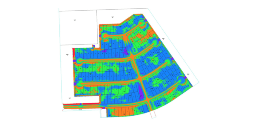
This is a panel discussion featuring two Surveying and Engineering Design service providers: EHRA and Wood Rodgers. We will discuss how they are leveraging Phoenix LiDAR’s systems to perform the heavy lifting in order to provide both the fastest data acquisition and best data deliverables to their clients. You won’t want to miss hearing their many compelling successes throughout their LiDAR-based Surveying and Engineering Design workflows.

Discover the innovative use of LiDAR technology in animal landscape ecology with Phoenix LiDAR Systems’ November 2020 webinar. This session delves into how remote sensing technologies, like LiDAR, are revolutionizing ecological research, particularly in understanding animal-landscape interactions. Hosted by Kory Kellum, a top GIS engineer at Phoenix LiDAR, the webinar features insights from Evan Hawkeridge, a PhD student from Harvard University’s Davies Lab.
Learn about the role of ecosystem engineers, such as elephants and termites, and how their behaviors influence ecosystems on a regional scale. The discussion covers advanced data collection methods using drones equipped with LiDAR and thermal sensors, challenges faced in field operations, and groundbreaking research projects in Kruger National Park and the Republic of Congo.
Tune in to explore how these technologies provide unprecedented detail and accuracy in ecological studies, offering new perspectives on animal behavior and landscape changes. Perfect for ecologists, researchers, and tech enthusiasts, this webinar showcases the future of ecological monitoring and analysis.