ResourceType
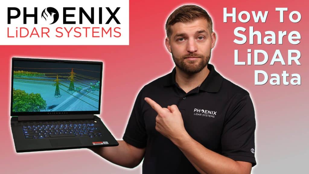
In this video, Kory Kellum from Phoenix LiDAR Systems addresses the challenges of sharing LiDAR data between service providers and end users. He introduces LiDARMill’s Cloud Viewer, a solution that simplifies the process of sharing detailed photorealistic 3D data. Traditional LiDAR data sharing methods can be cumbersome for end users who may lack the software and skills needed to view and navigate LiDAR data efficiently. Cloud Viewer eliminates these barriers by allowing users to share point clouds and geospatial data through a simple URL link, accessible on any device without the need for an account or login.
Kory explains how to use LiDARMill and Cloud Viewer to upload LAS or LAZ files, incorporate ground control points, mission trajectories, and more. Users can customize appearance parameters, create cross-sections, adjust data visualization, and even generate fly-throughs for presentations. The video emphasizes the ease of use and the powerful features of Cloud Viewer, making it an essential tool for surveyors, engineers, and other professionals who need to share LiDAR data effectively. Watch the video to learn how to streamline your LiDAR data sharing with Phoenix LiDAR’s Cloud Viewer and request a free 30-day trial to experience its benefits firsthand.
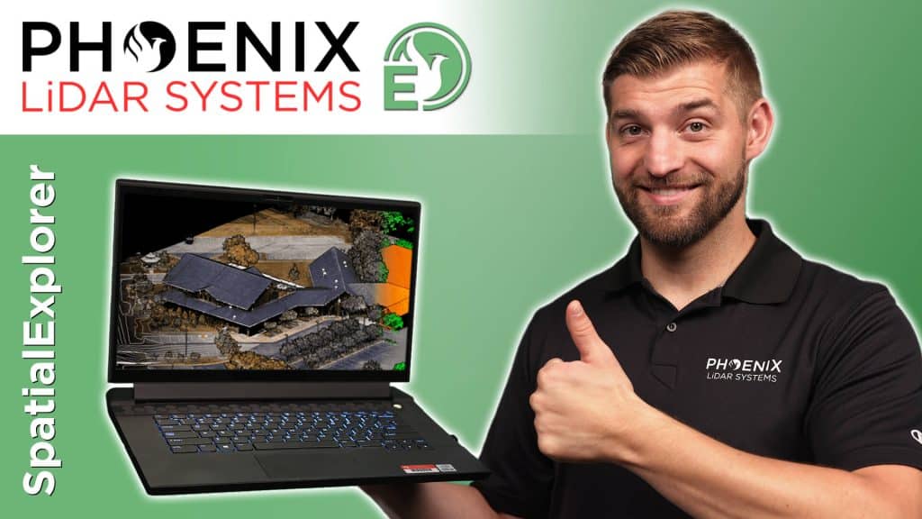
In this video, Kory Kellum from Phoenix LiDAR Systems introduces SpatialExplorer (SE) and its Pro plugin (SE Pro). SE is a powerful desktop software that simplifies LiDAR and image processing. SE Pro includes tools for trajectory processing, LiDAR and camera calibrations, point cloud classification, and generating raster and vector products.
He explains how SpatialExplorer Pro streamlines workflows from selecting a coordinate reference system to post-processing trajectories with NavLab tools. The software allows for precise point cloud creation and refinement, utilizing features like LiDAR Snap for accuracy. It also offers advanced point cloud colorization and classification tools.
SE Pro generates detailed reports and deliverables, saving time for service providers and providing transparency for end users. Additional tools include change detection and application-specific exports. Watch to learn how SE Pro can enhance your LiDAR projects and request a free trial from Phoenix LiDAR Systems.
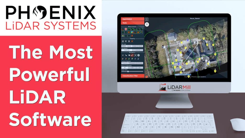
In this video, Kory Kellum from Phoenix LiDAR Systems introduces LiDARMill, a revolutionary cloud-based LiDAR processing software designed to save time and money. LiDARMill automates the entire post-processing workflow, including trajectory post-processing, point cloud classification, colorization, QA/QC reporting, and more.
This video highlights the key benefits of LiDARMill: it is easy to use with an intuitive interface, minimizes hardware and time investment, delivers powerful and accurate results, and simplifies data sharing. The software enables users to visualize, analyze, and share LiDAR data effortlessly through the Cloud Viewer, which can be accessed from any device without needing specialized software.
LiDARMill’s automation capabilities and user-friendly features make it ideal for service providers looking to streamline their workflows and deliver high-quality LiDAR data. Watch the video to learn more about how LiDARMill can enhance your LiDAR processing projects and request a free 30-day trial to experience its benefits firsthand.

In this video, Kory Kellum from Phoenix LiDAR Systems introduces the Ranger-LR, his personal favorite and the most adaptable LiDAR system available. Known as the “universal soldier” of LiDAR mapping systems, the Ranger LR can be used on UAVs, helicopters, and mobile vehicles, offering unmatched versatility for both aerial and ground applications.
The Ranger-LR features the Riegl VUX-1LR22 LiDAR sensor with five-millimeter precision at a 150-meter range and a powerful 1550-nanometer laser that penetrates dense vegetation. It has a maximum range of 1000 meters on 20% reflectance targets and can achieve up to 15 target returns per laser pulse for enhanced vegetation mapping. It collects over 190 points per square meter at 400 feet above ground level from a UAV and over 30 points per square meter at 550 feet from a helicopter.
Ideal for corridor mapping, topography, urban surveying, archaeology, agriculture, and rapid response applications, the Ranger-LR is designed for those seeking a highly adaptable and precise LiDAR system.
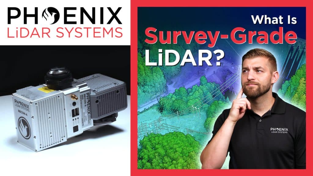
In this video, Kory Kellum from Phoenix LiDAR Systems explains the meaning behind the term “survey grade LiDAR” and explores different grades of LiDAR with their benefits and drawbacks. Corey delves into the history and context of survey grade accuracy, highlighting how modern tools achieve precise measurements. He defines survey grade accuracy, typically around 10 centimeters or better, and discusses the American Society for Photogrammetry and Remote Sensing’s positional accuracy standards.
The video covers various accuracy classes of LiDAR, from one centimeter to over three meters, and explains their applications. It emphasizes the importance of choosing the right LiDAR system for specific needs, whether it’s high accuracy drone-based surveys or large-scale mapping projects. Phoenix LiDAR Systems offers a range of solutions that meet these varying requirements, ensuring precise and reliable results.
In this video, Kory Kellum from Phoenix LiDAR Systems walks you through the five essential steps to process LiDAR data after collection. Starting with raw data, he explains how to transform it into an optimized, colorized, and classified point cloud.
The steps include: post-processing the trajectory to correct flight path errors, generating a point cloud by fusing LiDAR measurements with the optimized trajectory, refining the point cloud’s accuracy with the LiDAR Snap tool, colorizing the point cloud with RGB values from the system’s camera, and classifying the point cloud to extract and segment features like ground, vegetation, and buildings.
This video also demonstrates how these steps are performed using Phoenix LiDAR’s SpatialExplorer software, highlighting the improvements at each stage. By following these steps, you can create accurate 3D models and data derivatives such as digital elevation models, contour maps, and vegetation analysis.
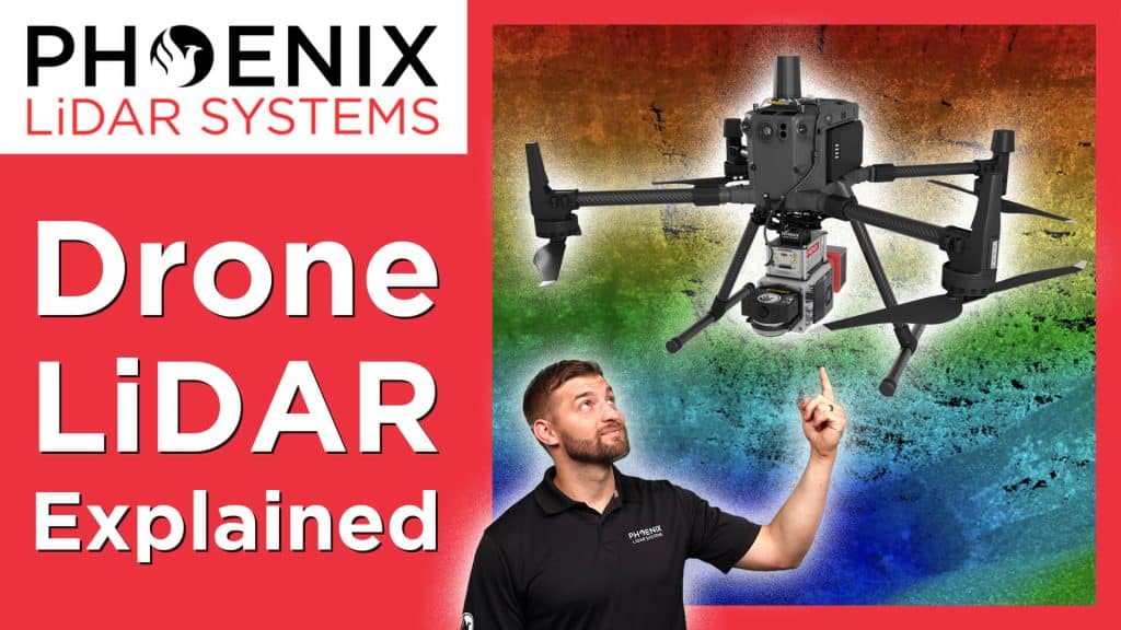
In this video, Kory Kellum from Phoenix LiDAR Systems explains the technology required to produce high-accuracy drone-based LiDAR data. Corey delves into the hardware components necessary for LiDAR acquisition, including the GNSS antenna and receiver for positioning, the IMU for orientation, the LiDAR sensor for measuring angles and distances, a CPU for real-time calculations, and an SSD for data storage.
The video demonstrates how these components work together to generate accurate 3D point clouds and offers tips for optimizing data accuracy, such as using a GNSS reference station and performing boresight alignment calibration. Understanding these technologies and best practices ensures the highest quality drone-based LiDAR data for various applications.
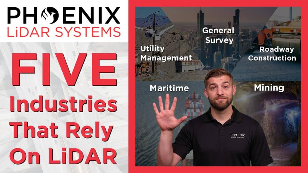
In this video, Kory Kellum from Phoenix LiDAR Systems explains how LiDAR technology impacts five critical industries and enhances everyday life. He explores LiDAR applications in surveying, utility management, roadway construction, mining, and maritime operations.
In surveying, LiDAR is used to map topography for floodplain analysis, property surveys, and land development, offering increased accuracy and safety. Utility management benefits from LiDAR by monitoring vegetation encroachment on power lines and assessing damage to pipelines, railways, and waterways, ensuring timely maintenance and safety. In roadway construction, LiDAR helps with planning, as-built mapping, and maintenance assessments, reducing project time and enhancing road safety.
The mining industry uses LiDAR for accurate volume measurements and safe monitoring of mining operations, while maritime applications rely on bathymetric LiDAR for underwater mapping, ensuring safe boat passage and efficient shipping of goods.
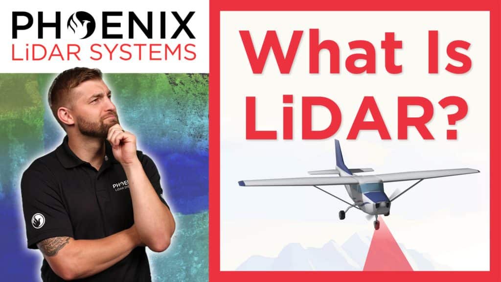
In this video, Kory Kellum from Phoenix LiDAR Systems introduces the fundamentals of LiDAR technology. You’ll learn about the purpose of LiDAR, its applications, how it works, and its components. LiDAR, which stands for Light Detection and Ranging, is a remote sensing tool used to measure 3D features quickly and accurately. It’s widely used in vegetation mapping, utility management, roadway construction, mining, and bathymetric mapping.
The video explains how LiDAR emits laser pulses to measure distances, with the system recording the time it takes for the light to return. This data, combined with positioning and orientation information from GPS and IMU sensors, creates a detailed 3D point cloud. Multiple returns from a single pulse allow LiDAR to capture data through vegetation and other obstacles.
This video also highlights practical uses of LiDAR data, such as estimating tree height, measuring power line sag, and detecting changes in topography.
Interested in learning more about how LiDAR works? Read our more in depth article on LiDAR fundamentals.