Customize Consent Preferences

We use cookies to help you navigate efficiently and perform certain functions. You will find detailed information about all cookies under each consent category below.

The cookies that are categorized as "Necessary" are stored on your browser as they are essential for enabling the basic functionalities of the site. ... 

Always Active

Necessary cookies are required to enable the basic features of this site, such as providing secure log-in or adjusting your consent preferences. These cookies do not store any personally identifiable data.

No cookies to display.

Functional cookies help perform certain functionalities like sharing the content of the website on social media platforms, collecting feedback, and other third-party features.

No cookies to display.

Analytical cookies are used to understand how visitors interact with the website. These cookies help provide information on metrics such as the number of visitors, bounce rate, traffic source, etc.

No cookies to display.

Performance cookies are used to understand and analyze the key performance indexes of the website which helps in delivering a better user experience for the visitors.

No cookies to display.

Advertisement cookies are used to provide visitors with customized advertisements based on the pages you visited previously and to analyze the effectiveness of the ad campaigns.

No cookies to display.

Log In
Login to Phoenix LiDar System
M300 Mountable LiDAR systems

The Best DJI M300 UAV LiDAR Solutions – RECON-XT & MiniRANGER-3

Reading time: 1 minutes
Date: September 5, 2022

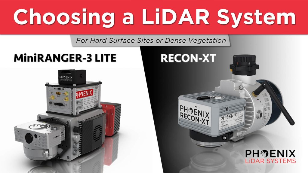
In this video, Kory Kellum from Phoenix LiDAR Systems guides viewers on choosing the right DJI M300 mountable LiDAR solution. He compares the Phoenix Recon XT and the MiniRanger 3, both of which are high-performance, survey-grade systems adaptable for UAV and mobile mapping applications. He also highlights the intrinsic differences between a higher-powered single laser system and a lower-powered multi-laser system to help users understand their specific use cases.

The video showcases real-world applications of these systems. It includes a detailed look at a project site where Scott McGowan from Kestrel Aerial uses the MiniRanger 3 Lite and the Recon XT. The MiniRanger 3 Lite, known for its precision and adaptability, excels in high-density point collection and meets USGS quality level 0 specifications. The Recon XT, valued for its performance in dense vegetation and its wide vertical field of view, is ideal for environments with heavy foliage.

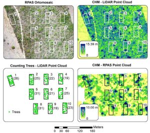
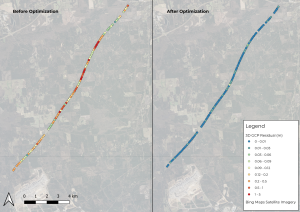
Throughout the video, viewers see practical demonstrations of each system’s capabilities, including data visualization and analysis. The video concludes with a recap, emphasizing the importance of selecting the appropriate LiDAR system for specific project requirements, whether for land development, utility infrastructure, or vegetation mapping.

Fill Out the Form to Download the Resource

Related Posts