
Industry
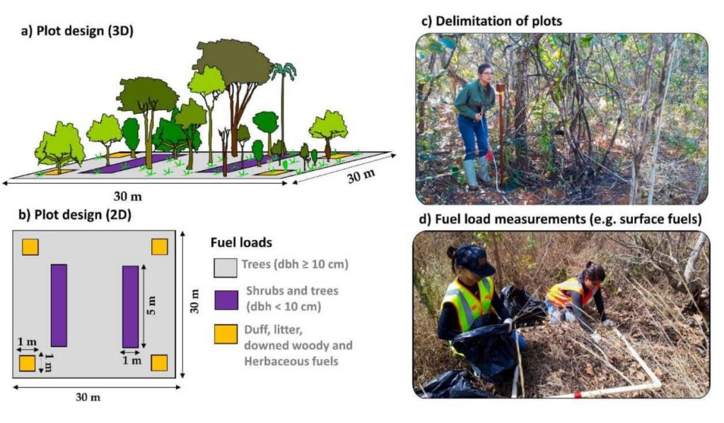
This whitepaper explores a groundbreaking framework for quantifying fuel load in fire-prone regions, focusing on the Brazilian tropical savanna (Cerrado biome), using NASA’s GEDI full-waveform spaceborne LiDAR sensor. Understanding fuel load is crucial for integrated fire management, preserving carbon stock, biodiversity, and ecosystem functioning, and assessing global climate regulation. Traditional remote sensing methods lack the capability to measure vertical vegetation structure accurately.
Our study leverages UAV-collected LiDAR data to simulate GEDI full-waveforms, from which we derive vegetation structure metrics. These metrics are then correlated with field-measured fuel load components using Random Forest models. The resulting models, which predict woody and total fuel loads with high accuracy (R² = 0.88 and 0.71, respectively), provide reliable estimates even for lower strata components.
This innovative approach allows for the creation of fuel load maps for the entire Cerrado and can be extended to other fire-prone regions, enhancing fire management and carbon monitoring efforts. This research showcases the potential of spaceborne LiDAR to revolutionize environmental management and climate initiatives in tropical savannas and beyond.
In recent years, airborne laser scanning has revolutionized the documentation of historic cultural landscapes, extending its applications from natural landscapes to built environments. The integration of unoccupied aerial vehicles (UAVs) with LiDAR systems is a transformative advancement, providing complementary data for precise mapping of targeted areas.
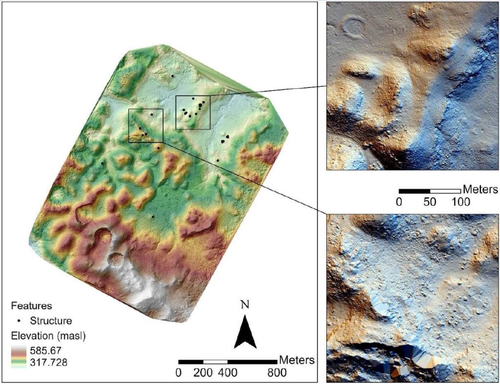
This whitepaper presents the findings from a 2019 study in the Maya Lowlands of Chiapas, Mexico, utilizing UAV LiDAR to capture and analyze data from six archaeologically significant areas. These areas, characterized by diverse environments, land cover, and archaeological features, were studied for their pre-Hispanic settlements and agrarian landscapes. The results confirm the immense potential of UAV LiDAR systems for high-precision archaeological mapping and underscore the importance of multidisciplinary collaboration.
The high-precision data acquired is invaluable for mapping archaeological features and understanding long-term land use and landscape changes in archaeological contexts.
In the July 2021 Phoenix LiDAR Systems webinar, Senior Geomatics Engineer Kory Kellum discussed aerial surveys with high-performance LiDAR technology. Phoenix LiDAR Systems, based in Austin, Texas, specializes in custom UAV LiDAR solutions. The webinar highlighted the practical applications of UAV-based LiDAR in aerial surveying and engineering through insights from Pape-Dawson Engineers, Angela Livingston, and David Trotter. They shared their use of the Phoenix Ranger with the VUX1 UAV scanner, emphasizing benefits like high-resolution data, speed, vegetation penetration, and access to difficult sites.
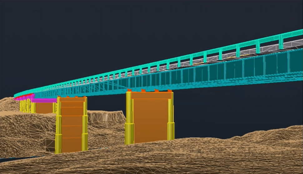
The webinar covered workflows from site assessment to data processing, showcasing detailed and accurate point clouds for extracting data products like contours and infrastructure details. Examples included aerial survey mapping a railroad bridge and a riverbank. The Q&A session addressed flight planning, check shots under canopies, and data processing software.
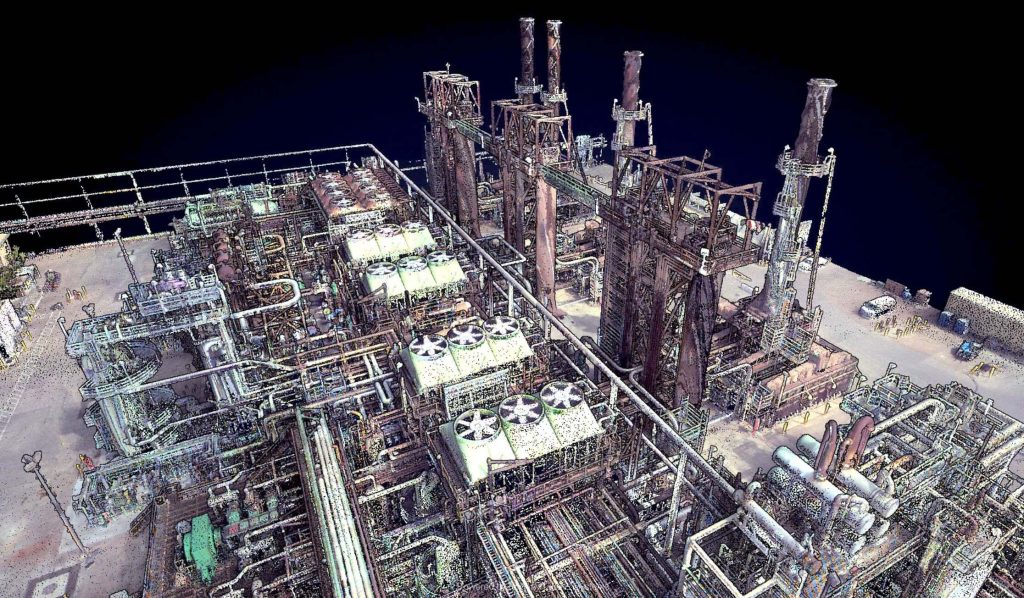
In this webinar, hosted by Kory Kellum of Phoenix LiDAR Systems, we explore the innovative use of LiDAR technology in oil and gas applications. Featuring insights from Ryan McMann and Andrew Healy of Measurement Sciences Inc. (MSI) and Scott McGowan of Precision Aerial Compliance Solutions, this session delves into the benefits of Phoenix’s survey-grade LiDAR mapping systems for UAVs and helicopters.
Learn how MSI transitioned from traditional land surveying to LiDAR, achieving efficient and detailed pipeline mapping and river-crossing surveys. Discover how Precision Aerial leverages LiDAR for refinery expansions, pipeline planning, and environmental assessments, significantly improving accuracy and efficiency. The discussion covers challenges in drone-based LiDAR surveys, data management strategies, and the integration of sonar and LiDAR for comprehensive results.
This video also explores potential applications in other industries, such as dam integrity and power line inspections. The webinar concludes with a Q&A session, addressing key questions about LiDAR technology’s capabilities and future developments. Don’t miss this insightful look at how LiDAR is revolutionizing the oil and gas industry.
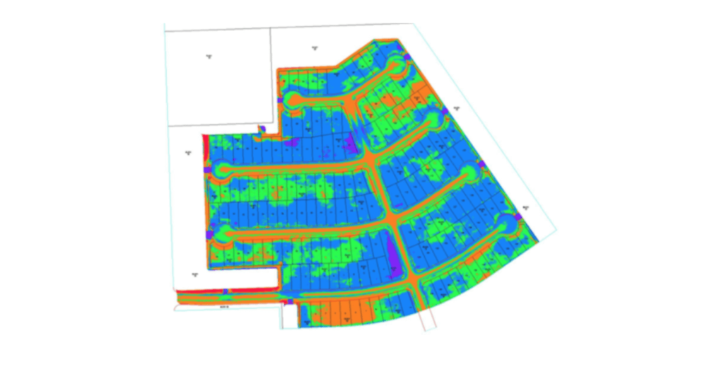
This is a panel discussion featuring two Surveying and Engineering Design service providers: EHRA and Wood Rodgers. We will discuss how they are leveraging Phoenix LiDAR’s systems to perform the heavy lifting in order to provide both the fastest data acquisition and best data deliverables to their clients. You won’t want to miss hearing their many compelling successes throughout their LiDAR-based Surveying and Engineering Design workflows.

Discover the innovative use of LiDAR technology in animal landscape ecology with Phoenix LiDAR Systems’ November 2020 webinar. This session delves into how remote sensing technologies, like LiDAR, are revolutionizing ecological research, particularly in understanding animal-landscape interactions. Hosted by Kory Kellum, a top GIS engineer at Phoenix LiDAR, the webinar features insights from Evan Hawkeridge, a PhD student from Harvard University’s Davies Lab.
Learn about the role of ecosystem engineers, such as elephants and termites, and how their behaviors influence ecosystems on a regional scale. The discussion covers advanced data collection methods using drones equipped with LiDAR and thermal sensors, challenges faced in field operations, and groundbreaking research projects in Kruger National Park and the Republic of Congo.
Tune in to explore how these technologies provide unprecedented detail and accuracy in ecological studies, offering new perspectives on animal behavior and landscape changes. Perfect for ecologists, researchers, and tech enthusiasts, this webinar showcases the future of ecological monitoring and analysis.
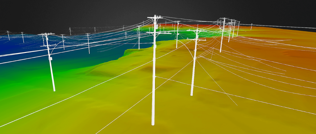
Join Iram Unfold from Phoenix LiDAR Systems as he delves into the transformative power of LiDAR and UAV technology for power line surveys. This comprehensive webinar covers every aspect of a survey project, from initial client interactions and RFP responses to precise data acquisition, post-processing, and final deliverables.
Discover how Phoenix LiDAR Systems’ compact, customizable LiDAR mapping systems, known for their high accuracy and 3D imaging capabilities, can revolutionize utility industry applications. Learn through a fictional case study about “Stuart’s Utility Company” and explore key considerations for sensor specifications, mission planning, and the integration of weather station data for accurate wire loading models.
Iram emphasizes the importance of accurate data acquisition, effective post-processing, and the generation of actionable insights. The session also includes a Q&A segment addressing ground control points, trajectory matching, and sensor recommendations.
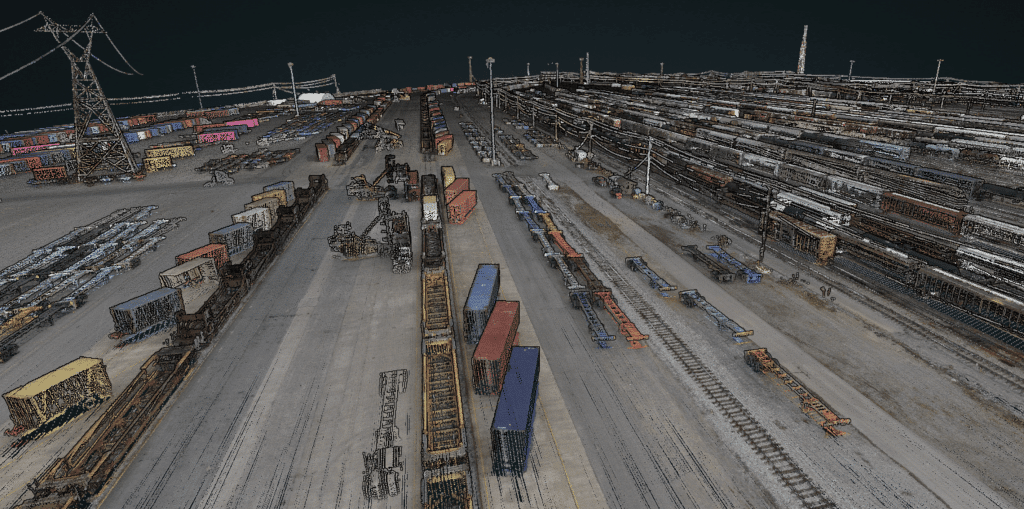
Join Kory Kellum in this insightful Phoenix Lidar Systems webinar featuring experts from CSX and American Rail Engineers (ARE) as they discuss the transformative use of mobile and UAV-based LiDAR in rail applications. Phoenix LiDAR Systems, a leader in commercial UAV LiDAR technology, offers custom LiDAR mapping systems for various platforms. This webinar explores how CSX and ARE leverage these advanced systems for asset inventory, change management, vegetation management, hydrology mapping, and more.
CSX representatives Steve Carmody and Tony Boise share their journey from manual data collection to utilizing mobile LiDAR units (Scout 16s) and permanently installed units (HDL 32s), significantly enhancing efficiency and safety. They also discuss plans to expand their capabilities with aerial LiDAR for complex environments like railroad yards.
ARE experts Steven Ushak, Taylor Engel, and Sam Johnson highlight their successful use of the Mini Ranger system for projects such as coastal resilience studies and PTC vegetation cutback planning. They emphasize LiDAR’s ability to penetrate vegetation and collect data in challenging conditions, including nighttime operations, and discuss future upgrades to larger systems for broader coverage and higher resolution.
The webinar underscores the critical improvements LiDAR technology brings to the rail industry, showcasing various applications and the potential for further advancements with aerial LiDAR and beyond visual line of sight operations. Concluding with a Q&A session, the discussion addresses data accuracy, field-to-office workflows, and operational challenges in diverse environments.
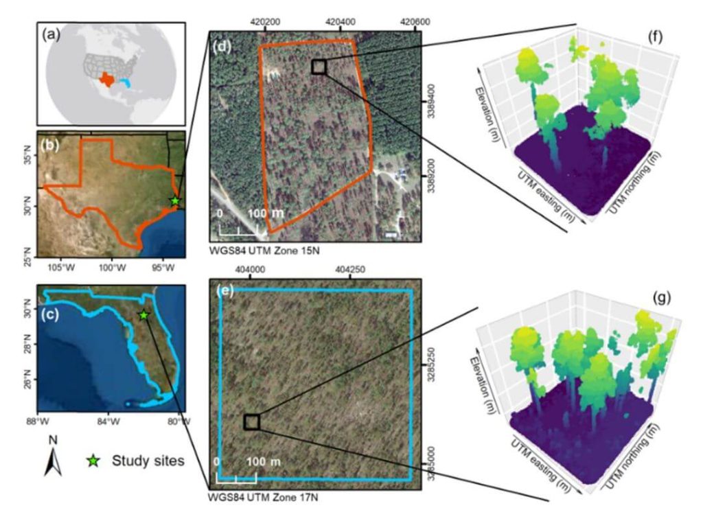
The proliferation of unmanned aerial vehicles (UAVs) over the past decade has been driven by advancements in structure-from-motion (SfM), machine learning, and robotics. A crucial application in forestry is individual tree detection (ITD), essential for calculating forest attributes like stem volume, forest uniformity, and biomass estimation.
This whitepaper addresses the challenges users face in adopting UAVs and algorithms for specific projects by providing a detailed tutorial for performing ITD. It covers the use of low-cost UAV-derived imagery and UAV-based high-density LiDAR, utilizing open-source R packages to develop a canopy height model (CHM) and implement the local maxima (LM) algorithm for ITD.
Accuracy assessments are derived through manual visual interpretation and field-data validation. Targeted at beginners in remote sensing, this guide employs a simple methodology and uses study plots with relatively open canopies. Supplementary materials include R codes and sample plot data to facilitate practical application.