Industry

Explore the transformative impact of Drone LiDAR technology in revolutionizing transportation infrastructure and environmental restoration. This video delves into how high-precision LiDAR mapping is becoming essential in transportation projects, enhancing accuracy in capturing topography and uncovering hidden utilities for better planning and execution.
Featuring real-world applications from industry leaders like David Evans and Associates, and hydrological projects led by Evan Radford, the video highlights the wide-ranging benefits of this technology.
Discover how Drone LiDAR reduces workload, improves safety for field crews through aerial scanning with drones and helicopters, and accelerates data collection. We also discuss the integration of aerial scanning with ground surveying to ensure unparalleled data accuracy and detail, crucial for comprehensive project success.
Additionally, we examine the role of advanced LiDAR software tools, like strip matching, in ensuring data quality and precision. This exploration is designed to equip professionals across industries with insights into the capabilities and advantages of Drone LiDAR technology in transforming transportation planning and environmental efforts.
Unlocking the Power of Drone LiDAR: Transforming Transportation Projects. The world of transportation infrastructure is undergoing a profound transformation, and at the heart of this revolution is Drone LiDAR technology. This groundbreaking innovation is fundamentally reshaping the way we approach transportation projects, providing unparalleled precision and accuracy in high-precision mapping. In our comprehensive exploration, we delve into the captivating realm of Drone LiDAR. We start by unraveling the core concepts, introducing you to the technology’s essence, and highlighting why it’s becoming an indispensable tool in various industries.
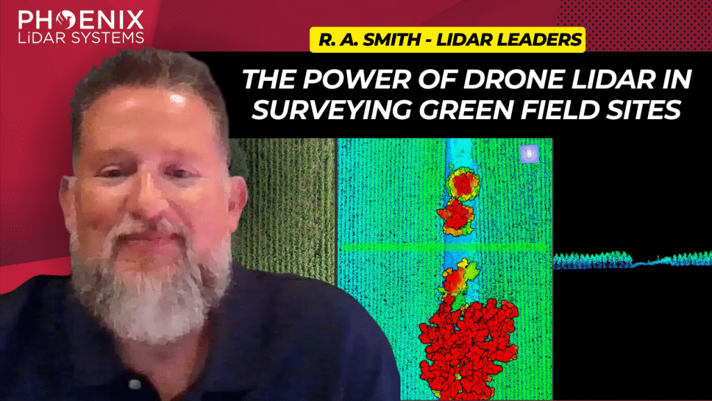
This video delves into the transformative impact of the Phoenix MiniRanger 3 on raSmith’s aerial survey operations, a leading name in civil engineering and surveying based in Brookfield, Wisconsin.
Adopted to enhance the efficiency of surveying expansive greenfield sites, the MiniRanger 3 overcomes challenges posed by dense vegetation like corn, soybeans, and alfalfa, using advanced LiDAR technology.
This state-of-the-art aerial LiDAR system stands out for its high vertical accuracy, robust point density, and reliable GPS integration, making it ideal for detailed and obstructed terrains.
RaSmith’s integration of the Phoenix MiniRanger 3 has not only streamlined their aerial survey workflow but also allowed them to tackle labor shortages, diversify into corridor work, and expand scanning services for public utilities.
Backed by Phoenix’s exceptional technical support, this adoption highlights a significant shift towards more resource-efficient and precise surveying methods. The video underscores the system’s role in pushing the boundaries of civil engineering and surveying, paving the way for future advancements in LiDAR technology.

The Centralia Coal Mine in Centralia, WA, ceased operations in 2006 and is now undergoing an extensive reclamation process. A portion of the 9,800-acre site has been repurposed by Seattle’s First Mode as a proving ground for the world’s largest hydrogen-powered mine haul truck. Utilizing the Phoenix LiDAR RECON-XT, First Mode is conducting detailed 3D surveys to build and test a 10% grade haul road, essential for the truck’s performance. This innovative use of reclaimed land exemplifies how former industrial sites can be transformed into high-tech testing grounds, highlighting the synergy between environmental restoration and cutting-edge technology.
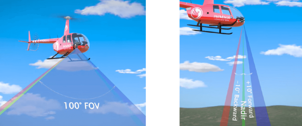
Discover the comprehensive guide to selecting the right LiDAR system with our detailed LiDAR Selection Guide. This article covers everything from the basics of LiDAR technology to in-depth comparisons of current scanners. Learn about the technical specifications, platform configurations, and software considerations essential for optimizing your LiDAR mapping projects.
Whether you are in forestry, construction, or surveying, our guide provides the insights needed to choose the best LiDAR solution for your needs. Read on to understand the advantages of UAV LiDAR, the components that make up a LiDAR system, and how to achieve high precision and accuracy in your mapping endeavors.
Phoenix LiDAR System offers survey-grade LiDAR systems for a variety of industries and applications.
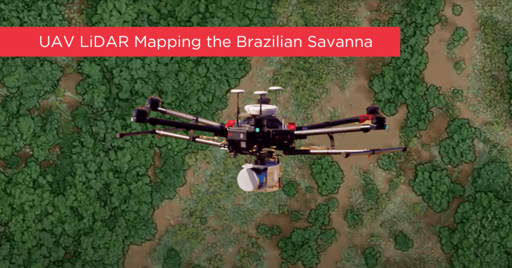
Tropical savanna ecosystems play a critical role in the global carbon cycle, but their ability to store and sequester carbon is uncertain due to the combined effects of anthropogenic activities and climate change. This study explores the potential of UAV LiDAR technology for accurate 3-D mapping of aboveground biomass (AGB) in the Brazilian Savanna (Cerrado).
By assessing five regression models using field sample plots, the research identifies the most effective model for estimating AGB across forest, savanna, and grassland formations. Results indicate that UAV LiDAR can significantly enhance biomass estimation, with notable accuracy across different vegetation types, although further development is needed for grassland biomass estimation.
These findings provide essential data for carbon emission mitigation strategies and support integrated fire management in tropical savanna ecosystems.

This whitepaper delves into the innovative use of high-density LiDAR data and Quantitative Structure Modelling (QSM) to estimate individual tree attributes, traditionally predicted by field-derived allometric models. Leveraging LiDAR data collected by Unmanned Aerial Vehicles (UAVs), we evaluated the accuracy of QSM in determining key tree metrics such as diameter at breast height (dbh), tree height, volume, and aboveground biomass components (stem, branch, and total).
Our study compares two QSM approaches: integrating QSM-derived dbh and height into field-based equations for volume estimation, and deriving tree volume directly from QSM. Despite a slight overestimation tendency, the models demonstrated satisfactory performance, highlighting QSM’s potential to provide detailed and extensive tree attribute estimates.
This method offers a promising alternative for forest management decision-making, especially in analyzing tree architecture and biomass. The findings underscore the value of UAV-LiDAR and QSM in enhancing the precision and scope of forest attribute assessments.
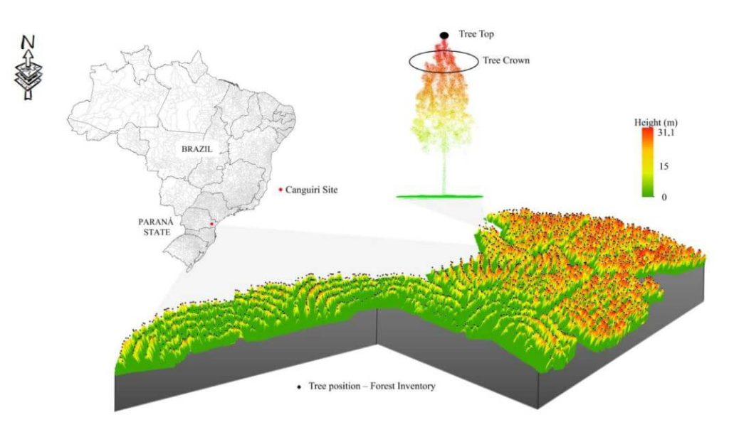
This whitepaper presents a novel approach to forest inventory within integrated crop-livestock-forest systems using high-density UAV-LiDAR point clouds. Focusing on Eucalyptus benthamii seed forest plantations, we utilized the GatorEye UAV-LiDAR system to compare two forest inventory methods: Sampling Forest Inventory (SFI) with various plot arrangements and Individual Tree Detection (ITD).
By analyzing a point cloud with over 1400 points per square meter, we assessed basal area and volume estimates using both field and LiDAR-measured heights. We compared the number of trees, basal area, and volume per hectare across different scenarios, using statistical analysis to evaluate accuracy and equivalence. Our results show that the SFI approach with a 2300 m² area provides estimates comparable to the ITD method, with minimal error and improved processing efficiency.
This study offers valuable insights for selecting optimal plot sizes in forest inventories, enhancing precision in integrated crop-livestock-forest systems.
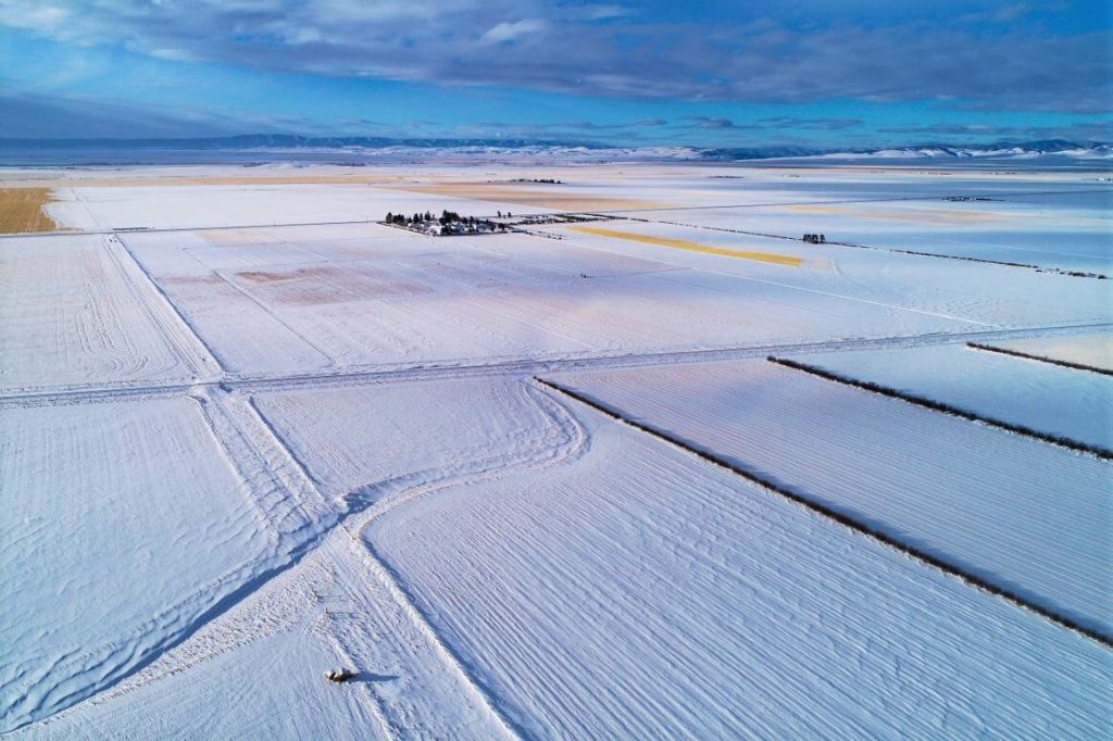
The December 2021 Phoenix LiDAR Systems webinar focused on LiDAR snow surface mapping for NASA’s SnowEx program. Jeff Rizza from DJ&A detailed a 2021 snow surface mapping project using high-resolution drone LiDAR to capture data in Montana’s prairie biome. Highlighting his experience with UAVs and LiDAR, Jeff discussed DJ&A’s collaboration with NASA and Montana State University to improve snow data collection methods.
The webinar covered Phoenix’s LiDAR systems, cold-weather challenges, and innovative survey methods for accurate snow surface mapping. Jeff showcased data insights on snow dynamics influenced by wind and vegetation and discussed processing challenges using Phoenix’s SpatialExplorer and Terascan software. The Q&A session addressed equipment, data processing, and unique SnowEx project aspects. Jeff also previewed an upcoming white paper comparing LiDAR and photogrammetry, highlighting LiDAR’s advantages in vegetation-dense areas.
Evolving the Capabilities of LiDAR
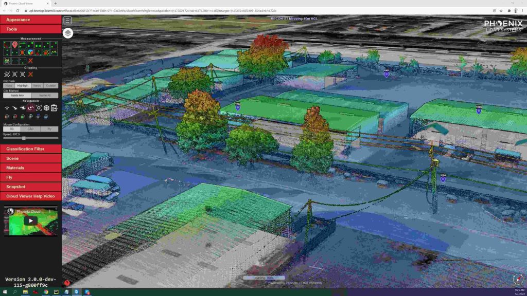
With the introduction of the RECON series, Phoenix LiDAR Systems is removing barriers to widespread LiDAR remote sensing adoption. The RECON series combines low-cost hardware with Phoenix LiDAR Systems industry leading software, LiDARMill, and is empowering a new generation of professionals like never before.
The RECON series features higher accuracies than competing products (that are based on Applanix or DJI navigation systems), while offering extremely simple, automated post-processing solutions to extract maximum value from each dataset.
Utilizing the LiDARMill online, automated processing platform, raw datasets can be imported straight from a USB drive, with reference and optional ground control data seamlessly integrated. Simple wizards enable advanced processing options like trajectory optimization, LiDAR and camera calibration, AI classification, smart decimation and the creation of high-quality deliverables (contours, DTM/DSM/CHM, pointcloud tiling etc.). A fully registered, colorized pointcloud is produced that is accurate in both relative and absolute terms. Project reports then summarize project performance and verify system accuracy.
Phoenix Lidar Systems is committed to designing the world’s most advanced, complete LiDAR solutions. With the RECON + LiDARMill combination, users can deploy a simple toolkit that is able to derive accurate and reliable datasets in a matter of hours. Powerful, affordable, and comprehensive…the RECON series by Phoenix Lidar Systems is now available, and sure to disrupt the remote sensing industry.