ResourceType
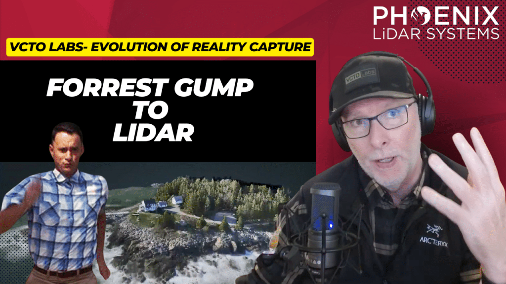
In this captivating video, we explore the powerful impact of LiDAR technology in geospatial storytelling from a pioneer in the field, Pete Kelsey from VCTO Labs. Pete shares his transformative experience using LiDAR to document and preserve the iconic Moai statues on Easter Island, highlighting how this project not only aided local decision-making regarding tourism but also resonated emotionally on a global scale.
The video also delves into LiDAR’s diverse applications, from preserving historical sites like Marshall Point Lighthouse, featured in “Forrest Gump,” to enhancing film production by providing accurate, photorealistic data. Join us as Pete discusses the future of storytelling with LiDAR technology, demonstrating its potential to inspire and effect change across various industries.
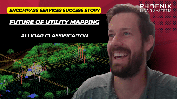
Discover the transformative power of drone-based LiDAR technology in this insightful video featuring industry experts James Kessner and Aaron Handl from Encompass Services. Explore how drones, integrated with LiDAR, are revolutionizing surveying and remote sensing by offering precise, cost-effective data collection alternatives to traditional methods.
The video delves into the environmental and technical challenges of drone LiDAR, including weather impacts and accessibility, and discusses solutions such as Trimble Business Center and LiDARMill for efficient data processing and analysis.
Learn about the importance of point cloud data classification, wire detection through dense vegetation, and the role of advanced tools like the Recon MiniRanger sensor and AI-powered software in enhancing data accuracy.
This video also highlights the applications of LiDAR data in generating imagery and orthomosaics for subsurface utility engineering projects, providing critical insights for utility companies and engineers.
Join Kessner and Handl as they navigate the complexities of drone-based LiDAR and demonstrate its vast potential in improving survey deliverables and operational efficiency.
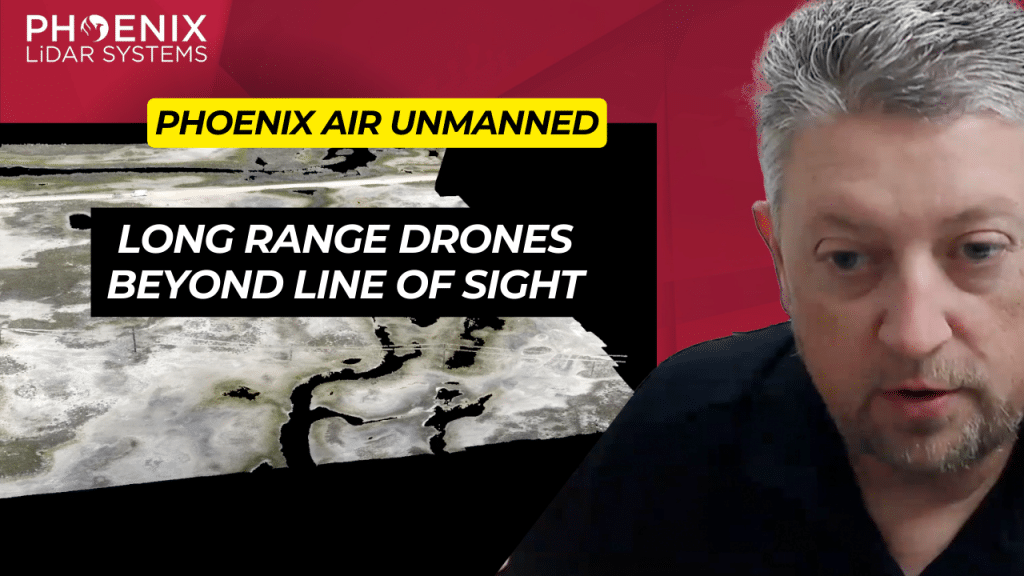
Explore the cutting-edge world of drone operations with Phoenix Air Unmanned, a leader in the industry known for its advanced use of LiDAR technology and dedication to safety and innovation.
This video provides an in-depth look at how Phoenix Air Unmanned, a subsidiary of Phoenix Air Group, is revolutionizing drone applications with state-of-the-art technology, including the Phoenix LiDAR Systems Ranger UAV.
Discover how their Beyond Visual Line of Sight (BVLOS) capabilities allow for efficient data acquisition over vast terrains, making them a key player in sectors like utilities for vegetation management and disaster response.
Learn about their diverse services that cater to multiple industries, their rapid data gathering capabilities that outpace traditional methods, and their prowess in creating detailed 3D models for enhanced analysis and decision-making.
The video also highlights the LiDARMill, an innovative online processing suite that simplifies LiDAR data processing, demonstrating Phoenix Air Unmanned’s commitment to pushing technological boundaries and delivering exceptional results across various sectors.
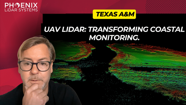
This video presents a detailed comparative analysis of two leading LiDAR sensors, the VUX and Avia, within the geomatics sector. Focusing on their performance in capturing precise vegetation and terrain data, the video highlights the VUX sensor’s superior precision, energy penetration, and pulse rate, making it ideal for challenging environments like dense forests.
The research also explores the integration of unmanned aircraft systems (UAS) with LiDAR technology, showcasing the potential of the Riegl Vux 1LR and Live OXAVIA sensors. Key insights include the Department of Transportation’s interest in UAS for crash scene reconstructions and surveying, illustrating the need for efficient data collection methods.
Phoenix LiDAR Systems is featured for its advanced UAS LiDAR solutions and Spatial Explorer Pro software, emphasizing the increasing importance of LiDAR technology in geomatics, especially for environmental applications like wetlands where accurate elevation data is crucial.
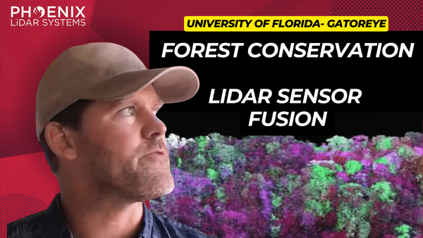
Discover the future of forest analysis with drone and LiDAR technology in this video. Led by Evan Braubin, an associate professor at the University of Florida, the GatorEye research program is revolutionizing how we study forests. Using the Harris Aerial H6 platform and the high-resolution GatorEye XTR system, drones equipped with LiDAR and hyperspectral sensors provide unparalleled insights into forest structure and species distribution.
The video highlights the integration of sensor fusion, combining visual, auditory, and temperature data for a comprehensive understanding of the forest environment. Learn about the Phoenix SpatialExplorer algorithm, which enhances data density and accuracy by meticulously calibrating flight parameters.
Braubin’s collaboration with Phoenix LiDAR has propelled his research, developing advanced systems like the OrkCS and Orca CS ground stations. This innovative approach is transforming forest analysis, uncovering the intricate impact of vegetation on animal movement and distribution.
Explore the groundbreaking advancements in remote sensing and forest analysis in this video, featuring keywords such as LiDAR technology, drone sensor fusion, GatorEye, hyperspectral sensors, Harris Aerial, and Phoenix SpatialExplorer. Welcome to the future of forest analysis!
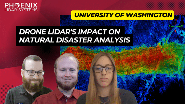
In the ever-evolving world of technology, LiDAR (Light Detection and Ranging) has emerged as a groundbreaking tool, especially in the realm of natural disaster research. The RAPID Facility, an integral part of the Natural Hazards Engineering Research Infrastructure (NERI) network, has been at the forefront of harnessing this technology. Their mission? To support researchers in collecting invaluable data on natural disasters, offering insights that were previously unimaginable.
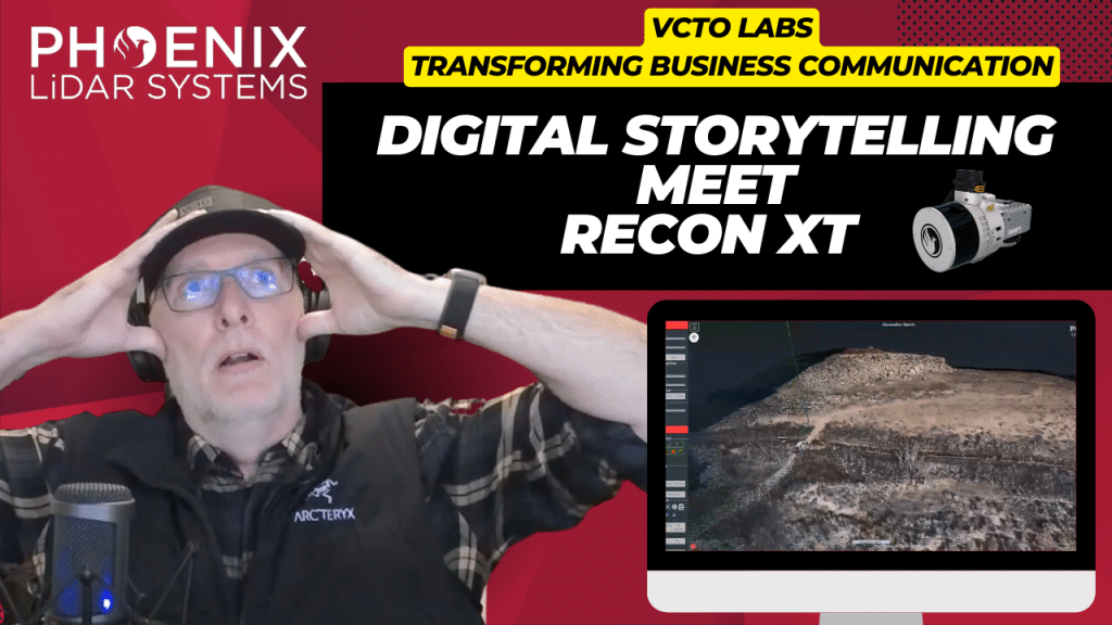
Join Pete Kelsey, owner of VCTO Labs, as he showcases the transformative power of 3D virtualization and LiDAR technology in storytelling. This video highlights Pete’s expertise in creating visually stunning 3D models of historic sites like Easter Island and the USS Arizona. By integrating LiDAR with GNSS, Pete crafts detailed digital representations of physical assets, bringing data to life.
Featuring the Recon XT GNSS LiDAR system mounted on the DJI M300 drone, this video demonstrates how Drone LiDAR technology captures intricate details from above, creating immersive narratives. Pete’s collaboration with Phoenix LiDAR provides the cutting-edge hardware and software that make these projects possible.
One standout project is Skinwalker Ranch in Utah, where Pete uses LiDAR to create a digital twin of the site, offering precise measurements and virtual tours of this enigmatic location. Pete’s dedication to his craft and partnership with Phoenix LiDAR exemplify his commitment to excellence and innovation.
Explore the world of 3D virtualization and LiDAR technology with Pete Kelsey and VCTO Labs. For more information and to connect with the community, visit vcqlabs.com. Welcome to the future of storytelling through 3D models and LiDAR.

The Centralia Coal Mine in Centralia, WA, ceased operations in 2006 and is now undergoing an extensive reclamation process. A portion of the 9,800-acre site has been repurposed by Seattle’s First Mode as a proving ground for the world’s largest hydrogen-powered mine haul truck. Utilizing the Phoenix LiDAR RECON-XT, First Mode is conducting detailed 3D surveys to build and test a 10% grade haul road, essential for the truck’s performance. This innovative use of reclaimed land exemplifies how former industrial sites can be transformed into high-tech testing grounds, highlighting the synergy between environmental restoration and cutting-edge technology.
Discover the comprehensive guide to selecting the right LiDAR system with our detailed LiDAR Selection Guide. This article covers everything from the basics of LiDAR technology to in-depth comparisons of current scanners. Learn about the technical specifications, platform configurations, and software considerations essential for optimizing your LiDAR mapping projects.
Whether you are in forestry, construction, or surveying, our guide provides the insights needed to choose the best LiDAR solution for your needs. Read on to understand the advantages of UAV LiDAR, the components that make up a LiDAR system, and how to achieve high precision and accuracy in your mapping endeavors.
Phoenix LiDAR System offers survey-grade LiDAR systems for a variety of industries and applications.