LiDAR
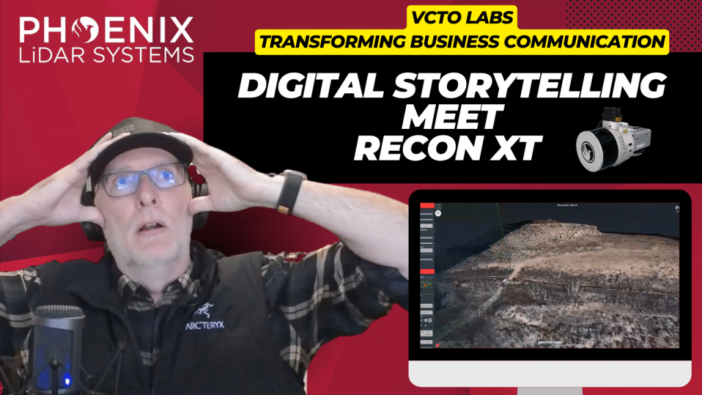
Join Pete Kelsey, owner of VCTO Labs, as he showcases the transformative power of 3D virtualization and LiDAR technology in storytelling. This video highlights Pete’s expertise in creating visually stunning 3D models of historic sites like Easter Island and the USS Arizona. By integrating LiDAR with GNSS, Pete crafts detailed digital representations of physical assets, bringing data to life.
Featuring the Recon XT GNSS LiDAR system mounted on the DJI M300 drone, this video demonstrates how Drone LiDAR technology captures intricate details from above, creating immersive narratives. Pete’s collaboration with Phoenix LiDAR provides the cutting-edge hardware and software that make these projects possible.
One standout project is Skinwalker Ranch in Utah, where Pete uses LiDAR to create a digital twin of the site, offering precise measurements and virtual tours of this enigmatic location. Pete’s dedication to his craft and partnership with Phoenix LiDAR exemplify his commitment to excellence and innovation.
Explore the world of 3D virtualization and LiDAR technology with Pete Kelsey and VCTO Labs. For more information and to connect with the community, visit vcqlabs.com. Welcome to the future of storytelling through 3D models and LiDAR.
In the July 2021 Phoenix LiDAR Systems webinar, Senior Geomatics Engineer Kory Kellum discussed aerial surveys with high-performance LiDAR technology. Phoenix LiDAR Systems, based in Austin, Texas, specializes in custom UAV LiDAR solutions. The webinar highlighted the practical applications of UAV-based LiDAR in aerial surveying and engineering through insights from Pape-Dawson Engineers, Angela Livingston, and David Trotter. They shared their use of the Phoenix Ranger with the VUX1 UAV scanner, emphasizing benefits like high-resolution data, speed, vegetation penetration, and access to difficult sites.
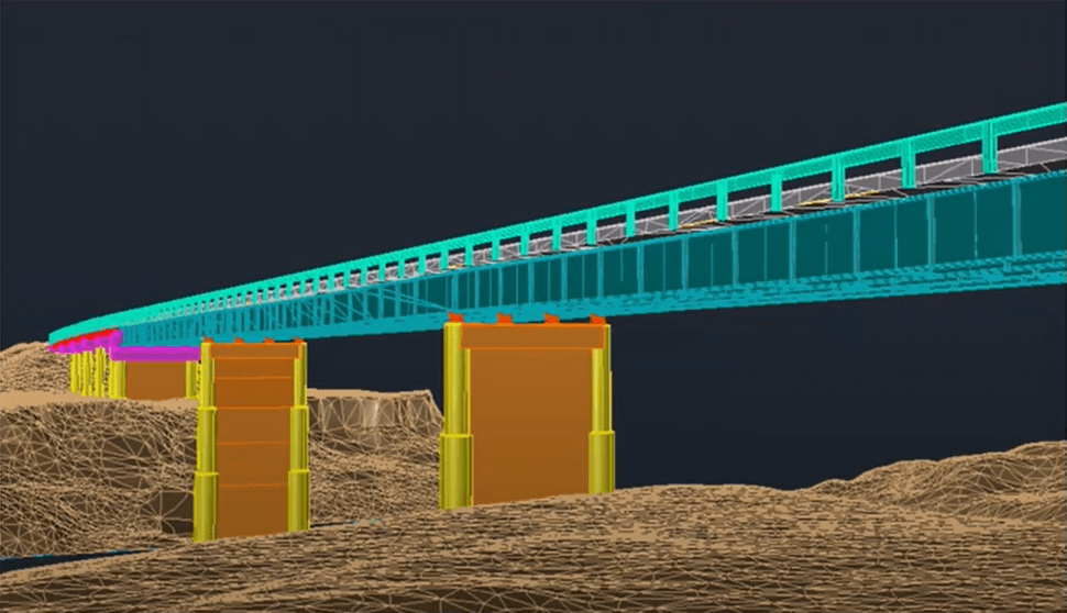
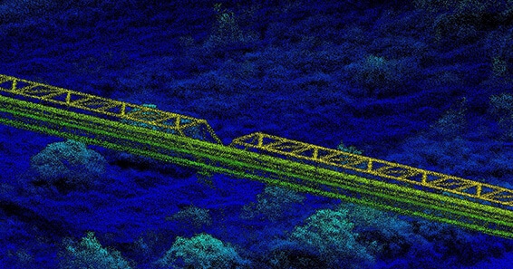
The webinar covered workflows from site assessment to data processing, showcasing detailed and accurate point clouds for extracting data products like contours and infrastructure details. Examples included aerial survey mapping a railroad bridge and a riverbank. The Q&A session addressed flight planning, check shots under canopies, and data processing software.
Join the May 2021 Phoenix LiDAR Systems webinar, hosted by Senior GIS Engineer Ira Monkfold, as he dives into survey-grade calibration and accuracies from point cloud data. This insightful session focuses on the LiDAR Snap 4 calibration tool within the SpatialExplorer software. Learn about the essential requirements for achieving precise point cloud data and how Phoenix LiDAR Systems can help you create survey-grade data effortlessly.
Ira explains the critical importance of precise system calibration, covering accurate measurements of lever arms and the alignment of laser, GNSS, and IMU components. He highlights the necessity of mission-specific optimization to address in-flight anomalies, ensuring data accuracy. The integration of surveyed ground control points is emphasized as a vital step for achieving geospatial accuracy, with LiDAR Snap 4 providing comprehensive calibration and reporting tools.
LiDAR Snap 4 revolutionizes the calibration process by combining multiple steps into a single, user-friendly software interface, significantly reducing complexity and time. The software features advanced capabilities such as encoder calibrations and trajectory optimizations, offering users reliable survey-grade point cloud data. The webinar also includes a Q&A session, addressing software capabilities, processing times, and compatibility with various LiDAR systems and platforms.
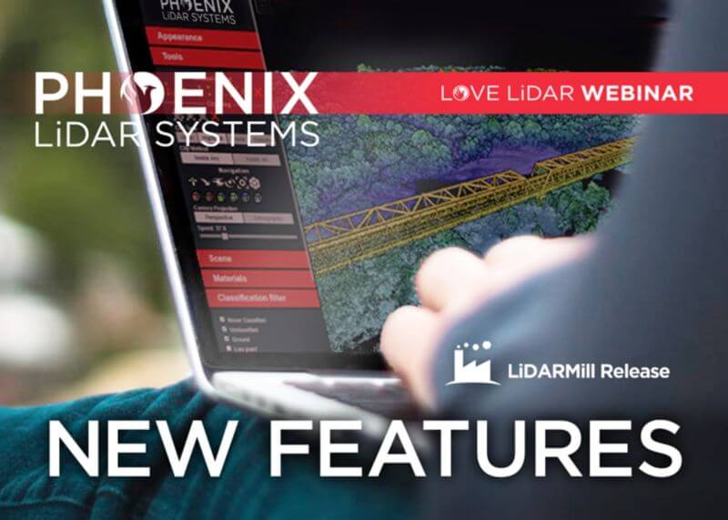
In this Phoenix LiDAR Systems webinar, hosted by Conrad Conterno, discover the latest features and updates in their cloud processing software, LiDARMill, for early 2021. Phoenix LiDAR Systems specializes in comprehensive mapping solutions, covering the entire data collection and finalization process. Conrad introduces LiDARMill, a cloud-based automated data processing software designed to streamline workflows and maximize accuracy. This powerful tool handles navigation data, LiDAR data calibration, point cloud creation, and includes built-in QC tools along with an online data viewer.
The webinar highlights several new features in LiDARMill, including an overhauled coordinate reference system (CRS) wizard that ensures accuracy from the beginning, enhanced ground control point (GCP) handling which allows designation of points as control or check, and improved accuracy reporting based on these checkpoints. There is also a new option for generating tiled results, particularly useful for managing large projects, and comprehensive documentation to guide users. Additionally, the deployment of the new SpatialExplorer 6 core significantly enhances data quality and calibration precision.
A major upcoming feature is a machine learning-based automated classification pipeline, currently in beta testing and tailored for utility data sets. This AI classifier aims to save time and increase classification accuracy by automatically identifying various features in point cloud data.
Conrad demonstrates these features within the LiDARMill interface, highlighting the importance of setting the correct CRS and using the updated GCP configuration tool. He also showcases the new tiled data download option and the ease of accessing online documentation.
During the Q&A session led by Dr. Ben Adler, various topics are addressed, including support for third-party systems, mobile LiDAR processing, reference station-less processing, and manual classification. Ben discusses the handling of large data sets, the new AI classification pipeline, and the visualization of reference stations within the cloud viewer.