Resource Type
Industry
Product Group
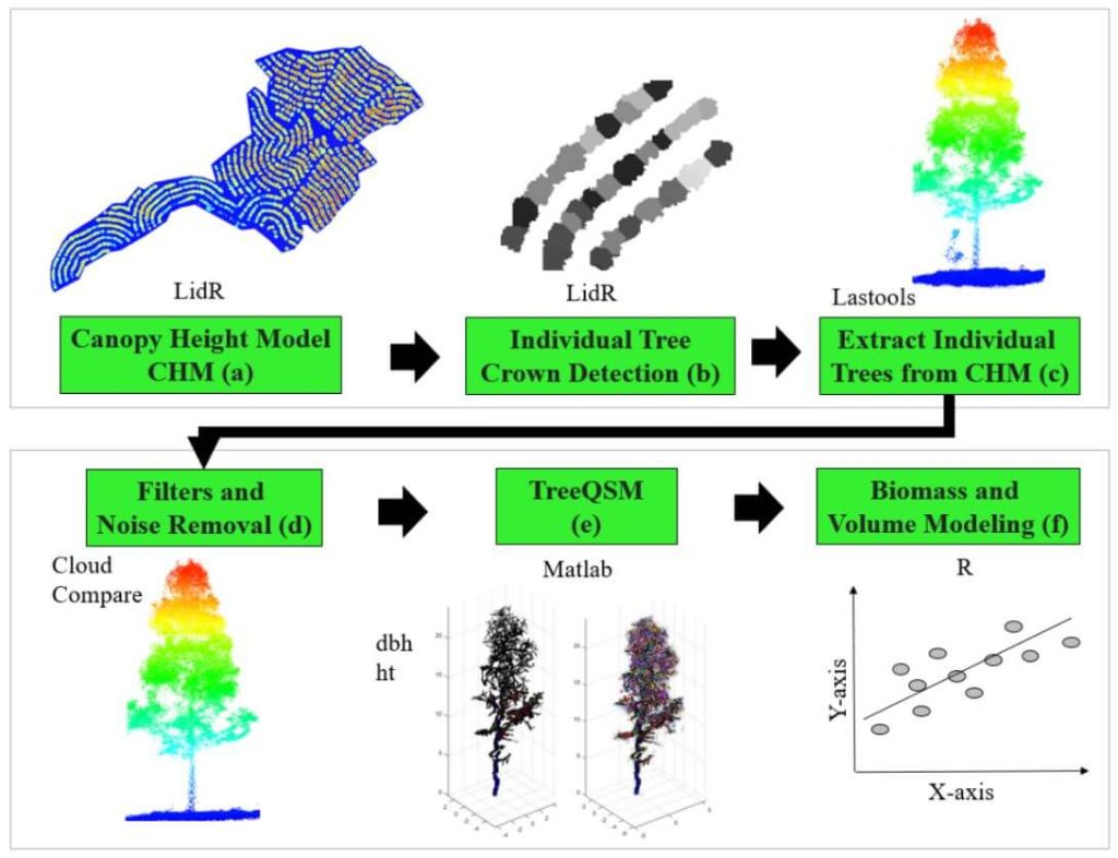
This whitepaper delves into the innovative use of high-density LiDAR data and Quantitative Structure Modelling (QSM) to estimate individual tree attributes, traditionally predicted by field-derived allometric models. Leveraging LiDAR data collected by Unmanned Aerial Vehicles (UAVs), we evaluated the accuracy of QSM in determining key tree metrics such as diameter at breast height (dbh), tree height, volume, and aboveground biomass components (stem, branch, and total).
Our study compares two QSM approaches: integrating QSM-derived dbh and height into field-based equations for volume estimation, and deriving tree volume directly from QSM. Despite a slight overestimation tendency, the models demonstrated satisfactory performance, highlighting QSM’s potential to provide detailed and extensive tree attribute estimates.
This method offers a promising alternative for forest management decision-making, especially in analyzing tree architecture and biomass. The findings underscore the value of UAV-LiDAR and QSM in enhancing the precision and scope of forest attribute assessments.
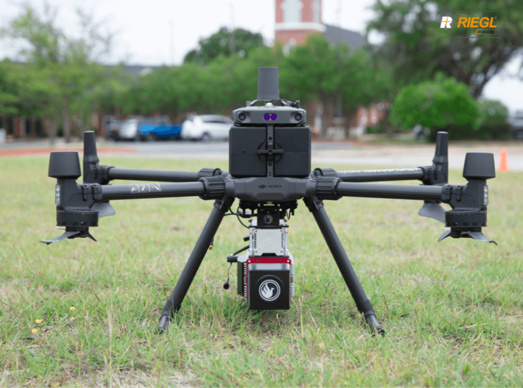
MiniRANGER-3 LITE Now M300 Airframe Compatible
The complete UAV LiDAR mapping solution
The moment you have all been waiting for is here! Phoenix LiDAR Systems is proud to announce the most powerful M300 compatible payload on the market – the MiniRANGER-3 Lite!
We combined Reigl industry leading laser precision with the ubiquitous M300 airframe, and topped the solution off with Phoenix LiDAR Systems’ renowned real-time 3D data visualization software.
This package provides the next generation of mapping professionals with a compact and cost-effective tool that leverages the highest number of target echoes per laser shot offered by any M300 payload.
The MiniRANGER-3 LITE and DJI M300 package provides the next generation of mapping professionals with a compact and cost-effective tool that leverages the highest number of target echoes per laser shot offered by any M300 payload.
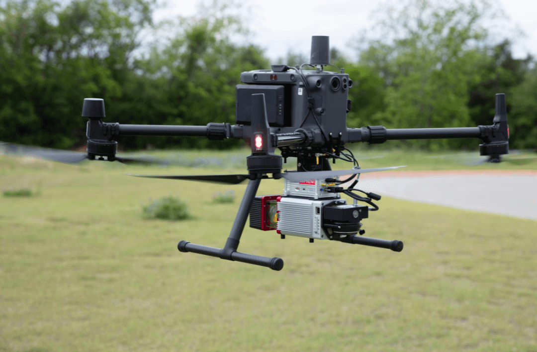
MiniRANGER-3 LITE:
- 15mm measurement range accuracy
- Selectable 100 kHz, 200 kHz, 300 kHz laser pulse repetition rate (PRR) » Modular and upgradable system for maximum project flexibility
- Multiple target capability – up to 5 target echoes per laser shot M

DJI M300 RTK:
- Safe and Reliable platform packed with redundancy features
- Integrated drone health management system
- Change batteries without powering down
- Improved flight display

Join Phoenix LiDAR Systems and SkySkopes for a quick fly through video focused on the RANGER series of helicopter based mapping solutions. SkySkopes is a top-tier data service provider that operates a wide variety of advanced sensors and aircraft for transmission and distribution line inspections, oil and gas applications, and many other innovative use cases that focus on adding value.
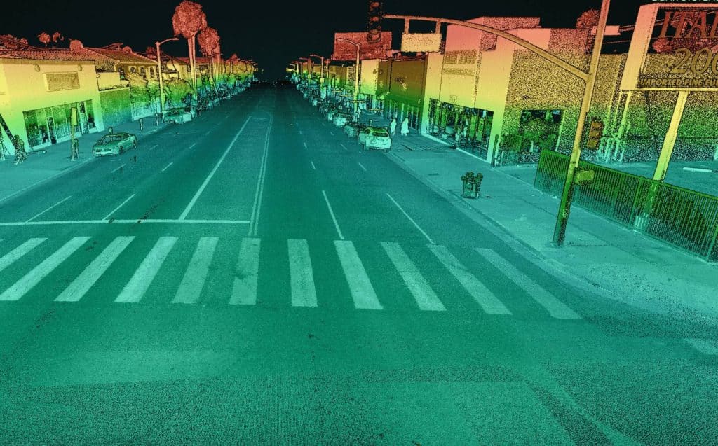
Join Kory Kellum, Senior Geomatics Engineer at Phoenix LiDAR Systems, in this February 2022 webinar as he introduces flexible LiDAR mapping solutions tailored to diverse customer needs. Since 2013, Phoenix LiDAR has pioneered innovations like the first commercial UAV LiDAR system and the LiDARMill cloud-based post-processing platform.
Kory highlights the new mobile data processing features in SpatialExplorer 7, emphasizing its high data density, accuracy, and efficiency. Ideal for applications like roadway design, bridge surveys, and asset inventory, mobile LiDAR mapping offers detailed data collection without lane closures or traffic disruptions.
SpatialExplorer 7 provides comprehensive mobile LiDAR processing with robust automated camera and LiDAR calibration, supporting multiple platforms to integrate mobile and aerial data seamlessly. The software includes mission guidance tools for complete data collection, navigation data processing options, and LiDAR Snap 4 for trajectory optimization.
Camera Snap 2 offers automated calibration of 360-degree imagery from the Ladybug camera, featuring custom mask creation and improved RGB extraction. The software generates various quality control reports, ensuring data accuracy and saving users time.
Corey demonstrates a mobile processing workflow in Spatial Explorer 7, covering trajectory clipping, point cloud generation, and calibration. The video concludes with examples of point cloud optimization and classification.
In the Q&A session, Kory and Dr. Ben Adler discuss the capabilities of Phoenix LiDAR’s systems, their applications, data processing options, and integration with other tools. They also highlight the flexibility of Spatial Explorer 7 in handling various data types and supporting different coordinate systems.
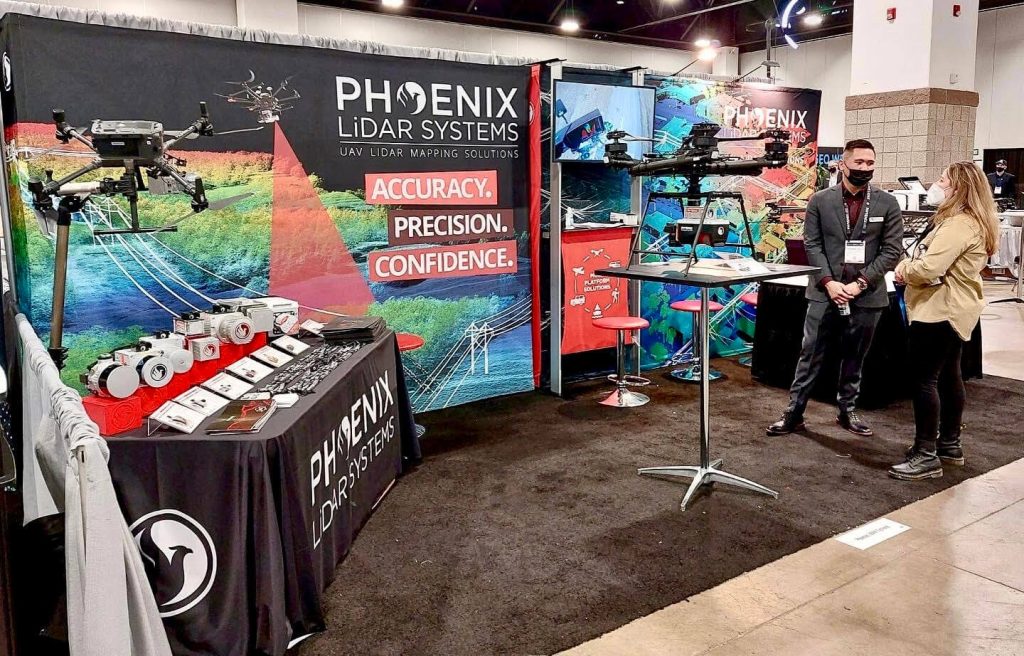
GEO Week Feb. 6-8, 2022︱Denver, CO
We had an incredible time connecting with our partners in person and sharing our full portfolio of LiDAR mapping solutions at GEO Week 2022! Our newly showcased solutions included the RECON Series, RANGER ULTRA, PIONEER P-360, and our SpatialExplorer 7 software suite.
We were especially thrilled to have had our Regional Sales Manager, Al Jarrah Habib showcase our RECON-XT in an exclusive “Pitch the Press” event. A group of industry press representatives selected only 15 exhibitors to briefly present a new solution in a one hour event. Selected exhibitors were given two minutes to present their new solution, followed by a one minute Q&A. The solutions chosen represented the cutting edge in reality capture, collaborative work and visualization tools.
Technology and its capabilities are changing constantly with new features, products, and software designed to make work safer, faster, less expensive, and better performing. Exhibiting organizations highlighted the latest technologies available during the Product Preview Presentations. Our Director of Operations, Rob Dannenberg unveiled all the new features and capabilities of Phoenix LiDAR’s SpatialExplorer 7 software suite.
In a special collaboration, our partners at SkyFront showcased our RANGER-XL at their booth and we shared their Perimeter 8 at our booth. Displayed on the Perimeter 8 during GeoWeek 2022, the Ranger ULTRA and Ranger XL are considered the leading edge of technology for survey-grade LiDAR systems in the industry and an invaluable asset for linear infrastructure and wide-area mapping Lidar data collections.
GEO Week 2022 yielded an impressive display of the latest lidar and geospatial technologies and innovative BIM use cases. Phoenix is pleased to have played a part in this year’s exhibition!
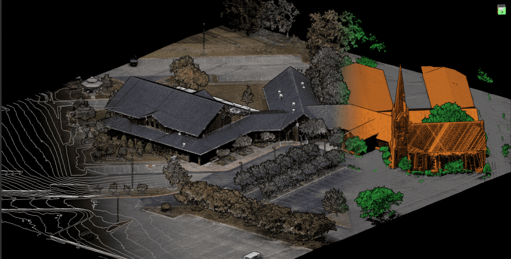
Phoenix LiDAR’s SpatialExplorer 7 software suite delivers a robust start-to-finish data acquisition and processing workflow where the user is in control.
The expandable SpatialExplorer suite from Phoenix LiDAR is built to ensure that your data acquisition is a success. From mission guidance to real time point clouds and easy field QC we leave nothing to chance when it comes to data collection.
For full control over each step of data post processing this desktop software has the professional tools you’ll need. LiDARSnap and CameraSnap provide industry leading results for datasets from airborne, mobile, or other platforms. Analytic tools then transform your highly accurate data into actionable products and automatically generated quality reports.
Acquisition
– Configure all system sensor and store custom profiles to ensure the correct settings during each acquisition
Post Processing
– Cloud and local GNSS/INS trajectory processing options
MissionGuidance
– Navigation guidance for pilots and mobile vehicle operators to stay exactly on the planned course
SE7 has additional functionality with SpatialPro add-on and/or MissionGuidance add-on. Check out all the features here!
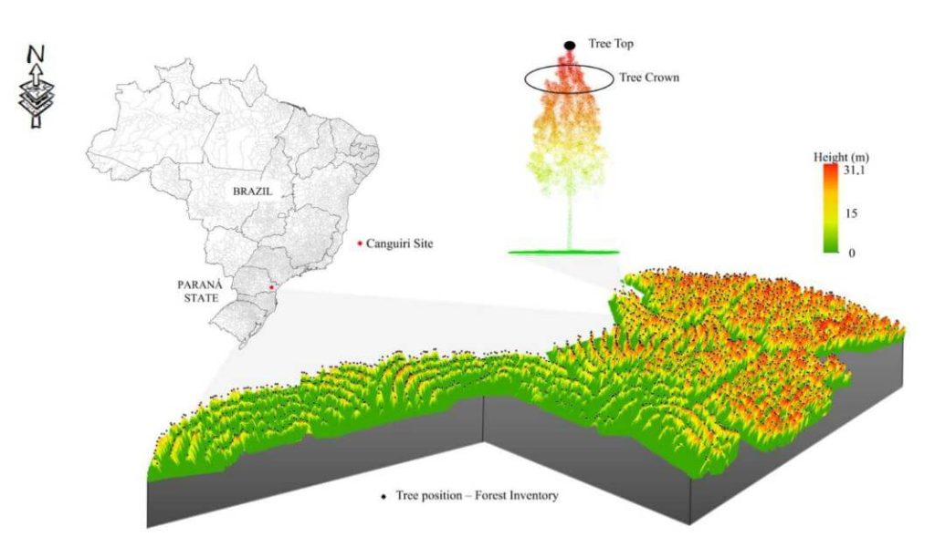
This whitepaper presents a novel approach to forest inventory within integrated crop-livestock-forest systems using high-density UAV-LiDAR point clouds. Focusing on Eucalyptus benthamii seed forest plantations, we utilized the GatorEye UAV-LiDAR system to compare two forest inventory methods: Sampling Forest Inventory (SFI) with various plot arrangements and Individual Tree Detection (ITD).
By analyzing a point cloud with over 1400 points per square meter, we assessed basal area and volume estimates using both field and LiDAR-measured heights. We compared the number of trees, basal area, and volume per hectare across different scenarios, using statistical analysis to evaluate accuracy and equivalence. Our results show that the SFI approach with a 2300 m² area provides estimates comparable to the ITD method, with minimal error and improved processing efficiency.
This study offers valuable insights for selecting optimal plot sizes in forest inventories, enhancing precision in integrated crop-livestock-forest systems.
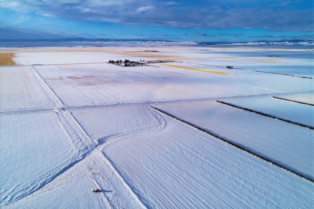
The December 2021 Phoenix LiDAR Systems webinar focused on LiDAR snow surface mapping for NASA’s SnowEx program. Jeff Rizza from DJ&A detailed a 2021 snow surface mapping project using high-resolution drone LiDAR to capture data in Montana’s prairie biome. Highlighting his experience with UAVs and LiDAR, Jeff discussed DJ&A’s collaboration with NASA and Montana State University to improve snow data collection methods.
The webinar covered Phoenix’s LiDAR systems, cold-weather challenges, and innovative survey methods for accurate snow surface mapping. Jeff showcased data insights on snow dynamics influenced by wind and vegetation and discussed processing challenges using Phoenix’s SpatialExplorer and Terascan software. The Q&A session addressed equipment, data processing, and unique SnowEx project aspects. Jeff also previewed an upcoming white paper comparing LiDAR and photogrammetry, highlighting LiDAR’s advantages in vegetation-dense areas.
Evolving the Capabilities of LiDAR
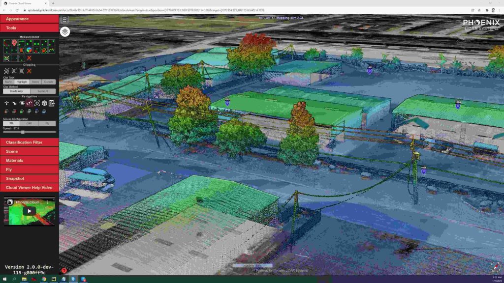
With the introduction of the RECON series, Phoenix LiDAR Systems is removing barriers to widespread LiDAR remote sensing adoption. The RECON series combines low-cost hardware with Phoenix LiDAR Systems industry leading software, LiDARMill, and is empowering a new generation of professionals like never before.
The RECON series features higher accuracies than competing products (that are based on Applanix or DJI navigation systems), while offering extremely simple, automated post-processing solutions to extract maximum value from each dataset.
Utilizing the LiDARMill online, automated processing platform, raw datasets can be imported straight from a USB drive, with reference and optional ground control data seamlessly integrated. Simple wizards enable advanced processing options like trajectory optimization, LiDAR and camera calibration, AI classification, smart decimation and the creation of high-quality deliverables (contours, DTM/DSM/CHM, pointcloud tiling etc.). A fully registered, colorized pointcloud is produced that is accurate in both relative and absolute terms. Project reports then summarize project performance and verify system accuracy.
Phoenix Lidar Systems is committed to designing the world’s most advanced, complete LiDAR solutions. With the RECON + LiDARMill combination, users can deploy a simple toolkit that is able to derive accurate and reliable datasets in a matter of hours. Powerful, affordable, and comprehensive…the RECON series by Phoenix Lidar Systems is now available, and sure to disrupt the remote sensing industry.